Guatemala - El Salvador - Honduras - Nicaragua - Costa Rica
January 10-29, 2023
Tikal - Guatemala City - Antigua - Lake Atitlan - Chichicastenango - San Salvador - Joya de Ceren - Copan - Tegucigulpa - Leon - Managua - Granada - Liberia - Monteverde - La Fortuna - San Jose
(Skip to Part 2 - Granada, Nicaragua and Costa Rica)
 |
| Ruins of Copan - Honduras |
 |
| Flags of Countries Visited |
Table of Contents
Not since my 7th-grade social studies class in the early 1970s had I been so deeply exposed to Central American history and culture, from Mesoamerican civilizations and Spanish Colonialism to sheer natural beauty. This trip was the complement to a trip I took to Mexico just a few months earlier (see Mexico 2022 blog here). Like the earlier trip, this one delivered a decent dose of history, nature, and culture while experiencing interesting sights, amazing scenery, decent weather, friendly people, great food, and comfortable accommodations.
 |
| Assorted Trip Photos |
 |
| Assorted Trip Photos |
Every time I tell people about a trip, I get the same questions. So I'll answer those questions now and devote the rest of this blog to all the great things I saw and did.
Did You Do This Trip on Your Own or with a Tour Company? I took an escorted tour with Explore - Central America Experts. I had never traveled with this company before so I was somewhat apprehensive about booking it in the first place. But my apprehension was short-lived after seeing how professionally run, comprehensive, and nicely paced the tour was. Kudos to our tour director/driver Raphael Ramos, who was exceptionally knowledgeable, helpful, and entertaining, and all the local guides.  |
| Explore - Central America Experts Landing Page |
My tour group originally had 3 or 4 other people in it, but for some reason, they all canceled out before the tour started. So I was joined by my travel friend from Houston, Texas on a private tour in a Nissan Pathfinder SUV instead of the usual 20 people and motorcoach I had grown accustomed to on other organized tours.
 |
| Our Awesome Tour Guide Raphael on the Left |
How Long Was Your Trip? When Did You Go? Where Did You Go? The tour lasted 20 days from January 10-29, 2023. I spent:
- 5 days in Guatemala (Guatemala City, Tikal, Antigua, Lake Atitlan, Chichicastenango)
- 2 days in El Salvador (San Salvador and environs)
- 5 days in Honduras (Copan, San Pedro Sula,Tegucigalpa, Choluteca)
- 2 days in Nicaragua (Leon, Managua, Masaya National Park, Granada)
- 5 days in Costa Rica (Liberia, Monteverde, La Fortuna, San Jose, Cartago, Irazu Volcano)
- 1 day flying back and forth from the US
How Did You Get There and Back? I flew from my home in Milwaukee to Houston, where I stayed with a travel friend for a day before taking a direct flight from Houston to Guatemala City. On the way home, I took a direct flight from San Jose, Costa Rica to Houston, and then took another direct flight to Milwaukee. Round trip I flew about 4,600 miles.
 |
| Air Travel Map - 4,600 Miles. |
On the ground during the tour, we traveled around 2,200 miles by private car from Guatemala to Costa Rica over 19 days.
 |
| Ground Travel Map - 2,200 Miles |
The private vehicle was clean, modern, and well-maintained, with several USB ports and outlets for charging phones and other electronics.
 |
| Our Private Tour Vehicle |
I kept in touch with friends back home with an international calling, texting and data plan through my US mobile phone carrier.
Where Did You Stay? We mostly stayed in a number of tourist-class hotels that were in or close to the center of town. All hotels were modern, clean, and comfortable, with decent amenities, including WiFi. When I signed up for the tour, we had a choice of three hotel classes, from tourist class to luxury. We tolerated the tourist class accommodations, but if I had to do it again, I would go a step up in comfort.
 |
| Guatemala Hotels |
 |
El Salvador & Honduras Hotels
|
 |
Nicaragua Hotels
|
 |
Costa Rica Hotels
|
The electricity and plugs in Mexico are identical to the US (A- and B-type, 120V 60hz), so you can use your US appliances in Mexico without adapters or power converters.
Meals? Most meals were on our own, except breakfast, which was included every morning at our hotels. Breakfasts were pretty standard. They included, to varying degrees, eggs, sausage, fruit, toast, juice, and coffee. Almost all included tortillas, refried beans, and fried plantains.
 |
| The "Tipico" Breakfast in Central America |
How was the Weather? I traveled in January. The weather was wonderful. The daytime temperatures ranged from 72F - 86F with low to moderate humidity despite being 10 - 15 degrees north of the equator.
What Clothing Did You Pack? I brought about 4 days' worth of quick-drying clothes ("Dri-Fit") for the 20-day trip and did laundry in the bathroom sink at the hotel every few days. I brought mostly shorts and T-shirts. I also brought two pairs of long pants and one long-sleeve shirt to prevent mosquito bites in jungle-like touring areas. I also brought two pairs of comfortable shoes, a rain jacket, a wide-brim hat, sunscreen, and insect repellent.
 |
| 4 Days of Clothes for 3 Weeks |
What was the Time Difference? There was no difference. My home is in the US Central Time zone and all the countries I visited were in the same time zone. No jet lag to contend with!
What Was the Currency? What Were Prices Like? As a general rule, the US dollar is widely accepted in all Central American countries, with the exception of Costa Rica. The only country that does not have its own currency is El Salvador, which uses the US dollar. I only got currency in Guatemala at the start of the trip and used my credit card for everything else over the rest of the trip. Had I needed currency in Honduras, Nicaragua and Costa Rica, it would not have been a problem since there were ATMs everywhere. Currency conversion rates seemed fair and nominal though my bank charged conversion fees that were higher than average but not exorbitant.
The currencies by country were:
- Guatemala – Quetzal
- El Salvador – US Dollar
- Honduras – Lempira
- Nicaragua – Córdoba
- Costa Rica – Colón
Prices were noticeably cheaper than in the US and you can get some great bargains. The flip side, however, is that you have to lug your purchases around on the trip and eventually home.
What Did This Whole Trip Cost You? It was neither cheap nor expensive. I spent $4,500, or about $225 per day. It was money well spent and an excellent travel value. I paid 90% of the trip cost ($4,050) before leaving the US. Once on the ground, I spent another $450 on items not included in the tour, such as tips, lunches and dinners on my own, and international mobile phone/internet charges.
Special Trip Considerations.
- General Considerations. Travel in Central America is not like traveling in the US or Western Europe. With the exception of Costa Rica, the people are noticeably poorer and the infrastructure is less developed. It takes an open mind and patience to deal with the slower pace, bureaucracy at border crossings, and lack of creature comforts. If you're looking to be pampered, waited on hand and foot, and zoom from town to town, this is not the place for you. I like culture shock so I've learned to take everything in stride and enjoy the experience.
- Personal Safety. We had absolutely no safety issues on the entire trip. However, before I left on the trip, I consulted a number of sites about safety. While the civil wars have ended and the governments are stable in every country we visited, it still pays to be a well-prepared and responsible traveler. Every country in Central America is safe as long as travelers use common sense, maintain vigilance, and keep up to date with the latest travel advisories for each country. The best place to start is the US Dept of State Travel Advisories website for the latest information and safety warnings. You can also register your trip with the Dept of State using its STEP Program. That way you can get up-to-the-minute information while on the go. Fortunately, tour companies place a high priority on safety and our company was no exception. It pretty much steered me clear of any problems.
- COVID 19. Proof of COVID vaccination was a precondition to travel with Central America Experts. Otherwise, there was no COVID testing required anywhere.
- Malaria. The mosquitoes can be bad year-round. I did not take malaria pills before the tour. Be sure to bring insect repellent with maximum DEET from the US (Note: Central American insect repellents contain a maximum 15% DEET whereas US brands contain up to 40%). Be sure to bring a long sleeve shirt and a pair of pants, both light in color, to prevent mosquito bites. After getting bit up bad at Copan, I wore insect repellent every day. The bites came from sand flies not mosquitos. So there was no itch, just red welts for a few days on my legs.
- Air Quality. Air quality was poor in the cities and less so in the small towns. I have mild asthma so the older I get, the harder it is to tolerate pollution. The diesel fumes got the best of me early on and I fought sinus drainage and a cough for the first week of the trip. At one point, I wore an N95 mask.
- Physical Condition. We traversed a lot of steps, uneven surfaces, and steep grades, sometimes exacerbated by high temperatures and humidity. If you have mobility or heat issues, this is probably not the tour for you.
Any Parting Comments? Travel is an adventure. It’s an opportunity to experience, learn and appreciate how people around the world live. While I’m always happy to come home at the end, I never come back the same person.
Following is a day-by-day account of my trip. Each day starts with an overview of what we did, followed by my daily journal. I stopped giving history lessons in my posts but added links you can click on to read more about the places I visited. You can just read on from here or go back up to the Table of Contents above and jump to a specific day or topic of interest.
Enjoy!
Itinerary: Arrival day - Arrive in Guatemala City, transfer to hotel. Balance of day at leisure.
Daily Journal
Weather: 72F and partly sunny. No humidity. Gorgeous!
I didn't sleep well. I woke up at 1:45 am and never got back to sleep except for dozing off now and then. At 5 am, I got up, showered and packed my suitcase. By 6:30 am, we were on our way to the Houston International Airport (IAH) for our 9:40 am flight to Guatemala City. Our 2-1/2-hour flight departed on time, and by 12:30 pm, our United Airlines Boeing 737-800 (Max 8) arrived on time in Guatemala City. I love the Max 8 because of the roomy overhead bins. You are almost always assured space for carry-on luggage though mine would have also fit comfortably under the seat in front of me.
 |
| Today's Travel - Houston to Guatemala City |
 |
| Our United 737 Max 8 to Guatemala City |
 |
| Arriving in Guatemala City - Beautiful Views |
 |
| Arriving in Guatemala City - Beautiful Views |
 |
| Arriving in Guatemala City - Arriving at Gate |
 |
| Welcome to Guatemala City |
After clearing Guatemalan customs, we met our driver Jorge outside baggage claim and drove a short distance to our hotel in a busy commercial area near the airport.  |
| Guatemala City - Hotel Dai Nonni |
 |
| Guatemala City - Hotel Dai Nonni - Clean & Nice Location |
After checking into our hotel, we wandered the area around the hotel and found many good restaurants, bars and shopping malls. We stopped for lunch at a traditional Guatemalan restaurant called El Green. My fajitas were fantastic and the local Gallo beer hit the spot.
 |
| Mall in Guatemala City Where We Had Lunch |
 |
| Guatemala City - Ice Cold Gallo ("Rooster") Beer |
After lunch, we headed to a nearby Parque Las Americas Mall and stocked up on water and snacks at a grocery store there. Then it was back to the hotel for a short nap. Because of our proximity to the airport, I was occasionally awoken by the sound of planes taking off.
 |
| Guatemala City - Parque Las Americas Mall |
After my much-needed nap, we went out to the ice cream parlor down the street for dollar cones. I noticed that I was short of breath and that my legs felt tired. That's when it dawned on me that Guatemala City was 5,000 feet above sea level and that I was probably suffering from the altitude. After ice cream, it was back to the hotel and to bed since we had a 4 am wake-up call the next day for the early morning flight north to Flores for a visit the Mayan ruins at Tikal.
Itinerary: Tikal day tour by air - Very early morning transfer to the airport to catch the domestic flight to Flores. One-hour drive to Tikal. In its heyday in 700 AD, Tikal was the capital of a vast Mayan empire. Today, the site is one of Guatemala’s premier tourist attractions. Its unspoiled jungle setting makes it a special destination for discerning travelers, particularly archaeology enthusiasts, naturalists and bird watchers. We will tour the ceremonial plazas and see the pyramids that rise above the forest canopy. Mid-afternoon, we will head back to Flores for a short visit before heading to the airport to catch a flight back to Guatemala City. Upon arrival, transfer to your hotel. Overnight at Guatemala City.
Daily Journal
Weather: 72F and sunny. Low humidity.
Today was a busy and eventful day that started well before sunrise and ended long after sunset with a lot of movement in between.
The day began with a 4:00 am wake-up call to meet our ride to the Guatemala International Airport to catch a 6 am domestic flight north to Flores, Guatemala. At 4:30 am, with box breakfast in hand - ham and cheese sandwich, juice, biscuits, banana - we met our guide and driver Jorge for the 15-minute drive to the airport. By 5 am, we had checked into our TAG Airlines flight and were waiting at our gate.  |
| Today's Travel - Guatemala City to Tikal & Back |
 |
| Our Plane to and from Flores |
 |
| Tikal is in Northern Guatemala |
At 5:45 am, we departed on the 45-minute flight to Flores aboard our ATR-72 Turboprop. It was dark outside when we took off, but by 6 am, the sun started to rise in the east. By the time we arrived in Flores, it was daylight. The flight was cloudy so I really didn't see much out the window of the airplane, except for beautiful Isla de Flores, a tourist hot spot we stopped at for an hour on our way back to the airport at the end of the day.  |
| Isla de Flores - We Spent the End of the Day Here |
Around 6:30 am, we met our guide for the day, Billy Cruz, and driver, Henry, outside the terminal and began the 45-minute drive to Tikal National Park. Because Tikal National Park did not open till 9 am, we made several stops along the way. At 7:30 am, we stopped along the shores of Lake Peten Itza to admire the views. We then stopped at nearby Restaurant Gonalez and ended up having a second breakfast. I had an American omelet and delicious Guatemalan coffee. After breakfast, we stopped at Black River (Rio Negro), once a major trade route from Belize through Tikal and the entire Mayan empire. |
| Lake Peten Itza |
 |
| Restaurant Gonzalez Breakfast Stop |
 |
Restaurant Gonzalez Breakfast Stop
|
 |
Restaurant Gonzalez Breakfast Stop
|
 |
| Rio Negro |
Around 8:30 am, we arrived at Tikal National Park, a UNESCO World Heritage Site and once the capital of the Mayan empire. Tikal's history starts in 1,000 BC. In its heyday, Tikal grew to 225 square miles in size with a population of 100,000. For unknown reasons, it was systematically abandoned in 900 AD. It was rediscovered in 1840 and the first visitors arrived in 1880. Today, Tikal is a premier tourist destination located in a dense jungle setting with lots of wildlife, including quati, agouti, howler and spider monkeys, parrots, turkeys, tapirs, ocelots, and jaguars. We spent several hours touring the ceremonial plazas and enormous pyramids rising above the forest canopy. I definitely got a good dose of exercise today walking all the paths and climbing all the temples. At 9 am, we started our tour of Tikal viewing a model of the entire site near the main entrance. We learned that Tikal was constructed mostly from 200 AD to 900 AD and then completely abandoned. The site was then totally consumed by the immense Guatemalan jungle. Although locals were aware of its existence, it wasn’t until the mid-19th century that Tikal was fully surveyed. Today, it is among the best-understood Mayan ruins.
 |
| Entrance to Tikal National Park |
 |
| Orientation with Our Local Guide Billy Cruz |
 |
| Tikal National Park Model |
 |
Tikal National Park - Bird's Eye View
|
The Maya were bright and resourceful people. They developed a hieroglyphic script that was the only truly developed writing system of its time. They also came to be known for their developments in architecture, art, and mathematics as well as for their calendar and astronomical system. But they never mastered the wheel, the arch, or metal tools, and never domesticated animals. |
| Mayan Art Near Entrance to Tikal National Park |
Because of the large crowd of visitors, we took a counterclockwise tour through the most popular areas of the park, which contain numerous temples, plazas, and other ruins.
 |
| Pond with Crocodiles |
 |
| Ceiba Tree |
 |
| Strangler Palm |
 |
| Non-Stinging Honey Bee Hive in Strangler Palm Tree |
Our first stop on the walking tour was Complexes Q & R containing stele with Mayan heiroglyopics and the stunning East Temple.
 |
| The Trail Was Like a River |
Upon arrival at Temple IV, The Two-Headed Serpent Temple, our guide waited below while we climbed the steps to the top under the blistering noon sun. The 212-foot-high Temple IV is the highest pyramid temple at Tikal. It towers over the rainforest. According to Maya experts, leader Yax Kin ordered the temple built around 734 AD. The summit affords a panoramic view over the site, with views of the other major temples rising from the treetops. Star Wars (1977) fans will recognize the view as the movie site of the rebel base from which the successful attack on the Death Star originated. |
| Mundo Perdido - Lost World Temple |
 |
| Mundo Perdido - Lost World Temple |
 |
| Mundo Perdido - Lost World Temple - Temple IV in Background |
 |
| Mundo Perdido - Lost World Temple |
After Mundo Perdido, we walked to the Great Plaza where Temples I and II are located. Along the way, we saw a number of other impressive temples and structures.
 |
| Ceremonial Temple |
 |
| Ceremonial Temple |
 |
| Temple III - Temple of the Jaguar Priest - 810 AD - Burial Chamber of Unknown Ruler |
 |
| Temple V - 700 AD - Burial Chamber of Unknown Ruler |
 |
| The Tree Roots Look Like Snakes |
Upon arrival at the Great Plaza, we were welcomed with an imposing view of Temples I and II, the Acropolis, and the Ball Court. We started our visit by climbing Temple II, the Masks Temple. The Great Plaza is acoustically designed so that high priests could be heard from anywhere in the plaza. Guides illustrate this by clapping hands and demonstrating the echo.
 |
| Temple II on the Great Plaza |
 |
| Temple II on the Great Plaza - Long Climb Up in the Hot Sun |
 |
| Temple II on the Great Plaza - Panoramic View |
 |
| The Great Plaza with Temples I and II |
Temple I, known as the Great Jaguar Temple, was built for the 26th ruler of Tikal, Jasaw Chan K'awiil. Whether it was his burial tomb, or used during his life, is uncertain. This temple is a “step pyramid” constructed from small stone blocks and is an example of the temples constructed in the Classic Period at the height of Tikal’s power.
 |
| Temple I from Temple II |
 |
| Temple I from Temple II |
 |
| Temple I and Great Plaza from Temple II |
 |
| Acropolis on the Great Plaza |
 |
| Mayan Sculpture at Great Plaza |
At 2 pm, following our visit to the temples and ruins of Tikal, we stopped at an onsite restaurant, El Meson, for a steak lunch. It felt good to sit down after hours of walking and climbing. At 3 pm, we departed Tikal and made our way back to Flores. Along the way, we learned that our guide, Billy Cruz, has worked on the production crew of the TV show Survivor since 2005. Our driver, Henry, once worked for Francis Ford Coppola at his hotel near Flores.
At 4 pm, we arrived at Isla de Flores, a small, absolutely charming island in Lake Peten Itza dotted with resorts & lodges. We took a short drive around the island ending at the central square. We said goodbye to our guide, Billy, then ventured on our own for the next 90 minutes. After making a loop around the island admiring the colorful streets and people, we stopped on the main drag along the waterfront for ice cream. While there, we saw a gentleman from Houston at the bar across the street whom we had met on the plane coming to Guatemala. He had recognized me from the Bank of America in Houston where I was getting Guatemalan currency for the trip. We had a few beers with Robert before heading back to the central plaza to meet our driver.

Itinerary: Guatemala City to Antigua - In the morning, we will have a brief tour of Guatemala City, including the historic district and the center of government. In the afternoon, we will drive to Antigua Guatemala, the city founded in the early 16th century. Built 4925' above sea level in an earthquake-prone region, it was largely destroyed by an earthquake in 1773, but its main monuments are still preserved. Evening free, overnight at Antigua.
Daily Journal
Weather: 76F and sunny. No humidity.
I woke up at 6:00 am, took a shower packed my suitcase and headed to breakfast in the lovely hotel courtyard. I had a typical Guatemalan breakfast consisting of beans, fried plantains, eggs, juice, champanada and coffee.
 |
| Today's Travel - Guatemala City to Antigua |
 |
| Guatemala City Hotel Breakfast |
 |
| I Think Starry Eggs Means Sunny Side Up |
Around 8 am, we headed across the street to the shopping mall to get some more currency from the ATM.
At 9 am, we checked out of the hotel and met our driver and guide, Jorge, for a tour of the historic center of Guatemala City. On the way, we saw Torre del Reformador, a smaller version of the Eiffel Tower built in 1935 to commemorate the progressive administration of President Justo Rufino Barrios (1873–85).
 |
| Guatemala City's Version of the Eiffel Tower |
During the drive, we learned that Guatemala City is divided into 21 zones or “zonas.” The zonas are numbered sequentially in a spiral pattern beginning with Zona 1, the most central and oldest zone in the city. On our tour, we visited Zonas 1, 4 and 6.
 |
| Guatemala City Statue |
 |
| Guatemala City Center |
 |
| Guatemala City Center - Guatemala Flag |
Around 9:30 am, we parked the car and set out on foot for a brief walking tour. Highlights in the historic center included Plaza Mayor, City Hall, Metropolitan Cathedral, and the Central Market.
 |
| Guatemala City - Central Park |
 |
| Guatemala City - Main Square - Palace |
 |
| Guatemala City - Main Square - Palace |
 |
| Guatemala City - Main Square - City Cathedral |
 |
| Guatemala City - Main Square - City Cathedral |
 |
| Guatemala City - Main Square - City Cathedral |
 |
| Guatemala City - Main Square - City Cathedral |
We then headed over to the compact Cuatro Grados Norte, a pedestrian-friendly and safe section of bars, restaurants, shops, and discos. We strolled the streets admiring the ornate Post Office, street musicians (xylophone, guitar players), shops and restaurants. Several buildings date back to the capital’s founding in 1775, when the mudéjar (Moorish) architectural style was fashionable.
 |
| Guatemala City - Central Market |
 |
| Guatemala City - Central Market |
 |
| Guatemala City - Central Market |
 |
| Guatemala City - Pedestrian & Shopping Zone |
|
 |
| Guatemala City - Pedestrian & Shopping Zone |
 |
Guatemala City - Pedestrian & Shopping Zone
|
 |
| Guatemala City - Pedestrian & Shopping Zone |
 |
| Guatemala City - Pedestrian & Shopping Zone |
 |
| Guatemala City - Pedestrian & Shopping Zone - Post Office |
 |
| Guatemala City - Pedestrian & Shopping Zone |
 |
| Guatemala City - Pedestrian & Shopping Zone - Church |
 |
| Guatemala City - Pedestrian & Shopping Zone - Church |
 |
| Guatemala City - Central Park |
After the tour, our guide Jorge drove us 23 miles and 54 minutes southwest to Antigua, the colorful former Spanish colonial capital city founded in the early 16th century and built 1,500 meters above sea level in an earthquake-prone region surrounded by mountains and three volcanos. Antigua was largely destroyed by an earthquake in 1773, but its main monuments are still preserved. The scenic drive from Guatemala City went over and around massive volcanos and mountains.
For the past few days, we noticed a lot of refurbished Blue Bird school buses being used as public transportation. They came from the US after the buses were retired. Each is very unique and called a Chicken Bus.
 |
| Guatemala City - Chicken Bus |
 |
| Antigua - Runaway Truck Ramp |
By noon, we were bouncing down the narrow cobblestone streets to our hotel on the southeast corner of town, just a block outside the compact historic district.
 |
| Antigua - Map of City Center |
 |
| Antigua - Hotel Courtyard |
Our room wasn't ready so we dropped our bags off at the reception and ventured out into the town on our own for a few hours. Antigua was the most charming city we visited in Guatemala with its cobblestone streets, Spanish colonial architecture, and numerous churches spread out over one square mile.
 |
| Antigua - Iglesia Escuela de Cristo |
 |
| Antigua - Plazuela Escuela de Cristo - Quiet Park |
 |
| Antigua - Spanish Colonial Architecture |
 |
Antigua - Pretty Window Decorations
|
 |
Antigua - Spanish Colonial Architecture
|
 |
| Antigua - Spanish Colonial Architecture |
 |
| Antigua - Spanish Colonial Architecture |
 |
| Antigua - Spanish Colonial Architecture |
 |
| Antigua - Spanish Colonial Architecture |
 |
| Antigua - Spanish Colonial Architecture |
 |
| Antigua - Former Laundry Area |
 |
Antigua - Pretty Square
|
 |
| Antigua - Pretty Square |
 |
Antigua - Spanish Colonial Architecture
|
 |
| Antigua - Locals |
 |
| Antigua - Street Art |
 |
Antigua - Spanish Colonial Architecture
|
 |
Antigua - Spanish Colonial Architecture
|
 |
Antigua - Many Layers of Paint
|
After two hours of strolling, we stopped for lunch at the Santa Clara Cafe, which was a combination of a grocery store and restaurant with a very nice second-floor patio. The pizza was delicious and the price was affordable.
 |
| Antigua - Santa Clara Cafe - Lunch Stop |
After lunch, we wandered back to the hotel to check-in. Our room was situated at ground level overlooking a pretty courtyard. Late in the afternoon, we ventured back out into the city to explore some more on our own. We revisited a number of churches including the cathedral, which was adjacent to a hospital that was easy to mistake as part of the cathedral. We also visited one church that had been destroyed by an earthquake in 1773 and never restored.
 |
| Antigua -San Francisco Church |
 |
| Antigua -San Francisco Church |
 |
Antigua - Iglesia de Hermano Pedro (L) & Hospital (R)
|
 |
Antigua - Cathedral of Antigua - Main Plaza
|
 |
Antigua - Cathedral of Antigua - Main Plaza
|
 |
| Antigua - Main Plaza |
 |
| Antigua - Main Plaza |
 |
| Antigua - Ruins of La Compania de Jesus Church |
 |
| Antigua - Ruins of La Compania de Jesus Church |
 |
Antigua - Beautiful Arco de Santa Catalina
|
 |
| Antigua - Beautiful Arco de Santa Catalina |
 |
| Antigua - Storage for Religious Parades |
 |
Antigua - Spanish Colonial Architecture
|
 |
| Antigua - Iglesia La Merced |
 |
| Antigua - Iglesia La Merced |
 |
| Antigua - Ruins from 18th Century Earthquake - Cathedral |
 |
Antigua - Ruins from 18th Century Earthquake - Cathedral | Antigua - Ruins from 18th Century Earthquake - Cathedral
|
|
 |
Antigua - Ruins from 18th Century Earthquake - Cathedral
|
After exploring, we stopped for ice cream at a local Wendy's and sat in the central plaza to people-watch. Afterward, we wandered around town before heading back to the hotel for the evening. It had been a long day of walking and my legs were tired from navigating all the cobblestones streets. We didn't have much appetite for dinner so just stayed in and relaxed.
Itinerary: Antigua - In the morning, we will explore this beautiful colonial town, nestled in a valley surrounded by the peaks of three towering volcanoes. Over time, Antigua, Guatemala became the most important city in Central America, adorned with monasteries, churches, and other monuments built in the Spanish Colonial architectural style. We will have a chance to see both the restored buildings as well as those left as ruins. Among the intricate buildings and interesting museums to be visited on the tour are the ornate La Merced church, the ruins of the Capuchinas convent, and the San Francisco Cathedral. Afternoon and evening free to explore on your own or just relax. Overnight at Antigua.
Daily Journal
Weather: 74F and mostly sunny.
I woke up at 6 am after getting a decent night of sleep. Around 7 am, we went over to the courtyard for a breakfast of pancakes, eggs, fruit and coffee. It was very good.
 |
| Today's Travel - Antigua |
 |
| Antigua Hotel Breakfast |
 |
Antigua Hotel Breakfast
|
While waiting for our tour director to pick us up, we went up to the rooftop deck at the hotel for a panoramic view of the surrounding volcanoes and town.
 |
| Antigua Hotel - Viewing Platform |
 |
Antigua Hotel - Courtyard
|
 |
Antigua Hotel - Viewing Platform - Cat on Roof
|
Around 9:00 am, we met our tour director, Raphael, and our local guide, Mirla Carcuz, in front of the hotel for a 4-hour walking tour of Antigua.
 |
| Antiua - Guide Raphael (L) & Local Guide (R) |
Although we had seen a lot of Antigua on yesterday's walk, we purposely avoided going to places that we were scheduled to see on today's tour. After making our way through town to the central square, we stopped at San Francisco Church (1680) and the adjoining Ruinas de Cathedral. The cathedral had been destroyed by an earthquake in 1773.
 |
| Antigua - Ruinas de Cathedral |
 |
| Antigua - Ruinas de Cathedral |
 |
| Antigua - Ruinas de Cathedral - Fallen Pillar |
 |
| Antigua - Ruinas de Cathedral |
 |
| Antigua - Ruinas de Cathedral |
 |
| Antigua - Ruinas de Cathedral |
 |
| Antigua - Ruinas de Cathedral - Crematorium |
 |
| Antigua - Ruinas de Cathedral - Crematorium |
 |
| Antigua - Ruinas de Cathedral - Crematorium |
 |
| Antigua - Ruinas de Cathedral - Crematorium |
We then wandered the streets admiring the colorful colonial buildings until we came upon a jade store where we learned about the history of jade in Guatemala. Jade is a rare gem material that comes in many different colors but most people are familiar with the green variety. This jade was prevalent in the ancient Mesoamerican culture, however, its sources were lost for five centuries and rediscovered less than 50 years ago. There are numerous shops that sell jewelry and art made from Guatemalan jade. |
| Antigua - Jade Store |
 |
| Antigua - Jade Store |
 |
| Antigua - Jade Store |
After the jade store, we wandered over to Convent Santo Domingo, a Dominican church that had also been destroyed by an earthquake. The church and its adjoining archaeological museum had been purchased and incorporated into a five-star hotel. The museum was full of Mayan and Toltec artifacts of glass, clay, and other textiles.
 |
| Antigua - El Carmen Church |
 |
Antigua - El Carmen Church
|
 |
| Antigua - Tagging Along with a Tour Group |
 |
| Antigua - Convent Santo Domingo |
 |
| Antigua - Convent Santo Domingo |
 |
| Antigua - Convent Santo Domingo |
 |
| Antigua - Convent Santo Domingo |
 |
| Antigua - Convent Santo Domingo |
 |
| Antigua - Convent Santo Domingo |
 |
| Antigua - Convent Santo Domingo |
 |
| Antigua - Convent Santo Domingo |
 |
| Antigua - Convent Santo Domingo |
 |
| Antigua - Convent Santo Domingo |
 |
| Antigua - Convent Santo Domingo |
 |
| Antigua - Convent Santo Domingo |
 |
| Antigua - Convent Santo Domingo |
 |
| Antigua - Convent Santo Domingo |
 |
| Antigua - Convent Santo Domingo |
 |
| Antigua - Convent Santo Domingo |
 |
| Antigua - Convent Santo Domingo |
 |
| Antigua - Convent Santo Domingo |
 |
| Antigua - Convent Santo Domingo |
 |
| Antigua - Convent Santo Domingo |
 |
| Antigua - Convent Santo Domingo |
 |
| Antigua - Convent Santo Domingo |
By 1 pm, the tour was over and we were on our own for the rest of the day. We had lunch at a cafe on the central square and then went over to the square to watch people. After that, we hit all the shops before going back to the cafe for coffee.
 |
| Antigua - Fountain in Main Plaza |
 |
| Antigua - Guatemala Souvenir Shop |
 |
| Antigua - Guatemala Souvenir Shop |
We skipped dinner and headed back to the hotel. My feet hurt from walking on the cobblestone all day and the diesel car exhaust was starting to burn my throat. Those were the only negatives. Otherwise, it had been a glorious two days here in Antigua.
Itinerary: Antigua to Lake Atitlan - Today we drive to Panajachel, Lake Atitlan, known as one of the most beautiful lakes in the world. Here we will have a boat tour on Lake Atitlan. We will visit communities like Santiago de Atitlan and San Juan Laguna where we will find a Quiche Indian population that descends from the Mayas and walk around the colonial villages. Evening at leisure and overnight at Panajachel.
Daily Journal
Weather: 74F and mostly sunny.
Today we drove 60 miles northwest from Antigua to Panajachel, Guatemala to stay at Lake Atitlan, Guatemala, one of the most beautiful lakes in the world.
 |
| Today's Travel - Antigua to Panajachel |
 |
| Antigua - Hotel Viewing Platform |
Our tour director, Raphael, picked us up at the hotel at 8:30 am. A few hours later outside Panajachel, we stopped at a scenic overlook for pictures. Lake Atitlan is 80 square miles, and 11 miles long by 6 miles wide at an altitude of 5,200 feet. It is surrounded by three towering volcanoes: Atitlán (11,600'), Tolimán (10360') and San Pedro (9,800'), which compose an imposing panorama around the highland lake.
 |
| Lake Atitlan |
 |
| Lake Atitlan |
 |
| Lake Atitlan - Active Volcano |
Upon arrival in Panajachel, our room was not ready, so we took an orientation walk around Panajachel, especially the Calle Santander, a pedestrian street bustling with tourists, shops and restaurants that deadends at the waterfront. We walked to the waterfront and then walked back halfway back for lunch at a local restaurant called Guajimbo's where I enjoyed pork chops, fries, and a local beer called Cabra ("goat").
 |
| Welcome to Panajachel on the Shores of Lake Atitlan |
 |
| Panajachel - Chicken Bus |
 |
| Panajachel - Main Street to Waterfront |
 |
| Panajachel - Main Street to Waterfront |
 |
| Panajachel - Main Street to Waterfront |
 |
| Panajachel - Waterfront & Lake Atitlan |
 |
| Panajachel - Waterfront & Lake Atitlan |
 |
| Panajachel - Waterfront & Lake Atitlan |
 |
| Panajachel - Waterfront & Lake Atitlan |
 |
| Panajachel - Waterfront & Lake Atitlan |
 |
| Panajachel - Main Street Lunch Stop |
After lunch, we boarded a launch and motored around the lake for a few hours, stopping at two towns along the way. At each, we met the locals and visited the local church.
 |
| Panajachel - Waterfront & Lake Atitlan |
 |
| Panajachel - Waterfront & Lake Atitlan |
 |
| Panajachel - Lake Atitlan |
Our first stop was Santa Catarina Papolo. The second was Santa Antonio Papolo. At the first stop, we visited the Quiche Indian Culture Center where a local woman demonstrated the cotton-making and dye process used to create the thread they weave for clothing and textiles.
 |
| Atitlan Boat Ride - Santa Catarina Papolo |
 |
Atitlan Boat Ride - Santa Catarina Papolo
|
|
 |
Atitlan Boat Ride - Santa Catarina Papolo
|
|
 |
Atitlan Boat Ride - Santa Catarina Papolo
|
 |
Atitlan Boat Ride - Santa Catarina Papolo
|
 |
Atitlan Boat Ride - Santa Catarina Papolo
|
 |
Atitlan Boat Ride - Santa Catarina Papolo
|
 |
Atitlan Boat Ride - Santa Catarina Papolo
|
 |
Atitlan Boat Ride - Santa Catarina Papolo - Woman Has Never Cut Hair
|
 |
Atitlan Boat Ride - Santa Catarina Papolo
|
 |
Atitlan Boat Ride - Santa Catarina Papolo
|
At the second stop, Santa Antonio Papolo, we visited a store where you could buy colorful clothing made from the woven cotton we saw in the previous town. They dressed me up like a native for a photo opportunity. Both towns were nothing to write home about but the views of the buildings and mountains surrounding the lake were wonderful.
 |
Atitlan Boat Ride - Santa Antonio Papolo
|
 |
| Atitlan Boat Ride - Santa Antonio Papolo |
 |
| Atitlan Boat Ride - Santa Antonio Papolo - Dock Art |
 |
| Atitlan Boat Ride - Santa Antonio Papolo |
 |
| Atitlan Boat Ride - Santa Antonio Papolo |
 |
| Atitlan Boat Ride - Santa Antonio Papolo - Cotton |
 |
| Atitlan Boat Ride - Santa Antonio Papolo |
 |
| Atitlan Boat Ride - Santa Antonio Papolo - Dressed as Native |
 |
| Atitlan Boat Ride - Santa Antonio Papolo |
 |
| Atitlan Boat Ride - Santa Antonio Papolo |
 |
| Atitlan Boat Ride - Santa Antonio Papolo |
 |
| Atitlan Boat Ride - Santa Antonio Papolo |
|
In the late afternoon, we went back to Panajachel where we rode a tuk-tuk back to the hotel and checked in. I thought the hotel was awful but at least the bed was comfortable and the water hot.
Itinerary: Chichicastenango, to San Salvador, El Salvador - At 7:00 AM, drive to Chichicastenango, where we will enjoy the Indian market, reputedly the largest outdoor market in Central America. It attracts buyers and sellers from near and far every Thursday and Sunday. A great variety of handicrafts and souvenirs are for sale here, from colorful Mayan fabrics and ceremonial masks to genuine leather goods, jewelry and accessories. Also, we will have a chance to observe the Maya/Catholic rituals that take place at the Santo Tomas church. In the afternoon, you will be transferred to San Salvador, El Salvador, arriving before sunset.
Daily Journal
I woke up at 6 am after getting an excellent night of sleep. We went to the hotel restaurant next to the pool for breakfast at 7:30 am. The service was slow as we waited almost 50 minutes after ordering to get our food, which consisted of oatmeal, pancakes, fruit and coffee. We had to wolf down our food to meet our tour director at 8:30 am.
 |
| Today's Travel - Panajachel, Guatemala to San Salvador, El Salvador |
 |
| Panajachel Hotel Breakfast |
After picking us up, our tour director drove us 23 scenic miles north through the winding mountain roads to Chichicastenango.
 |
| Leaving Panajachel and Lake Atitlan |
At 9:45 am, we arrived in Chichicastenango, parked the car, and strolled through the crowded Mayan Indian market, reputedly the largest outdoor market in Central America. Everything under the sun is sold there every Thursday and Sunday, particularly a wide variety of Mayan handicrafts and souvenirs and food.
 |
| Chichicastenango - Street Scene |
 |
| Chichicastenango - Street Scene - Central Market - WOW! |
 |
| Chichicastenango - Street Scene - Central Market - WOW! |
 |
| Chichicastenango - Street Scene - Central Market - WOW! |
 |
| Chichicastenango - Street Scene - Central Market - WOW! |
 |
| Chichicastenango - Street Scene - Central Market - WOW! |
 |
| Chichicastenango - Street Scene - Central Market - WOW! |
 |
| Chichicastenango - Street Scene - Central Market - WOW! |
 |
| Chichicastenango - Street Scene - Central Market - WOW! |
 |
| Chichicastenango - Street Scene - Central Market - WOW! |
 |
| Chichicastenango - Street Scene - Cental Market - WOW! |
 |
| Chichicastenango - Street Scene - Central Market - Local Kids |
After strolling through the chaotic market, we watched a traditional Maya/Catholic ritual take place at Santo Tomas Church. The church celebrates both Catholic and Mayan gods.
 |
| Chichicastenango - Religious Ceremony |
 |
| Chichicastenango - Religious Ceremony |
 |
| Chichicastenango - Religious Ceremony |
 |
| Chichicastenango - Religious Ceremony |
 |
| Chichicastenango - Religious Ceremony |
 |
| Chichicastenango - Religious Ceremony |
Around 12 pm, we left Chichicastenango and drove 200 miles southeast to San Salvador, the capital of El Salvador via Guatemala City. We took an alternate route around Antigua that connected us to the Pan-American Highway south of Guatemala City. |
| Pan American Highway between Guatemala City and San Salvador |
At 2 pm, we took a bathroom and snack break at a gas station along the highway before continuing to the El Salvador border. Around 3 pm, we got stopped at a police checkpoint. They checked passports, went through our guide's luggage, checked the vehicle registration, took some pictures, and sent us on our way after 5 minutes.
Around 3:45 pm, we got to the El Salvador border crossing. It took 45 minutes standing in the hot afternoon sun in 91F heat to get processed out of Guatemala. When we got to the El Salvador side, we only had our temperatures checked and we were on our way.
 |
| Border Crossing - Guatemala into El Salvador |
Around 5 pm, we hit a several-mile backup of cars trying to get on the highway. When we got to the end, I noticed that the intersection was uncontrolled. Cars turning left for San Salvador had to cross two lanes of fast-moving oncoming traffic to get on. It ended up taking 45 minutes to get on the highway. What a mess. Once we were on the highway, we sped right along. It was odd that so many cars did not have headlights on after dark, that there were people standing around on the side of the highway with no reflective clothing, and a lot of open pickup trucks with people standing in the back.
Itinerary: Day trip to Cerre Verde Volcano National Park for viewing stunning scenery and hiking in the caldera. Driving tour around nearby Lago de Coatepeque followed by lunch at a lakeside restaurant. Return to San Salvador. Rest of day at leisure.Sonsonate.
Daily Journal
Weather: 83F and sunny.
After sleeping well. I woke up to a cold shower at 6:00 a.m. Online reviews revealed that this was an ongoing problem at this hotel. At 7:15 am, we went down to breakfast. Like my shower, it was awful. The rolls were rock hard, my beans cold and my eggs lukewarm. The only saving grace was the coffee, which was at least hot though weak. After breakfast, we went to Starbucks at a nearby mall for a real breakfast.
 |
| Today's Travel - San Salvador & Environs |
Our guide picked us up at 9 am. We drove 23 miles east to Cerre Verde Volcano National Park where we enjoyed the stunning overlooks and hiked down into the caldera for several hours.
During the picturesque drive west from San Salvador, we learned of the rivalry amongst the Latin American countries: Costa Rica is the arrogant brother. Honduras is the lazy brother, El Salvador is the hardworking brother, and Guatemala is the happy brother. Nicaragua is the revolutionary brother. Panama and Belize are the stepchildren.
We arrived at Cerre Verde Volcano National Park around 11 am. The views of the surrounding mountains, volcanoes and Pacific Ocean were wonderful.
 |
| East of San Salvador - Cerre Verde Volcano National Park |
 |
Cerre Verde Volcano National Park - Nice Scenery
|
 |
| Cerre Verde Volcano National Park - Nice Scenery |
 |
| Cerre Verde Volcano |
 |
Cerre Verde Volcano National Park - Nice Scenery | | Cerre Verde Volcano National Park - Nice Scenery |
|
 |
| Cerre Verde Volcano National Park |
 |
Cerre Verde Volcano National Park
|
 |
Cerre Verde Volcano National Park
|
 |
| Cerre Verde Volcano National Park |
We entertained the idea of hiking up the volcano, but there were not enough people interested to warrant the guides taking us up. So we took an hour nature hike down into the crater (caldera) of the extinct volcano with our guide Orchidia.
 |
Cerre Verde Volcano National Park - Caldera Hike - Our Guide
|
 |
Cerre Verde Volcano National Park - Caldera Overview
|
 |
| Cerre Verde Volcano National Park - Caldera Hike |
 |
Cerre Verde Volcano National Park - Caldera Hike
|
|
 |
Cerre Verde Volcano National Park - Caldera Hike
|
|
 |
| Cerre Verde Volcano National Park - Caldera Hike |
On the backside of the volcano, we got stunning views of Lago de Coatepeque. We also saw the Friendship Tree, an oak and cedar tree that grew together, and the Grandfather tree, the oldest tree dating to 1621.
 |
| Caldera Hike - Lago de Coatepeque |
 |
| Caldera Hike - Lago de Coatepeque |
|
 |
| Caldera Hike - Friendship Tree |
|
 |
Caldera Hike - Grandfather Tree
|
We ate lunch lakeside after the tour at Ranchi Allegre. I had a rice and chicken dish that caused diarrhea for several days. We were shocked and delighted to see our guide singing karaoke on the stage below as we finished our lunch.
 |
| Lago de Coatepeque - Lunch Stop |
 |
Lago de Coatepeque - Lunch Stop
|
 |
| Lago de Coatepeque - Lunch Stop |
 |
Lago de Coatepeque - Lunch Stop
|
 |
| Great But Caused Stomach Issues for Next 5 Days |
 |
| Raphael Our Tour Director Singing Karaoke |
After lunch, we drove back to San Salvador. The traffic was hideous. I think we spent more time stuck in traffic than seeing the sites in El Salvador. Our attempts to get downtown for a short walking tour were postponed until the following day due to traffic.  |
| San Salvador Traffic |
 |
| San Salvador Traffic |
 |
| San Salvador Traffic |
 |
| San Salvador - Is it 2022 or 2023? |
On the way back to the hotel, our guide asked us how the hotel was and we told him. He told the front desk that we had no hot water, no towels, and that the food was cold and unappetizing at breakfast. The hotel ended up giving us more towels and water and sent somebody up to look at the pipes but when that happened we were already in bed so we just ignored the knocking on the door.
Itinerary: San Salvador, to Copan, Honduras - At 7:00 AM we drive to San Salvador. En route, we will visit Joya de Ceren, a UNESCO World Heritage Site and the only Maya archaeological site where one can appreciate the day-to-day lifestyle of the pre-Columbian inhabitants due to well-preserved remains buried under the ashes of the volcanic eruption. Then we will explore the capital city of El Salvador, San Salvador, driving through the streets and avenues of residential and historical districts. We will first visit the David Guzman National Museum of Anthropology, then Zona Rosa on our way to the Divino Salvador del Mundo monument at Plaza Las Americas. We will then drive up to a viewpoint located in Planes de Renderos, allowing for a sweeping view of the city and surroundings. In the afternoon, we will head to the Maya ruins of Copan in Honduras. Along the way, we will drive back into Guatemala briefly to enter Honduras via El Florido border station, arriving at Copan before sunset.
Daily Journal
Weather: 81F and sunny.
Hotel: Hotel Buena Vista (Location)
After sleeping well, I woke up to another cold shower at 6:00 am.
 |
| Today's Travel - San Salvador to Copan, Honduras |
|
We then went down to breakfast at 7 am. Today's breakfast was better than yesterday's, though with diarrhea, I wasn't very hungry for my pancakes, orange juice, fruit, and coffee.
 |
| San Salvador Hotel Breakfast |
At 8:00 am, our tour director picked us up and we drove to downtown San Salvador for a walking tour. Sights included Liberty Square, the Palace, Metropolitan Cathedral, National Theater, El Rosario Church (patron saint of El Salvador) and the pedestrian zone for shopping. |
| San Salvador - Main Square |
 |
| San Salvador - Main Square |
 |
| San Salvador - Main Square |
 |
| San Salvador - Main Square |
 |
| San Salvador - Main Square - Palace |
 |
| San Salvador - Main Square |
 |
| San Salvador - Main Square |
 |
| San Salvador - Main Square - Cathedral |
 |
| San Salvador - Main Square - Cathedral |
 |
| San Salvador - Cathedral - El Rosario Tomb |
 |
| San Salvador - Pedestrian Zone |
 |
San Salvador - Pedestrian Zone
|
 |
San Salvador - Pedestrian Zone
|
|
 |
| San Salvador - Pedestrian Zone |
 |
| San Salvador - Pedestrian Zone |
 |
| San Salvador - Pedestrian Zone |
 |
| San Salvador - Pedestrian Zone |
 |
| San Salvador - Pedestrian Zone |
 |
| San Salvador - El Rosario Church |
 |
| San Salvador - El Rosario Church |
We then visited the Dr. David Guzman National Museum of Anthropology (MUNA). The museum contains comprehensive arrays of Maya and Olmec artifacts that showcase the lives and rich history of the Cuscatlán region from the pre-Hispanic era to the present day. We were guided through displays of traditional crafts of the area’s indigenous groups and permanent exhibition rooms covering topics such as migration and roots, agriculture and religion. The Entierros Prehispánicos exhibit has over 170 artifacts related to death and burials.  |
| San Salvador - Guzman Anthropology Museum |
|
 |
| San Salvador - Guzman Anthropology Museum |
 |
| San Salvador - Guzman Anthropology Museum |
 |
| San Salvador - Guzman Anthropology Museum |
 |
| San Salvador - Guzman Anthropology Museum |
After the tour of San Salvador, we headed 145 miles north to Copan, Honduras. Around 1 pm, and 22 miles from San Salvador, we stopped for an hour at Joya de Ceren, a UNESCO World Heritage Site known as the the "Pompeii of the Americas." This small Maya settlement was buried under volcanic ash when the Laguna Caldera Volcano erupted in AD 595. Residents fleeing the eruption left behind a wealth of everyday items that provide clues about ancient planting, home building, and food storage. About 30% of the entire site has been excavated. We saw the remains of 70 structures, including storehouses, kitchens, workshops, a worship area, a temazcal (ceremonial bath), and the village shaman's house.
Itinerary: Copan - In the morning, we will have a guided tour of the main archaeological site located just one mile away from town. Here we will see the hieroglyphic staircase, the ball court, the main ceremonial plaza and its famous high-relief carved stelae among many other structures. We will also visit the Museum of Maya Sculpture and Museum of Archaeology. Evening free and overnight at Copan.
Daily Journal
I woke up at 5:45 am, had breakfast, and walked through town before meeting our guide at 8 am and heading to Archaeological Park Copan a mile away.  |
| Today's Travel - Copan & Environs |
 |
| Copan - Hotel Breakfast |
 |
| Copan - Hotel |
 |
| Steep Copan Streets |
 |
| Steep Copan Streets |
 |
| Steep Copan Streets |
 |
| Copan Street Scenes |
 |
| Copan Street Scenes |
 |
| Copan Street Scenes |
 |
| Copan Street Scenes - General Francisco Morazán |
 |
| Copan Street Scenes |
 |
| Copan Street Scenes |
 |
| Copan Street Scenes |
 |
| Copan - Water for Sale at Grocery Store |
The Copán Ruins, considered by many to be one of the most spectacular cities of the ancient Maya civilization, is a ruins complex known for its beautiful stone temples, altars, hieroglyphs, and stelae. It is a UNESCO World Heritage Site. Even though Copán was occupied for more than two thousand years, the Copan Ruins complex was mostly built between 400 and 800 AD, when it served as the capital city of a major Classic period kingdom that controlled the southern side of the Mayan civilization. The city went into decline when it suffered a major political disaster in AD 738 – when King Uaxaclajuun Ub’aah K’awiil was executed by the king of Quiriguá, his former vassal. This unexpected defeat resulted in a 17-year hiatus, that combined with other factors, served as the catalyst for Copan's sudden abandonment at the beginning of the 9th century.
Even though Copan was well known by locals since the early 19th century, it wasn’t until 1975 that excavations began to uncover the mysteries behind this lost city. Today, these ruins are an active archaeological site, with ongoing excavations shedding new light on the history behind Copán. The entire ruin site includes more than 4,500 structures spread over 9 square miles. Copan, the principal group and larger site is a Mayan complex built for the high nobility.
After meeting our local guide, we embarked on a 2-hour tour that focused on the “Principal Group,” which covers approximately .075 square miles. Since the sites sit in an unbelievably lush valley, it is easy to spot a variety of resident animals that roam around the ruins. Among those are monkeys, guacamayas (large parrots), macaws, sloths, and peccaries, among others.
 |
| Copan - Map of "Principal Group" |
 |
| Copan - A UNESCO World Heritage Site |
 |
| Copan - A UNESCO World Heritage Site |
 |
| Copan - Mayan Cities of Yucatan |
 |
| Copan - Overview |
 |
| Copan - Many Bird Types |
 |
| Copan - Macaws |
 |
| Copan - Friendly Macaw |
The Acropolis - This area consists of both the western and eastern courts. The western court includes Temple 11, which was built during the reign of Yax-Pac, the last ruler of Copan, as his elaborate gateway to the underworld.
 |
| Copan - Unexcavated Ruins |
 |
| Copan - The Acropolis |
 |
| Copan - The Acropolis |
 |
| Copan - The Acropolis |
Temple 16 - This temple was built on top of a previous temple (the Rosalila Temple or Temple of the Sun) without damaging the remains. The exquisite stucco masks of this building retain their original colors. This is perhaps the best-preserved stucco building in the entire Maya civilization. You can climb to the top of Temple 16, approximately 100 feet high, where you can see the overall layout of the ruin complex. Located at the base of Temple 16 is the reproduction of Altar Q, which shows the succession of all 16 members of the Copan Dynasty, including Yax-Pac, seated on their own name glyphs. The altar is completely deciphered, and in it, you can see the founder of the dynasty Yax-Kuk-Mo, as he is passing the scepter of power directly to Yax-Pac. The original altar is in the museum.
 |
| Copan - Temple 16 |
 |
| Copan - Temple 16 - Entry & Tunnel |
 |
| Copan - Altar Q |
 |
Copan - Temple 16 - Entry & Tunnel
|
 |
| Copan - Replica of Altar Inside Temple 16 |
 |
Copan - Temple 16
|
 |
| Copan - Various Ruins |
 |
| Copan - Temple 16 |
 |
| Copan - Temple 16 |
 |
| Copan - Temple 16 - Gathering Place |
 |
Copan - Temple 16
|
 |
Copan - Grand Plaza
|
 |
Copan - Eerie Tree
|
 |
Copan - Grand Plaza
|
The Great Plaza - The immense plaza is famous for its stelae and altars that are found scattered around a well-groomed lawn. One of the most famous stelae is of “18 Rabbit”, who was the 13th ruler of Copan. The sculpture depicts the ruler with a decorative headdress and an intimidating scepter with a two-head snake. The area also includes the ball court, which is the second-largest court in Central America. The stelae are impressive in detail and humbling in size. These unique sculptural monuments make Copan shine among the ruin sites of the Mayan empire and are invaluable to our understanding of this lost civilization. The stelae are nine and fifteen feet tall and are carved in incredibly intricate high relief. They are portraits of the greatest rulers in the history of the city. On one side, you see carved the ruler’s image, and on the other, you see a series of hieroglyphs that describe such ruler’s power and politics.
 |
| Copan - Grand Plaza - Intricate Stelae |
 |
| Copan - Grand Plaza - Intricate Stelae |
 |
| Copan - Grand Plaza - Intricate Stelae |
 |
| Copan - Grand Plaza - Intricate Stelae |
 |
| Copan - Grand Plaza - Intricate Stelae |
 |
| Copan - Near Ballcourt |
 |
| Copan - Ballcourt |
 |
| Copan - Ballcourt |
The Hieroglyphic Stairway - The Hieroglyphic stairway is the most famous of Copan’s monuments. The stairway is located on Temple 26, and it contains 63 steps entirely carved with hieroglyphs depicting the history of the royal house of Copan. This stairway is the longest known text of ancient Mayan civilization to date, and archaeologists are still studying and deciphering the whole meaning of the hieroglyphic writing.
 |
| Copan - Hieroglyphic Stairway |
 |
| Copan - Hieroglyphic Stairway |
 |
| Copan - Hieroglyphic Stairway |
After visiting the outdoor temples, we spent an hour indoors at the
Mayan Sculpture Museum and the Copan Museum of Archaeology, marveling at the vast array of artifacts recovered from the ruins at Copan. Located at the entrance of Copan, the Sculpture Museum includes many sculptures and replicas from the site. The entrance to the museum is made in the form of a snake’s mouth, representing the Mayan belief that snakes represent a journey into the underworld. The museum’s most notable attraction is the full-size replica of the Rosalila Temple, complete with the bright red colors and ornate designs that once composed this structure. Also, here is the Altar Q, the square stone that depicts the rulers of Copan.
 |
| Copan - Mayan Sculpture Museum/Archaeology Museum |
 |
| Copan - Mayan Sculpture Museum/Archaeology Museum |
 |
| Copan - Mayan Sculpture Museum/Archaeology Museum |
 |
| Copan - Mayan Sculpture Museum/Archaeology Museum |
 |
| Copan - Mayan Sculpture Museum/Archaeology Museum |
 |
| Copan - Mayan Sculpture Museum/Archaeology Museum |
 |
| Copan - Mayan Sculpture Museum/Archaeology Museum |
 |
| Copan - Mayan Sculpture Museum/Archaeology Museum |
 |
| Copan - Mayan Sculpture Museum/Archaeology Museum |
 |
| Copan - Mayan Sculpture Museum/Archaeology Museum |
 |
| Copan - Mayan Sculpture Museum/Archaeology Museum |
The only negative of the tour was the scores of sand fly bites on both legs, which did not heal until after I was back home 10 days later.
Itinerary: Copan to San Pedro Sula - No visit to Copan can be complete without a close encounter with the quarters of the royal families at “Las Sepulturas.” We will end our Copan visit with a tour of the Macaw Mountain Bird Park. Afternoon drive to San Pedro Sula arriving around 6:00 PM. Evening free and overnight.
Daily Journal
Weather: 85F and sunny.
I woke up at 5:45 am, had breakfast, and met our guide at 8 am to start a day of touring and driving. Our first stop was Macaw Mountain Bird Park, a bird rescue, rehabilitation and release center located on ten acres of forested terrain in a stream-fed valley.  |
| Today's Travel - Copan to San Pedro Sula, Honduras |
At the park, we were immersed in the richness of Honduran bird diversity while wandering in the botanical garden filled with endemic plants and towering hardwood trees. At the end, we posed for pictures with several of the tamest macaws. On the way out is a parakeet who likes to say "Ola!" The owner also picks up stray dogs from town and keeps them at the sanctuary.
 |
| Copan - Macaw Mountain |
 |
| Copan - Macaw Mountain |
 |
| Copan - Macaw Mountain |
 |
| Copan - Macaw Mountain |
 |
| Copan - Macaw Mountain |
 |
| Copan - Macaw Mountain |
 |
| Copan - Macaw Mountain |
 |
| Copan - Macaw Mountain |
 |
| Copan - Macaw Mountain |
 |
| Copan - Macaw Mountain |
 |
| Copan - Macaw Mountain |
 |
| Copan - Macaw Mountain |
 |
| Copan - Macaw Mountain |
 |
| Copan - Macaw Mountain |
 |
| Copan - Macaw Mountain |
 |
| Copan - Macaw Mountain |
 |
| Copan - Macaw Mountain |
 |
| Copan - Macaw Mountain - Feeding Schedule |
 |
| Copan - Macaw Mountain |
 |
| Copan - Macaw Mountain - Stray Dogs Live Here Too |
 |
| Copan - Macaw Mountain |
 |
| Copan - Macaw Mountain |
After the bird rescue, we headed back to Archaeological Park Copan to visit Las Sepulturas (The Graves), which contains the ruins of a residential complex built for well-established residents. Walking with our local guide, we learned that ancient Mayan people lived, slept and worked together with their dead relatives. We visited various tombs and learned how the nobles lived with the social hierarchy of Mayan civilization.  |
| Copan - Las Sepulturas |
After Las Sepulturas, we embarked on an afternoon 110-mile, 3-1/2 hour drive northeast to the city of San Pedro Sula. Along the way near the town of Sula, we stopped for lunch at Rusticos restaurant. It was the first time in almost 3 days that I had a decent meal after developing digestive issues following lunch in San Salvador.
We arrived in San Pedro Sula around 4 pm and checked into our hotel. It was in the middle of nowhere. Our guide was from a suburb of San Pedro Sula so went home for the evening to be with his family for the first time since mid-December.
 |
| San Pedro Sula, Honduras - Hotel |
Since we weren't hungry, we just hung out at the hotel for the night.
Itinerary: San Pedro Sula to Tegucigalpa - At 8:00 A.M. We are on our way to central Honduras, admiring the green and mountainous scenery while we head to the capital city Tegucigalpa. En route, we will visit the impressive Pulhapanzak waterfall. We will have lunch at beautiful Lake Yojoa and visit the colonial former capital city Comayagua, where we will see the oldest functioning clock in the Americas. We will arrive in Tegucigalpa late afternoon. Evening free and overnight.
Daily Journal
Weather: 78F and sunny.
152 miles 3:42 with no stops
I woke up at 6 am, had breakfast at 7 am. We met our tour director at 8:30 am and embarked on a 152-mile journey south to the capital of Honduras, Tegucigalpa. |
| Today's Travel - San Pedro Sula to Tegucigalpa, Honduras |
|
 |
| San Pedro Sula Hotel Breakfast |
As we drove through San Pedro Sula, our guide pointed out that the city represents roughly 45% of the Honduran economy producing an astonishing amount of textiles for export. As we left town and headed south, we learned that Honduras is the largest producer of bananas in Central America. A banana tree produces only one bunch, dies and becomes fertilizer for its offshoots, which produce the next bunch of bananas.
About a third of the way to the capital city of Tegucigalpa, we stopped in Buenaventura to visit Cataratas Pulhapanzak, the largest waterfall in Honduras, with a drop measuring 140 feet. The road up to the waterfall was bumpy and full of potholes. But the reward of seeing the waterfall and Lake Yojoa were stunning. At the falls, we took the path and stairs down to the bottom and got showered in the mist.
Because the site also sits on top of an ancient indigenous village, artifacts dating back a few thousand years are uncovered whenever it rains. We were fortunate to get a glimpse of the artifacts when one of the groundskeepers invited us to the office to see a nice collection of clay artifacts and tools found on the premises over the years.
 |
| Buenaventura - Cataratas Pulhapanzak |
 |
| Buenaventura - Cataratas Pulhapanzak - Swim Area Above the Falls |
 |
| Buenaventura - Cataratas Pulhapanzak |
 |
| Buenaventura - Cataratas Pulhapanzak |
 |
| Buenaventura - Cataratas Pulhapanzak |
 |
| Buenaventura - Cataratas Pulhapanzak |
 |
| Buenaventura - Cataratas Pulhapanzak |
 |
| Buenaventura - Cataratas Pulhapanzak |
 |
| Buenaventura - Cataratas Pulhapanzak |
 |
| Buenaventura - Cataratas Pulhapanzak- Down We Go |
 |
| Buenaventura - Cataratas Pulhapanzak- Spider Hole |
 |
| Buenaventura - Cataratas Pulhapanzak |
 |
| Buenaventura - Cataratas Pulhapanzak |
After the waterfall, we had lunch at Hotel Naturalza along beautiful Lake Yojoa. I had a cheeseburger and fries, which was welcome after eating tortillas, refried beans and plantains for 10 straight days.
 |
| Buenaventura - Lake Yojoa |
Just outside Tegucigalpa, we stopped in the lovely colonial former capital city Comayagua, where we parked at the main square and hiked up to the bell tower of a church to see the oldest functioning clock in the Americas ring the quarter hour.
 |
| Comayagua - Main Square |
 |
| Comayagua - Main Square |
 |
| Comayagua - Main Square |
 |
| Comayagua - Main Square |
 |
| Comayagua - Main Square - Cathedral |
|
 |
Comayagua - Main Square - Cathedral
|
|
|
 |
Comayagua - Main Square - Cathedral
|
 |
Comayagua - Main Square - Cathedral
|
 |
Comayagua - Main Square - Cathedral - Arabic Clock
|
 |
Comayagua - Main Square - Cathedral
|
 |
Comayagua - Main Square - Cathedral
|
 |
Comayagua - Main Square - Cathedral
|
 |
Comayagua - Main Square - Cathedral
|
 |
Comayagua - Main Square - Cathedral
|
By 4:15 pm, we were back on the road for an hour to the capital city, Tegucigalpa. We checked into our centrally located hotel at 6 pm and spent the evening exploring the neighborhood. We walked over to a nearby shopping mall that was a throwback to the US from the 1980s. While our malls are dying, Honduras's shopping malls are thriving. The mall was enormous and must have had at least 200 stores and a sprawling food court that had every possible choice available, including most of the popular US fast food chains. I was shocked to see a Radio Shack. Although I wasn't hungry, I got a pizza from Pizza Hut that was cold and absolutely disgusting. |
| Tegucigalpa Hotel |
 |
| Modern Shopping Mall Near Hotel |
|
 |
| Modern Shopping Mall Near Hotel |
Itinerary: Tegucigalpa to Choluteca - Tegucigalpa is not only the capital city of Honduras but also a colonial town of abundant history. We will enjoy a morning tour of both modern and colonial districts, the Basilica of Suyapa, and a sweeping view of the metropolitan area at the foot of the giant figure of Christ located at Picacho Hill. We will finish our tour visiting two charming old colonial mining towns, Santa Lucia and Valle de Angeles that are home to the local artisan’s school and many souvenir shops. Mid-afternoon drive south to the city of Choluteca, near the Nicaraguan border for overnight.
Daily Journal
Weather: 90F and sunny.
I woke up at 6 am. For some reason, there was no water pressure in the hotel so could not shower. But eventually, the pressure came on and the faucet spewed brown water for a minute before it was safe to shower.
 |
| Today's Travel - Tegucigalpa to Choluteca, Honduras |
|
By 7 am, we were having a great breakfast at the hotel restaurant. Best one yet. It was good because the stomach issues I had been enduring for the past several days finally subsided.
 |
| Tegucigalpa Hotel Breakfast |
At 8:30 am, we met our tour director and headed into the historic center of Tegucigalpa, which means "silver mountain" because of the mining here.
At 9 am, we parked the car in the center of the city and walked through several squares and pedestrian areas. We noticed lots of antigovernment graffiti concerning the water shortage in the city. The city funnels water to the wealthy areas and rations water to the poorer neighborhoods, even selling it. Sometimes people go several weeks without water.
 |
| Tegucigalpa City Center Tour |
 |
| Tegucigalpa City Center Tour |
 |
| Tegucigalpa City Center Tour |
 |
| Tegucigalpa City Center Tour |
 |
| Tegucigalpa City Center Tour - Cathedral |
 |
| Tegucigalpa City Center Tour - Cathedral |
 |
| Tegucigalpa City Center Tour |
 |
| Tegucigalpa City Center Tour |
 |
| Tegucigalpa City Center Tour |
 |
| Tegucigalpa City Center Tour |
 |
| Tegucigalpa City Center Tour - Iglesias Los Dolores |
At 10 am, we drove up to Picacho Hill for sweeping views of the Tegucigalpa metropolitan area at the foot of a giant Christ statue.
 |
| Tegucigalpa - Picacho Hill Scenic Overlook |
 |
| Tegucigulpa - Picacho Hill Scenic Overlook - Christ Statue |
 |
Tegucigulpa - Picacho Hill Scenic Overlook
 | Tegucigulpa - Picacho Hill Scenic Overlook
 | Tegucigulpa - Picacho Hill Scenic Overlook
|
|
|
|
 |
Tegucigulpa - Picacho Hill Scenic Overlook
|
We finished our tour visiting a delightful old mining town, Valle de Angeles, that is home to an artisan school and many souvenir shops. Although touristy, the town was colorful and vibrant, and well worth a visit. We stopped for lunch at Virginia's Restaurant for pupusas, a corn tortilla mixed with pork or cheese and grilled on both sides, with a side of cold blueberry/lemon juice. |
| Valle de Angeles Tour |
 |
| Valle de Angeles Tour - Interesting Seating |
 |
| Valle de Angeles Tour |
 |
| Valle de Angeles Tour |
 |
| Valle de Angeles Tour |
 |
| Valle de Angeles Tour - Woodworker |
 |
| Valle de Angeles Tour |
 |
| Valle de Angeles Tour |
 |
| Valle de Angeles Tour |
 |
| Valle de Angeles Tour |
 |
| Valle de Angeles Tour |
 |
| Valle de Angeles Tour - Pupusas |
 |
| Valle de Angeles Tour |
 |
| Valle de Angeles Tour Pupusas & Blueberry/Lemon Juice |
 |
| Valle de Angeles Tour |
 |
| Valle de Angeles Tour |
 |
| Valle de Angeles Tour |
 |
| Valle de Angeles Tour |
 |
| Valle de Angeles Tour |
 |
| Valle de Angeles Tour |
 |
| Valle de Angeles Tour |
 |
| Valle de Angeles Tour |
After lunch, we stopped at a cafe outside of Vallee de Angeles for coffee. It was owned by the sister of Eduardo, the owner of the company running our tour.
 |
| Valle de Angeles - Coffee Stop |
Day 13 - Sunday, January 22, 2023 - Choluteca to Leon, Nicaragua
Itinerary: Choluteca to Leon, Nicaragua - In the morning, we will enter Nicaraguan territory and will arrive at the colonial city of Leon around noon. Later, enjoy a city tour of Leon to see the rich cultural and political history of one of Nicaragua’s oldest and most influential cities whose charm lies in the narrow colonial streets, museums, restaurants and cafes. In this guided walking tour, you will visit revolutionary murals, baroque and neoclassical churches like the Basilica de la Asuncion, the Museum of Legends, Arts and Poetry, and the Museum of Art Ortiz Gurdian. In addition, you will get to climb the rooftop of Central America’s largest cathedral and enjoy the amazing views over the city and surrounding Maribios Volcanic Chain. Evening at leisure, overnight at Leon.
Daily Journal
Weather: 92F and sunny.
I woke up early at 5:30 am, had "tipico" breakfast, and met our tour director at 830 am for the drive to Leon, Nicaragua.
 |
| Today's Travel - Choluteca, Honduras to Leon, Nicaragua |
 |
| Choluteca Hotel Breakfast |
At 9 am, as we approached the border crossing at Guasale, Honduras. There was a 5-mile line of trucks waiting to cross into Nicaragua. We drove past the line and parked the car.
 |
| Border Crossing - Honduras to Nicaragua |
 |
| Border Crossing - Honduras to Nicaragua |
 |
| Border Crossing - Honduras to Nicaragua - Paid My Fee |
 |
| Border Crossing - Honduras to Nicaragua - Permit to Enter |
At 9:20 am, we were standing in a long line at the Honduras border office waiting to be processed out of the country. Thirty minutes later, we were on our way to the Nicaragua border office. We met a Polish family backpacking through Central America. They didn't understand the process for getting into Nicaragua and got the runaround. A nice tour group took up a collection and paid the family's cash fee to get out of Honduras and into Nicaragua. But without the required advance permission to get into Nicaragua, they had to go through more bureaucracy to get into Nicaragua. The last we saw of the family they were hiking along the roadside in the blistering midday sun on their way to the Nicaragua border office. Hope they made it.
By 11 am, we were processed into Nicaragua, paid our $13 entry fee, and were on the road to Leon an hour away. The terrain was flat with towering mountains and volcanos on both sides of the road. It was noticeably dryer with large patches of brown grass in between the green.
 |
| Drive to Leon, Nicaragua |
We arrived in Leon around 1:30 pm. Because it t was Sunday and everything was closed, we joined an organized expedition to a nearby volcano, Cerre Negro, to climb and sled down. We walked a quarter mile over to the Via Via Youth Hostel from which the expedition started. The place, which looked like a bar and restaurant, was jammed with European backpackers.
We signed up for the tour, grabbed our complimentary t-shirt, got into the shuttle, and were on our way to Cerro Negro volcano one hour away.
 |
| Leon - Hotel |
 |
| Leon - Hotel |
 |
| Leon - Hotel |
 |
| Leon - Drive to Via Via Youth Hostel |
 |
| Leon - Via Via Youth Hostel |
 |
| Leon - Via Via Youth Hostel |
|
 |
| Leon - Via Via Youth Hostel - Kiddie Land |
|
 |
| Leon - Via Via Youth Hostel |
|
 |
| Leon - Via Via Youth Hostel |
|
Upon arrival, our leaders, Pierre and Hans, distributed backpacks containing gear and a sledding board to each person and we began the 3,000-foot trek up the side of the volcano to the summit. It took more than an hour to climb up with gear and sled in hand, and just a minute to get down. Most everybody in the group was 20-something. They came from Quebec, Germany, Holland and France. We stopped along the way to rest and take pictures. What's nice is that our guides took pictures of the entire group and posted them free on WhatsApp so that we would all have some souvenirs of our adventure.  |
| Leon - Drive to Cerro Negro Volcano - Guide Hans in Red |
 |
| Leon - Drive to Cerro Negro Volcano |
|
 |
| Leon - Cerro Negro - Going to Climb Up and Sled Down |
|
 |
| Leon - Cerro Negro - Going to Climb Up and Sled Down |
 |
| Leon - Cerro Negro - Ready to Climb with Board in Hand |
 |
| Leon - Cerro Negro - Away We Go |
|
 |
| Leon - Cerro Negro - Board Getting Heavy |
|
 |
| Leon - Cerro Negro - Nice Views |
|
 |
| Leon - Cerro Negro - Souvenir Stones |
|
 |
Leon - Cerro Negro - Nice Views
|
 |
Leon - Cerro Negro - Nice Views
|
 |
Leon - Cerro Negro - Almost There
|
 |
Leon - Cerro Negro - Made It
|
 |
Leon - Cerro Negro - Nice Views
|
 |
Leon - Cerro Negro - Nice Views
|
 |
Leon - Cerro Negro - Nice Views
|
 |
Leon - Cerro Negro - Travel Friend
|
 |
Leon - Cerro Negro - Nice Views
|
 |
Leon - Cerro Negro - Nice Views
|
 |
Leon - Cerro Negro - Nice Views
|
 |
Leon - Cerro Negro - Nice Views
|
 |
Leon - Cerro Negro - Nice Views
|
At the end of the trek, we took turns sliding down the side of the volcano. It could take 15 seconds to a minute-and-a-half to slide down depending on your bravery.
 |
Leon - Cerro Negro - Down I Go
|
|
 |
| Leon - Cerro Negro - Down I Go |
 |
| Leon - Cerro Negro - Made It |
After sledding down, we gathered at the bottom to enjoy Nicaraguan Rum & Cokes as the sun set in the west.  |
| Leon - Cerro Negro - Rum & Coke to Celebrate |
 |
| Leon - Cerro Negro - Beautiful Sunset |
|
 |
| Leon - Cerro Negro - A Little Dusty Coming Down |
|
 |
| Leon - Cerro Negro - Beautiful Sunset |
|
We then drove an hour back to Leon and had a free taco dinner and a few beers at Via Via Youth Hostel where the expedition started. One member of our group from Holland had been traveling solo, by herself, in Nicaragua for the past week and said he had never felt safer traveling through Central America than Nicaragua. Others at the table echoed in agreement. Up until this week, all of my impressions of Nicaragua had been shaped by Cold War-era politics and propaganda.
 |
| Back to Leon for Dinner at Via Via Hostel |
 |
| Back to Leon for Dinner at Via Via Hostel |
Around 8 pm, we walked a few blocks back to our hotel in the dark streets. No worries though. It had been a great day. I got some exercise, met some nice people, and enjoyed some spectacular scenery.
Itinerary: Leon to Granada - Early morning departure for Granada. En route, we will take a driving tour of the capital Managua and Masaya Volcano National Park, arriving at Granada at noon. In the afternoon, we will enjoy a carriage/walking tour of Granada. Granada is considered to be one of the oldest colonial cities in the Western Hemisphere. On this guided walking tour, you will explore the San Francisco Church and the neighboring San Francisco Convent built in 1529. Now functioning as a museum, the Convent is home to an impressive collection of pre-Columbian art. Continue on to the beautiful Merced Church where you will have the opportunity to climb to the top of the bell tower and take in spectacular views over the city, Lake Nicaragua, and Mombacho volcano. Evening free. Overnight at Granada.
Daily Journal
Weather: 93, sunny, and no humidity.
I woke up at 6 am, had the "tipico" breakfast of beans, rice, plantains, eggs and fruit at 7 am, and met our local guide Yader at the hotel at 8:30 am for a 2-hour walking tour of the center of Leon.
 |
| Today's Travel - Leon to Managua to Granada, Nicaragua |
|
 |
| Leon - Hotel Breakfast |
Along the way, we learned the history of Leon and saw a number of beautiful churches, colonial buildings and squares. The highlight was climbing to the top of the largest cathedral in Latin America for panoramic views, including the town and distant volcanoes. In order to go out on the roof of the cathedral, we had to take our shoes off. The tour ended at the lively central market, where I saw some of the worst sanitary conditions I ever saw, including meat displayed in the open air with flies all over it.
 |
| Leon - City Center Walking Tour |
 |
| Leon - City Center Walking Tour |
|
 |
| Leon - City Center Walking Tour - Church of the Recollection |
|
 |
Leon - City Center Walking Tour - Church of the Recollection | | Leon - City Center Walking Tour |
 | Leon - City Center Walking Tour
|
|
 |
| Leon - City Center Walking Tour - School |
 |
Leon - City Center Walking Tour
 | Leon - City Center Walking Tour
|
|
 |
Leon - City Center Walking Tour
|
 |
Leon - City Center Walking Tour - History Wall
|
 |
| Leon - City Center Walking Tour - History Wall |
 |
| Leon - City Center Walking Tour - History Wall |
 |
Leon - City Center Walking Tour
 | Leon - City Center Walking Tour
 | | Leon - City Center Walking Tour |
|
|
 |
| Leon - City Center Walking Tour |
 |
| Leon - City Center Walking Tour |
 |
Leon - City Center Walking Tour
|
 |
Leon - City Center Walking Tour - Cathedral
|
 |
Leon - City Center Walking Tour - Cathedral
|
|
 |
Leon - City Center Walking Tour - Cathedral
|
 |
Leon - City Center Walking Tour - Cathedral
|
 |
Leon - City Center Walking Tour - Cathedral
|
 |
Leon - City Center Walking Tour - Cathedral
|
 |
Leon - City Center Walking Tour - Cathedral
|
 |
Leon - City Center Walking Tour - Cathedral
|
 |
Leon - City Center Walking Tour - Cathedral
|
 |
Leon - City Center Walking Tour - Cathedral
|
 |
Leon - City Center Walking Tour - Cathedral
|
 |
Leon - City Center Walking Tour - Cathedral
|
 |
Leon - City Center Walking Tour - Cathedral
|
 |
Leon - City Center Walking Tour - Cathedral
|
 |
Leon - City Center Walking Tour - Cathedral
|
 |
Leon - City Center Walking Tour - Cathedral
|
 |
Leon - City Center Walking Tour - Cathedral
|
 |
Leon - City Center Walking Tour- American Embassy :-)
|
 |
Leon - City Center Walking Tour - Central Market
|
 |
| Leon - City Center Walking Tour - Central Market |
 |
| Leon - City Center Walking Tour - Central Market |
 |
| Leon - City Center Walking Tour - Central Market |
 |
| Leon - City Center Walking Tour - Central Market |
 |
| Leon - School Kids - First Day of New Semester |
At 11 am, we left Leon for Granada, Nicaragua, our last stop before entering Costa Rica later in the week. Along the way, we stopped at Central Park in Managua and Lago Managua before heading to nearby Volcan Masaya. Along the way, we stopped at a fried chicken franchise called Tip-Top. It was like KFC.
 |
| Managua, Nicaragua - The Real American Embassy |
 |
| Managua - Parque Central |
 |
| Managua - Parque Central - Poet Ruben Dario |
 |
| Managua - Parque Central |
 |
| Managua - Parque Central |
 |
| Managua - Parque Central |
 |
| Managua - Parque Central |
 |
| Managua - Parque Central |
 |
| Managua - Parque Central - Cathedral |
 |
| Managua - Parque Central - Cathedral |
 |
| Managua - Parque Central - Palace |
 |
| Managua - Parque Central |
 |
| Managua - Parque Central |
 |
| Managua - Parque Central |
 |
| Managua - Parque Central |
 |
| Managua - Parque Central - Gotta Love the AK47 |
 |
| Managua - Parque Central - National Theater |
 |
| Managua - Parque Central |
 |
| Managua - Parque Central |
 |
| Managua - Parque Central |
 |
| Managua - Parque Central - Lake Managua |
 |
| Managua - They Love Revolutionaries |
 |
| Managua - Lunch Stop - Like KFC |
Upon arrival at Masaya Volcano, we drove up a long road and climbed up a number of viewing platforms to look down into the crater. Although the volcano has not erupted since 1772, you could see and hear the magma bubbling deep inside the crater as a cloud of hot smoke and gas escaped into the atmosphere. Nicaragua is along the Ring of Fire and is home to more volcanos than any country in Central America.
 |
| Masaya Volcano Near Managua |
 |
| Masaya Volcano Near Managua |
|
 |
| Masaya Volcano Near Managua |
|
 |
| Masaya Volcano Near Managua |
|
 |
| Masaya Volcano Near Managua |
|
 |
| Masaya Volcano Near Managua |
|
 |
| Masaya Volcano Near Managua |
|
 |
| Masaya Volcano Near Managua |
|
 |
| Masaya Volcano Near Managua |
|
 |
| Masaya Volcano Near Managua |
|
 |
| Masaya Volcano Near Managua |
|
 |
| Masaya Volcano Near Managua - Breathtaking |
|
 |
| Masaya Volcano Near Managua |
|
After the volcano, we drove 45 minutes to Granada, arriving at around 4:30 pm. After checking into our hotel, we walked a short distance to the center of town and snapped photos of the beautiful Central Plaza before having dinner.  |
| Granada, Nicaragua - Hotel |
 |
| Granada, Nicaragua - Hotel |
|
 |
| Granada - Street Scenes |
 |
| Granada - Street Scenes |
 |
| Granada - Street Scenes |
 |
| Granada - Street Scenes |
 |
| Granada - Street Scenes |
 |
| Granada - Street Scenes |
 |
| Granada - Street Scenes |
 |
| Granada - Street Scenes |
 |
| Granada - Nicaraguan beer |
After dinner, we walked back to the hotel in the dark and called it an evening.


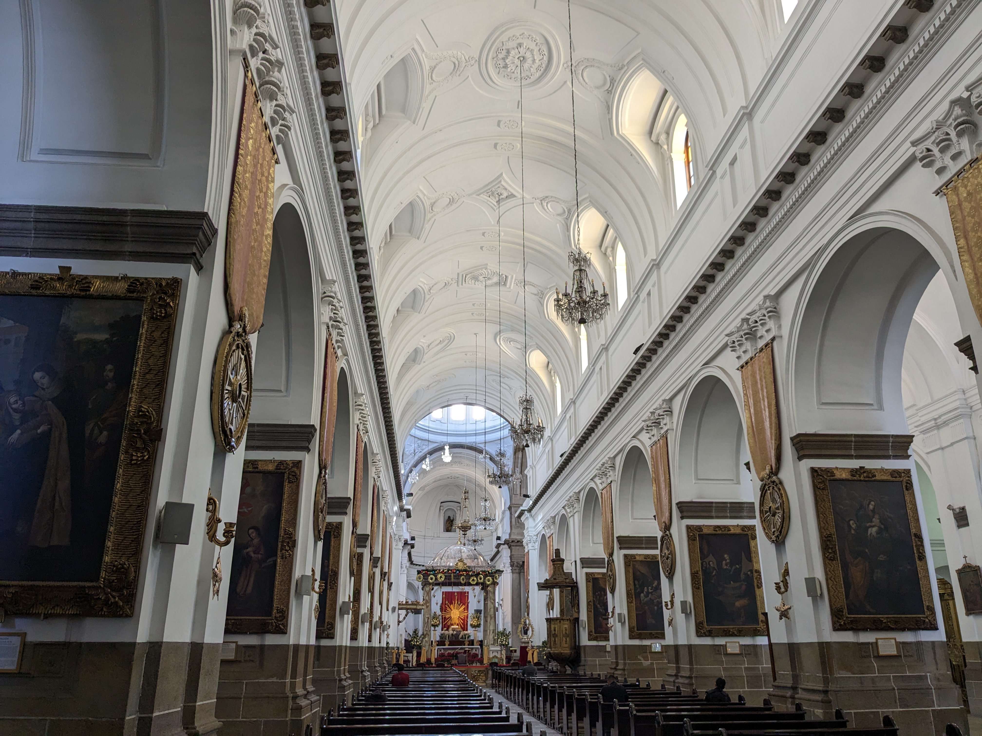


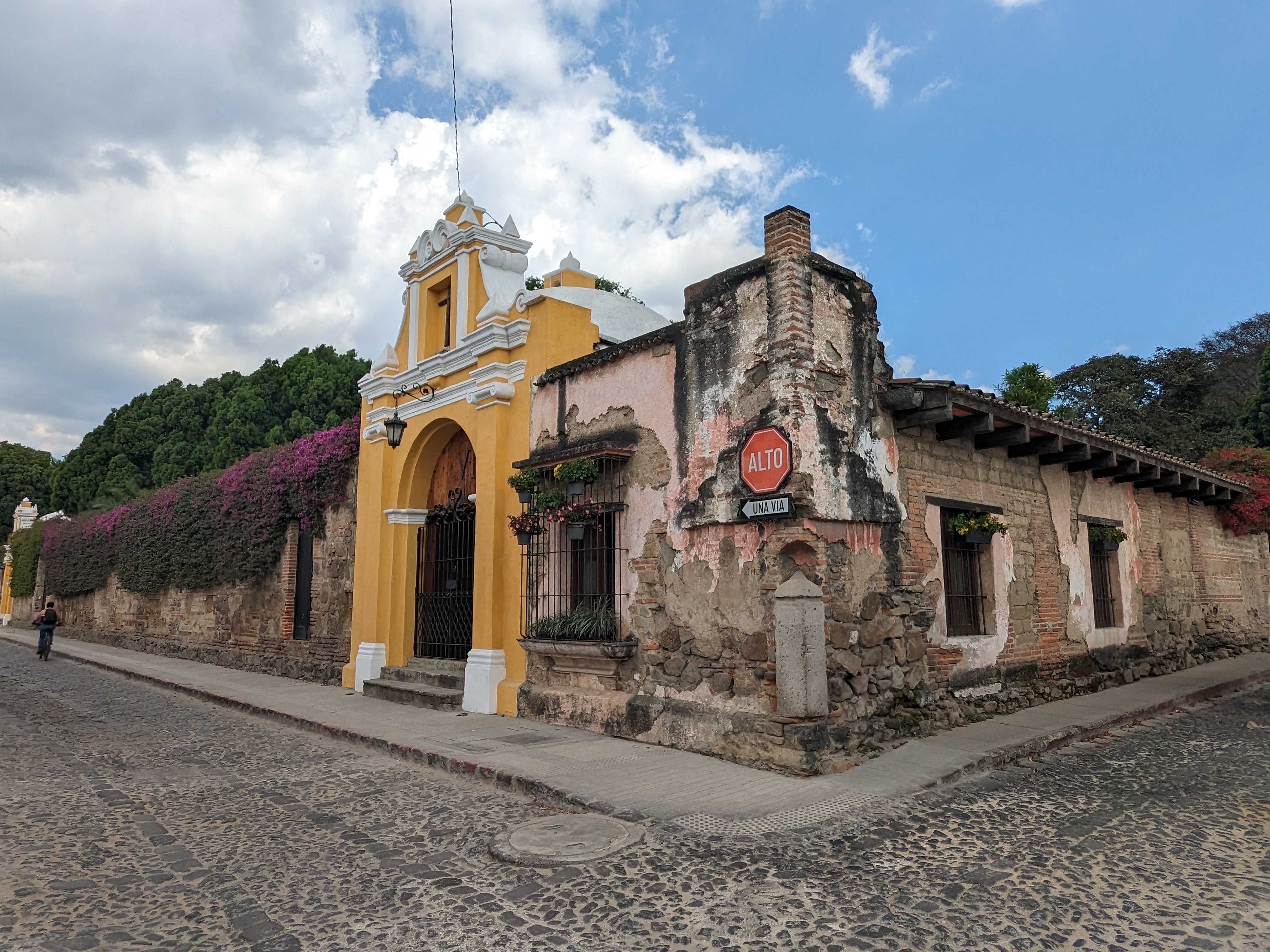


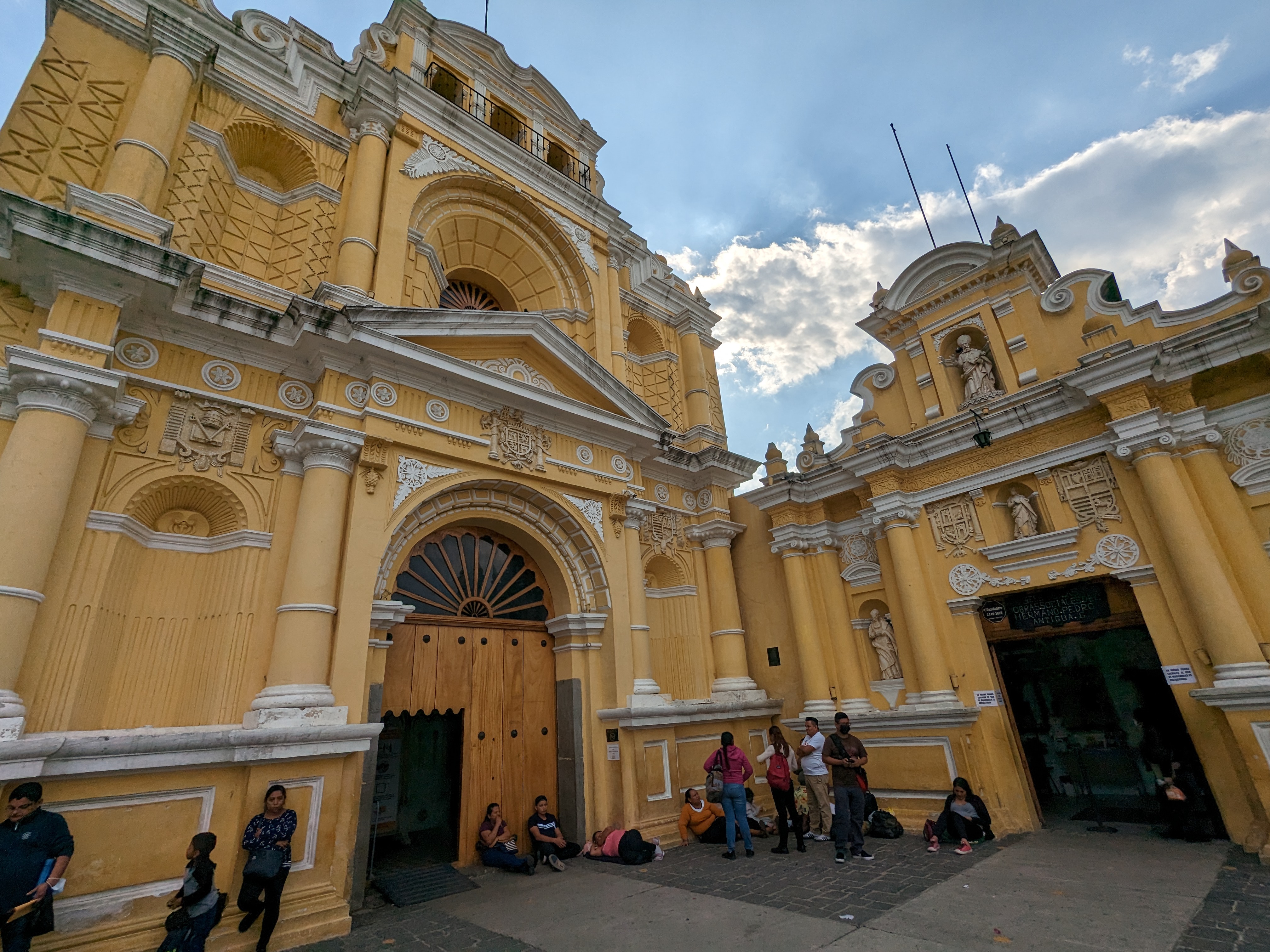


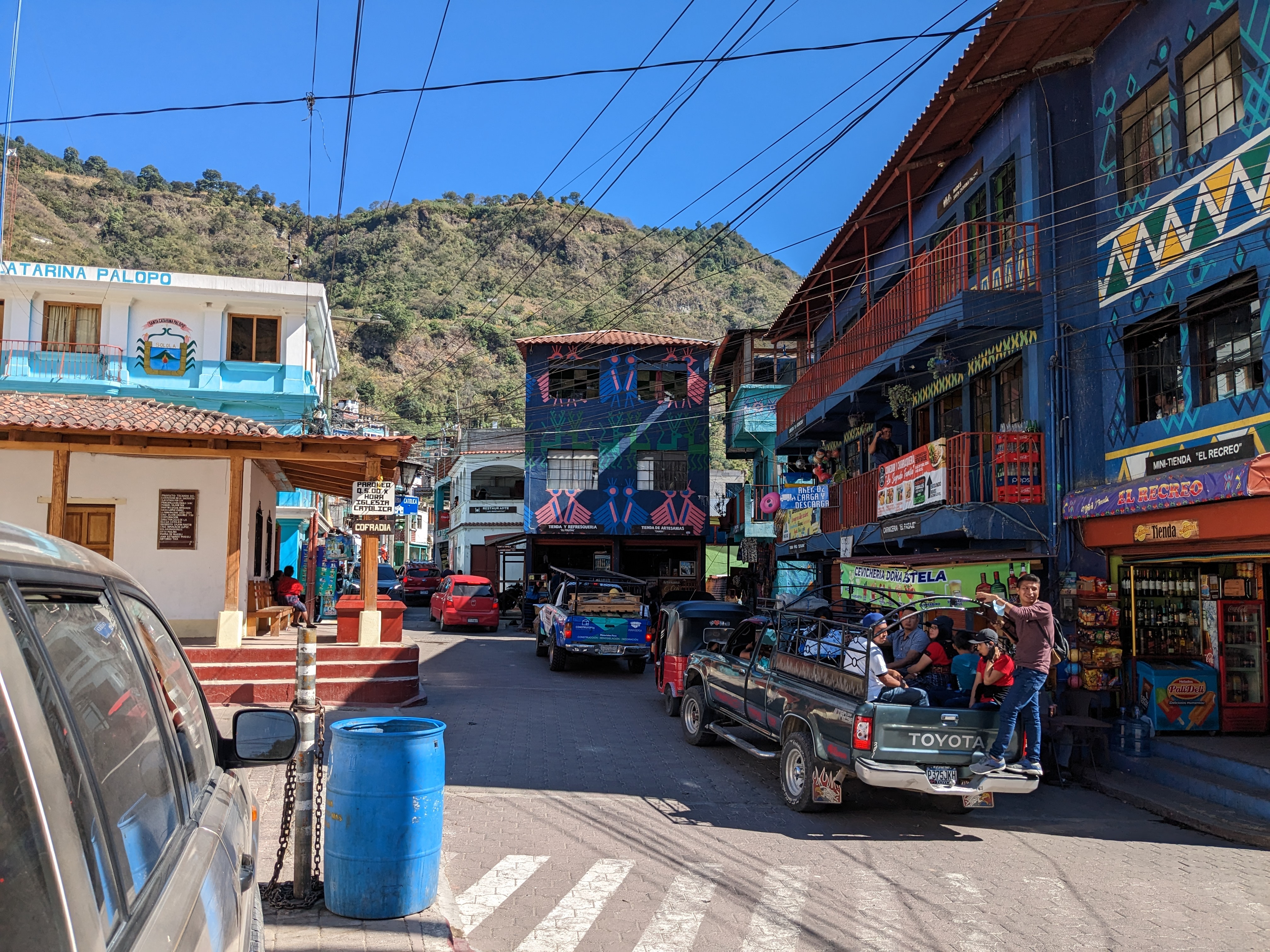


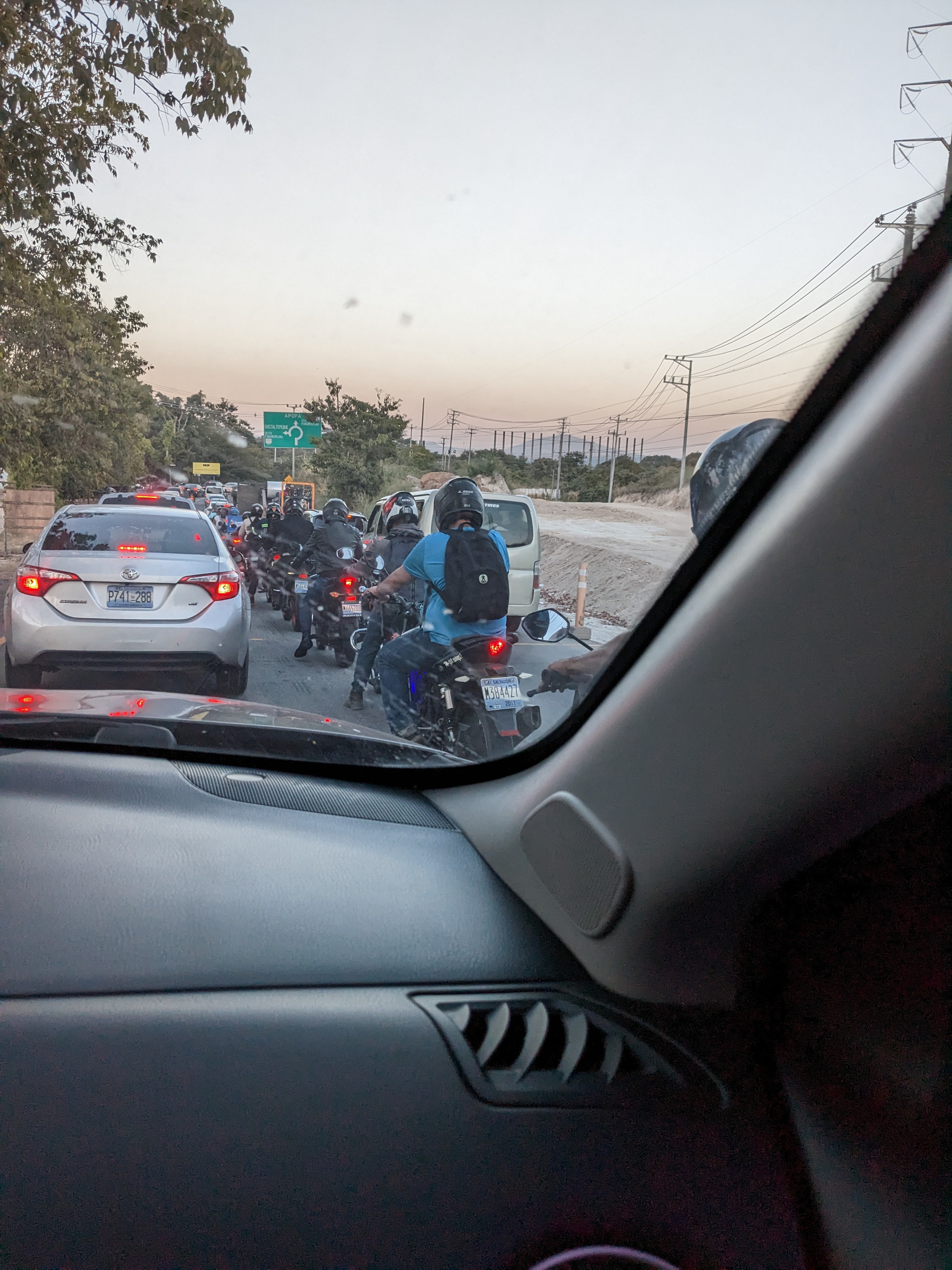


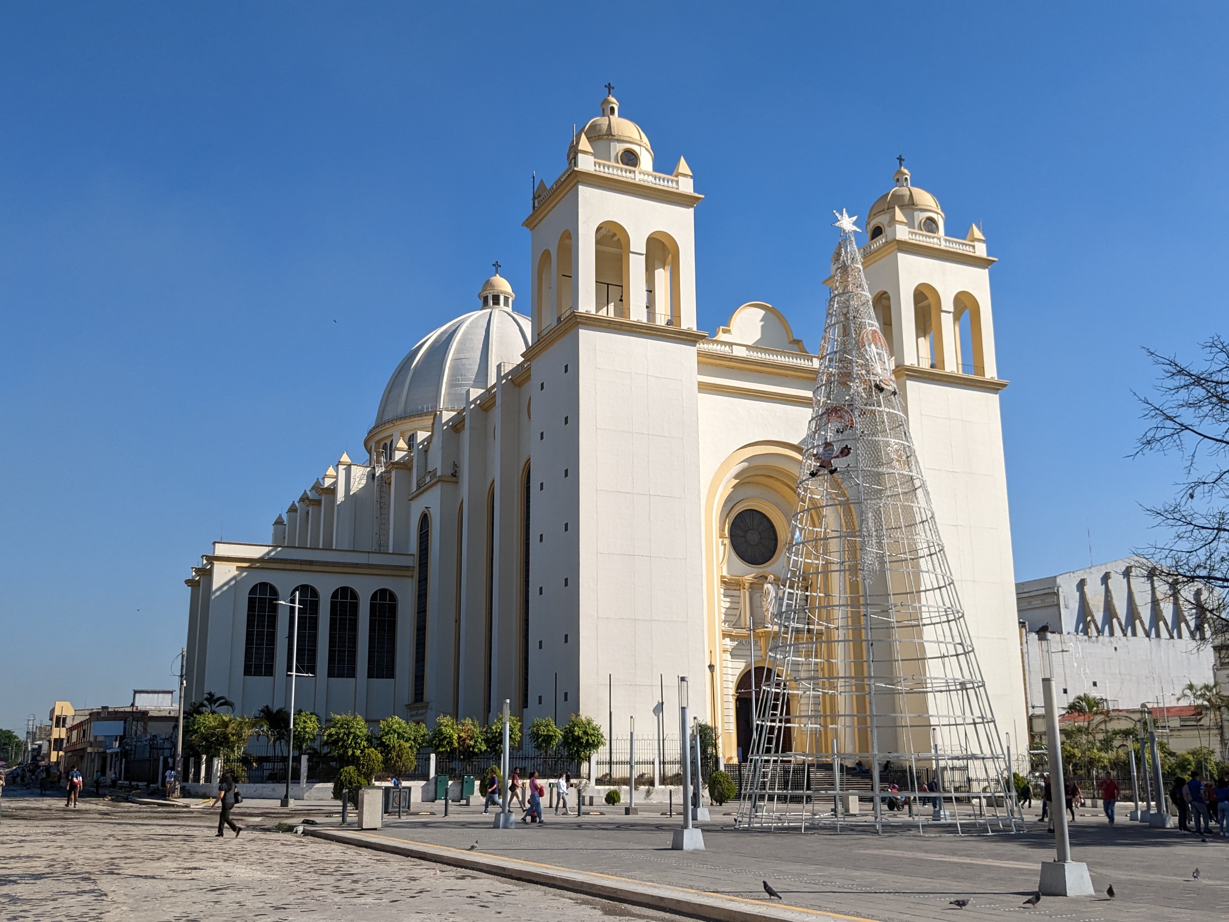


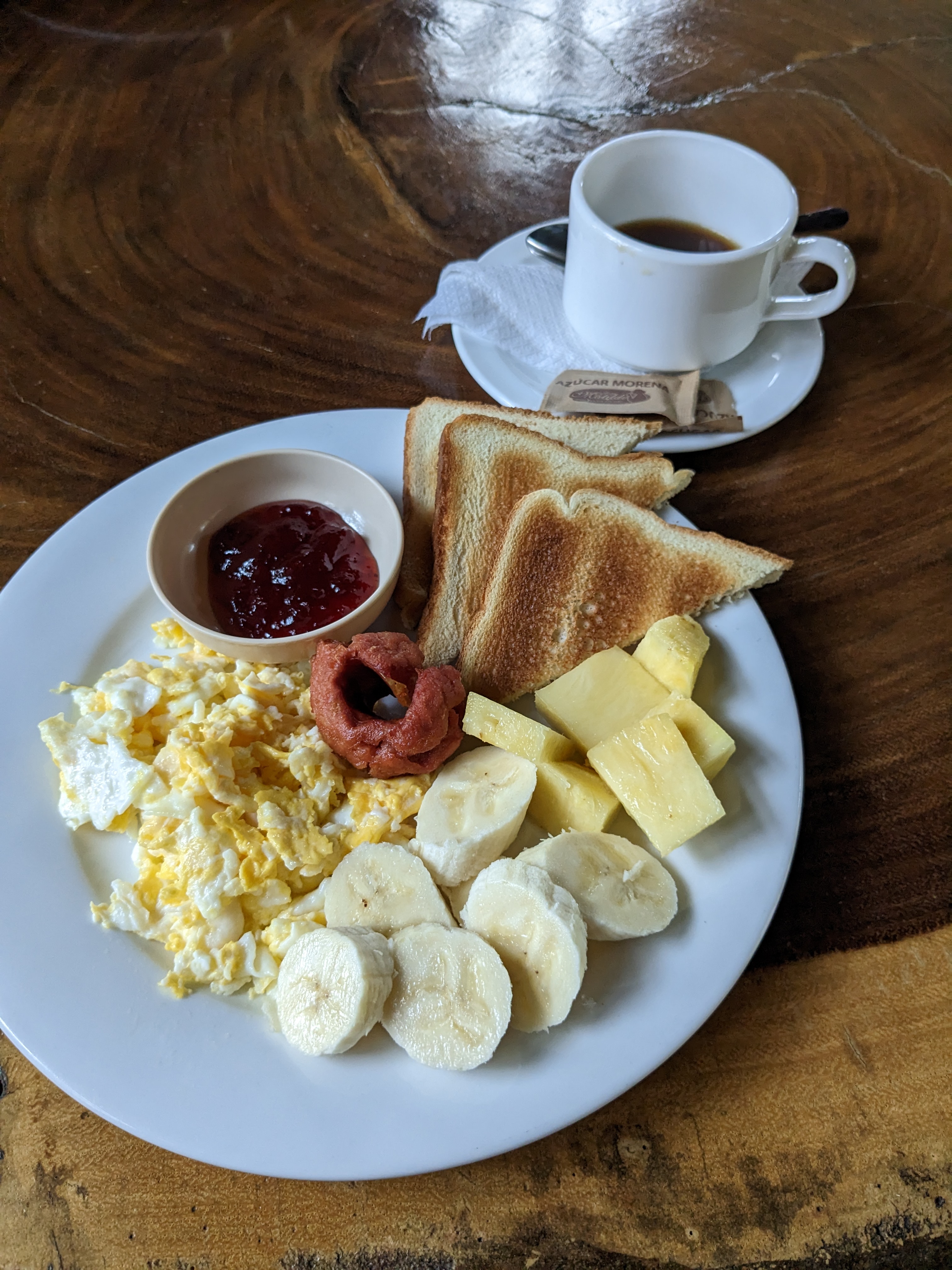


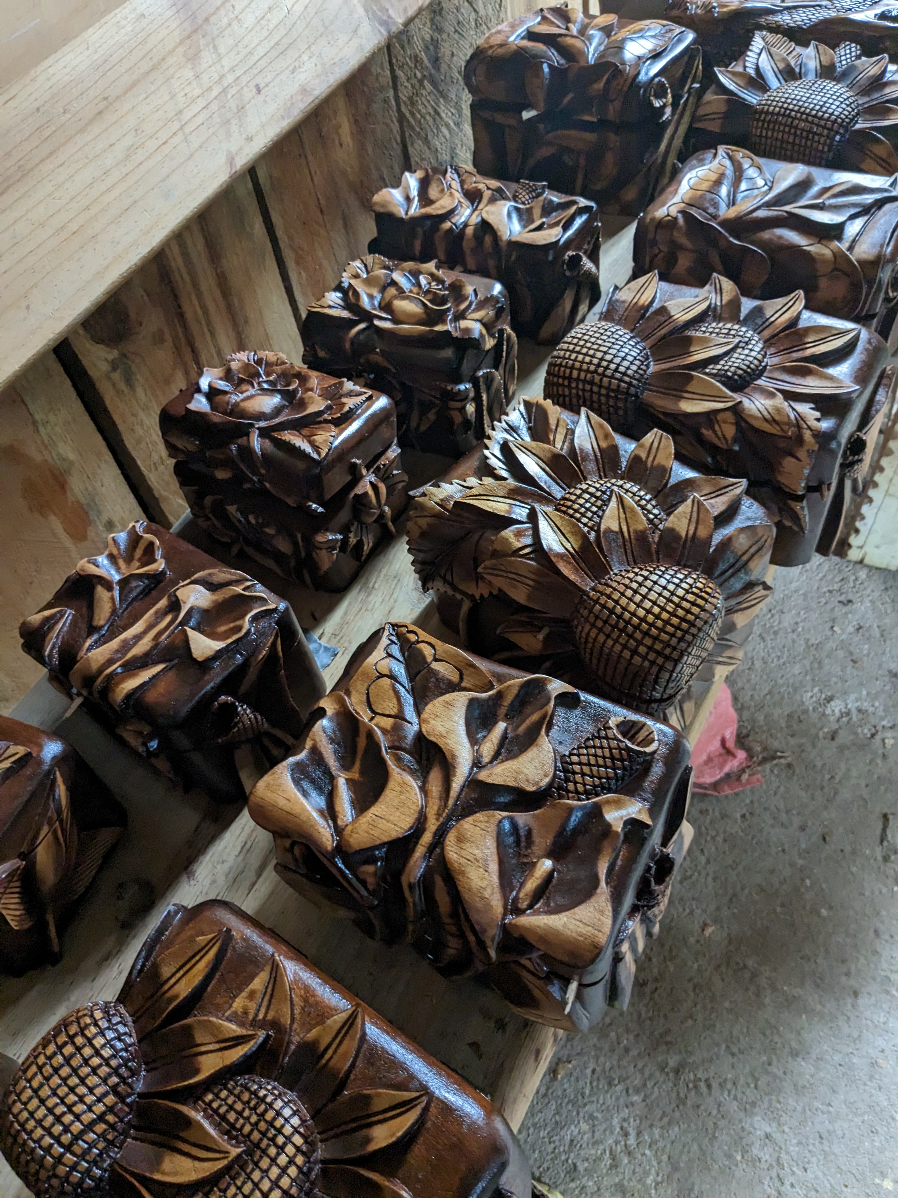