Panama City - Cartagena - Bogota - Guayaquil - Galapagos - Otavalo - Papallacta - Amazon - Baños - Patate - Quito
November 2 - November 19, 2018
 |
| Cartagena, Colombia |
Flags of the Countries Visited
Table of Contents
This trip was a long time coming but well worth the wait. It started more than a year earlier with travel friends asking me to join them on Gate1Travel's 12-day tour of Ecuador and the Galapagos Islands. In the interim, I thought it would be a waste of time going all the way down there from the US without also taking in some of the other countries in the vicinity. In the end, I tacked a 6-day, self-guided tour of Panama and Colombia onto the front end of the 12-day Ecuador/Galapagos tour and made it an 18-day extravaganza.
Because I am a Gate1Travel fan, I used their Panama and Colombia itineraries to help construct the self-guided portion of my tour. Gate1Travel always nails the major sites, but I'm not always a fan of their hotel options because they are often a little off the beaten path, making it necessary to taxi or use public transportation to get to the more happening areas for dinner and nightlife.
Overall the trip was a success. We had no trouble navigating Panama and Colombia on our own, and as usual, the Gate1Travel execution in Ecuador and Galapagos exceeded expectations. We got a decent dose of history, nature and culture while experiencing interesting sights, amazing scenery, decent weather, friendly people, great food, and comfortable accommodations.
How Long Was Your Trip? When Did You Go? Where Did You Go? 18 days from November 2 to 19, 2018. I spent:
- 2 days traveling back and forth from my home in Milwaukee, Wisconsin, USA
- 2 days in Panama City, Panama
- 2 days in Cartagena, Colombia
- 2 days in Bogota, Colombia
- 1 day traveling from Bogota to Guayaquil, Ecuador
- 2-1/2 days in the Galapagos Islands
- 1/2 day traveling from Galapagos to Quito
- 1 day in Quito
- 5 days traveling to Otavalo, Papallacta, the Amazon, Baños and Patate in Ecuador's high altitudes and rain forests before returning to Quito for the flight home
Did You Do This on Your Own or with a Tour Company? I guided myself through Panama and Colombia, then joined a Gate1Travel tour for Ecuador and the Galapagos Islands.
The self-guided portion included Panama City, Panama, followed by Cartagena and Bogota, Colombia. I took in comprehensive city tours one day in each city, then did a countryside excursion the next day. At night, I made sure I went to the happening parts of town and left a little time for shopping in between.
The escorted portion of the tour covered Ecuador's Galapagos Islands and the high-altitude cities of Otavalo, Papallacta, Amazon, Baños, Patate and Quito. The Gate1Travel tour was nicely paced and hit all the major stops. We had three different tour directors, but the one we had longest was an Ecuador native named Patricio Puga, who expertly guided us around the Quito vicinity during the last 8 days of the tour. Prior to that, we had two naturalist guides on the Galapagos Islands and another tour guide for a few days at the beginning of the tour who managed our arrival in Guayaquil and next-day transfer to the Galapagos Islands.
 |
| Our Gate1 Tour Director, Patricio Puga from Ecuador and Galapagos Naturalists Sato & Valentine |
My tour group had 24 people. Most came from various parts of the US. Four came from Canada. We were a very seasoned group of travelers and we got along well. The group included 8 friends I made on my 2014 tour of South Africa and Zimbabwe.
 |
| Tour Group (24 + Guide & Driver) in Patate, Ecuador |
 |
| The 2014 South Africa Group |
How Did You Get There and Back? I traveled more than 9,600 miles by plane and motorcoach over the 18-day trip. I flew 8,534 miles from the US to Panama, Colombia, Galapagos, Quito, and then back to the US. Toward the end of the trip, I travelled 426 miles by motorcoach in the rain forest and mountainous areas around Quito.
 |
| USA-Panama City-Cartagena-Bogota-Guayaquil-Galapagos-Quito-USA |
 |
| Quito-Otavalo-Papallacta-Punta Ahuano-Baños-Patate-Quito |
Was It Easy Navigating Your Way Around? Yes, because we were situated either in the heart of town within walking distance to most everything, or shuttled by motorcoach to our destinations. Taxis and Uber were available at reasonable rates.
 |
| Our Comfortable Gate1 Motor Coach |
Where Did You Stay? We stayed in a number of 3-, 4-, and 5-star hotels. Most were in or close to the center of town. In the less populated areas in the Galapagos Islands and the Quito region, we stayed in a number of fabulous resorts. All hotels and resorts were modern, clean and comfortable, with excellent, full-service restaurants and great Internet.
 |
| The Hotels I Stayed In |
On the escorted portion with Gate1Travel, most of our meals were included in the price of the tour. Each offered an excellent American and Continental breakfast buffet. And when we had group dinners at the hotel, we feasted on a bountiful buffet of western and local food.
The electricity situation in each room and in every country we visited was identical to the US, so didn't need the usual current converters and plug adapters.
 |
| Outlets Electronics Need to Fit |
What Was the Food Like? We found pretty much any type of food we wanted. I avoided street food and exotic food to avoid the need for imodium. While guinea pig ("cuy"), looked interesting, I opted for meals comprised of beef, chicken, pork and lamb. On one occasion, we stopped for empanadas at a local eatery in Otavalo, which proved a safe choice.
 |
| Guinea Pig ("Cuy") for Sale in Baños |
How Were the People? The locals were extremely friendly and overjoyed to see us. Although Spanish was the local language, most people we interacted with spoke English. I brought my Spanish phrase book for back up.
Panama, Colombia and Ecuador are also blessed with large indigenous populations. We got up close and personal with the Embera tribe in Panama, the only Afro-Colombian population in Colombia, and the Otavalo tribe in Ecuador, among others.
 |
| Indigenous Peoples of Panama, Colombia & Ecuador |
How was the Weather? The November weather bounced between hot and humid to cool and comfortable. The hot and humid areas included all of Panama, Cartagena, Galapagos and the Amazon River basin. T-shirts and shorts are a must. Note however that you will need to wear long-sleeve shirts and long pants when hiking in the Amazon basin, even if it's 95F and humid. In the higher elevations, like Bogota and the Quito region, it is far cooler and dryer. Long pants, sweatshirts, and jackets may be needed. And don't forget a rain jacket, a wide brim hat, sunscreen, insect repellent, a swimsuit and a pair of water shoes. The weather can be wet and unpredictable in November.
 |
| Average November Weather Where We Travelled |
What Was the Currency? What Were Prices Like? The only foreign currency we dealt with was the Colombia Peso ("Copa"). The US dollar is the standard in Panama and Ecuador. When we needed cash, there were ATMs everywhere. Prices were very low by US standards in all the countries we visited. For example, the Hilton hotel in Panama City and a centrally located hotel in Bogota was about $60 per night for two people. The 15-mile Uber premium ride from downtown Bogota to the airport was $8. A beer anywhere cost about $1.50 to $2.00 a bottle. A nice breakfast in Cartagena was about $5 and a decent dinner in Bogota was $10.
 |
| Colombia Peso = 50,000 Pesos = $17 USD |
What Did This Whole Trip Cost You? It was neither cheap nor expensive. I spent $6,740 in total, or about $366 per day.
The self-guided portion through Panama and Colombia during the first 7 days of my vacation cost about $225 per day. The Gate1 portion cost about $470 per day for 12 days. The average for 18 days was $374 per day. By combining two trips into one trip (self-guided + guided tour), I saved about $1,100 on airfare by making one flight down to the region instead of two separate trips.
It was money well spent and an excellent travel value. I paid most of the trip cost ($5,900) before I left the US by advance-booking hotels and sightseeing tours. Once on the ground, I spent another $860 on hotels, sightseeing, meals and tips, and international telephone charges, mostly on the self-guided portion of the tour in Panama and Colombia. Be sure to bring a lot of $5 and $1 bills for tipping and purchases in small towns since prices are fairly low and it's difficult for businesses to make change when you give them higher-denomination bills.
The only extraordinary cost was for immunizations. Because of a yellow fever epidemic in the region, I spent $250 on a yellow fever immunization before I left in order to get into Ecuador. This was required because our trip took us to Panama and Colombia for more than 12 hours before arrival in Ecuador.
Special Trip Considerations. If you suffer from altitude sickness, dislike hot and humid conditions, don't like mosquitos, have breathing issues, or are not in very good physical condition, take note:
- Bogota and the Quito region are high altitude areas (8,900'+ above sea level). It took a few days to adjust to the altitude and I found myself lightheaded and short of breath on several occasions. I didn't need medication or coca tea to relieve symptoms, but several people on the tour did.
- Panama, Cartagena, the Galapagos and the Amazon areas are very hot and humid year round. Water, comfortable clothing, a hat, raincoat, sunscreen, and insect repellent are needed to avoid withering under the challenging conditions. On several tours, we had wet landings, meaning we needed a pair of water shoes or a spare pair of dry shoes to wear because wet shoes and clothes will not dry quickly in the humid environment.
- Mosquito-borne diseases are rife in this region of the world year round. You may need malaria or yellow fever immunizations before arriving. And you will definitely be applying insect repellent generously throughout your visit.
- Air quality was fine in Panama City, Cartagena, Bogota and the Galapagos, but several Ecuador towns I visited had issues, particularly Quito, where the heavy, polluted air left me with a persistent cough and dry throat for the last seven days of my trip. Also in Punta Ahuano in the Ecuadoran Amazon, the smell of the locals burning trash around the hotel left our clothes and room smelling of smoke, as well as the exhaust fumes from the motorized canoes we used to get around. If you have breathing issues, you may need some sort of protection.
- Half the tour group commented that they wished they were in better shape because many of our tours included long hikes up steep inclines, arduous slogs over uneven and muddy surfaces, and precarious treks over large rocks and boulders, all in oppressive heat and humidity. A couple tour members were not able to go on hikes or had to be aided by our guides when they were overcome by heat or physical exertion.
Any Parting Comments? Yes. Travel is an adventure. It’s an opportunity to experience, learn and appreciate how people around the world live. While I’m always happy to come home at the end, I never come back the same person.
Following is a day-by-day account of my trip. Each day starts with an overview of what we did, followed by my daily journal. You can just read on or go back to the Table of Contents above and jump to a specific day or topic of interest.
Enjoy!
Itinerary: Fly USA to Panama City, Panama - Balance of day discovering Panama City
About Panama from Lonely Planet
Daily Journal
Weather: 40F and clear in Milwaukee and Chicago, but a balmy 80F and overcast in Panama City, Panama.
It was a long day of travel that started in Milwaukee and ended in Panama City, Panama.
My direct flight from Chicago to Panama City departed at 9 am so I had to get up at 3:15 am, shower and run to the bus station five blocks away for the 3:55 am CoachUSA bus to Chicago O'Hare.
The bus trip was uneventful except there was no bus and no passengers at the bus stop until 2 minutes before we left. I arrived at O'Hare at 6 am and was checked in and sitting at the gate by 7:15 am.
My Copa Airlines 737-800 left on time at 9 am for the 5-1/2 hour flight to Panama City. I had a nice view from my window seat over the left-wing.
 |
| My Plane - Chicago to Panama City |
 |
| Panama National Bird |
My flight arrived a few minutes early at 2:30 pm Panama time, which is the same as Chicago during daylight savings time. I was struck by how modern Panama City was. Apparently, it's the most cosmopolitan city in Latin America. Unfortunately, Joe's plane was an hour late arriving from Houston so I ended waiting for him instead of him waiting for me.
 |
| First Glimpse of Panama City - Wow! Modern |
 |
| Another View of Panama City |
The immigration process in Panama City was interesting because they not only took my picture, but also fingerprinted both hands. They also didn't tell us we had to fill out a customs declaration form before exiting the restricted area with luggage. So I had to go fill out the form and get back in line.
While I waited for Joe to arrive, I checked out international phone plans on AT&T. I ended up splurging on a $10/day plan, which ended up being a lifesaver since we were self-guiding ourselves through the first 7 days of the trip and I needed a way to stay in touch with the hotels and tours operators I booked the vacation with. I was also able to call Uber for a ride from the airport to our hotel, and that saved $22. It also helped avoid getting scammed by the scores of unauthorized cab drivers inside the terminal trying to pick off business from the official White Cab service.
When I asked one unauthorized cabbie about what his deal was, he said that the White Cab was about $35 to get into town, while he would only charge $25. Uber was only $12.75, including tolls and Airport parking, which the driver paid. Fortunately, the currency in Panama is the US dollar, so it was very convenient paying. Panama has a US currency called the Balboa, but it is equivalent to the dollar and is in the form of coins up to $1. Otherwise, they use the same paper money as the US.
Unfortunately, Joe's luggage did not show up and had to have it delivered to the hotel later in the evening.
The Uber to our hotel in downtown Panama City took about 25 minutes in the pouring rain and rush hour traffic. We stayed at the Hilton Garden Inn. It was very nice for $60 a night for two people. Upon arrival, I called both tour companies to confirm that we were in Panama City and that we looked forward to our tours with them over the next two days.
After checking in to our hotel, we wandered around the downtown area near our hotel until we stumbled into a really nice restaurant and wine bar called The Market. The restaurant could not serve alcohol that day because it was All Souls Day, which celebrates people who have died but not yet entered into heaven. However, the bartender disguised our beer in coffee cups and we happily toasted our arrival in Panama.
 |
| Our Hotel Hilton in Panama City |
We had pizza and artichoke spinach dip for dinner. The tab for dinner and five beers was $46 for the two, including tip. We learned over the ensuing days that Panama City is very inexpensive. After dinner, we took Uber back to our hotel a mile or so away for about $2.50.
I managed to stay up till about 10 pm even though I woke up at 3:15 am. Joe's luggage finally caught up with him from Houston and he was able to retrieve it from the lobby after I went to bed.
Itinerary: Comprehensive tour of the Panama City, including the Panama Canal at Miraflores Locks, Ancon Hill, the Amador Causeway, and Casco Viejo ("Old City"), a UNESCO World Heritage site. The tour was booked through TripAdvisor.com prior to the trip.
Daily Journal
Weather: 82F, partly sunny with occasional rain, and quite humid.
 |
| Panama Sign - Amador Causeway |
Because I had no jet lag or time zone changes to deal with, I got a good night's sleep. I woke up about 6 am, showered and had breakfast in the hotel restaurant.
Our native Panamanian tour guide, Tony, picked us up on time at our hotel at 7:15 am. We then made three more stops to pick up other people on the tour, which included a young man from Bogota, an older woman from Scottsdale, AZ, and a youngish, recent widow from Virginia. All of them had come to Panama at the spur of the moment and had booked the tour only a day or two in advance, which left me wondering what kind of tour I was getting because the more expensive tours had already filled up several weeks earlier when I tried to book them. In the end, we essentially got a driver who took us to all the places we want to see but who didn't do much narrating.

Because it was Independence Day from Colombia (1903), the city was alive with activity. We learned that a lot of people were in town and that there would be parades and celebrations in the city all weekend. Another celebration would occur in mid-November to celebrate Panama's independence from Spain (1821). Until 1820, Panama was part of Gran Colombia, a collection of now-independent nations who banded together to gain independence from Spain.
We learned that the first European to land in Panama was a Spaniard named Rodrigo Galvan de Bastidas in 1501. The first Spanish settlement in Panama was made in 1510. Then on September 25, 1513 Vasco Nunez de Balboa became the first European to see the Pacific Ocean (which he called the South Sea and which he claimed for Spain). Balboa established Panama City on the Pacific side of Panama and the town of Antigua on Caribbean side of Panama. Panama means abundance of fish and butterflies.
We learned that Panama City has a population of 4 million and is arguably the most cosmopolitan city in Latin American. I would agree with that. The city has a modern downtown and Pacific coast waterfront. The Amador causeway is also a nice development. And the beautifully preserved old town (Casco Viejo) can't be beaten. Our hotel was located in an up-and-coming residential area. Other than these areas, the city seems has poor, blighted, run down areas like any other big city.
Following the ousting of President Manuel Noriega several years ago, the country selects a new democratically-elected president every five years.
We also learned that rain is important to Panama because freshwater is used to operate the locks of the Panama Canal, not saltwater.
Finally, we learned that the road we were traveling on goes all the way to Costa Rica, but not to Colombia due to the violent drug trade. The Panama army stays away from the drug zones to the east so many drugs are produced in the eastern regions of Panama. Drugs flow from Panama to Costa Rica and then north to the United States.
Towards the end of the 25 minute drive to the Panama Canal, the discussion turned to the history of the Panama Canal. The French chose Panama over Nicaragua for the site of the canal because Panama has no earthquakes. The French tried building the canal from 1882 to 1889 after building the Suez Canal. They gave up due to malaria, yellow fever, mudslides and rain. The US took over the canal building project and had to negotiate with Gran Colombia. The US wanted the canal due to Panama's strategic location. After Panama gained its independence from Colombia in 1903, the US started construction of a military base and then the canal from 1904 to 1914. It took 8 years to dig from one end of the canal to the other.
In 2002, the US gave the canal to Panama. All profits go to Panama. The canal generates $8-10 million of revenue per day or $2 billion per year. The canal was expanded starting with a national referendum in 2006. The new expanded canal opened in 2016.
Upon arrival at the Miraflores Locks & Canal Visitor Center, we made our way immediately to the fourth-floor observation platform because a large ship was making its way through the locks right in front of us. While we waited for the next ship to come through, we quickly went through a museum recounting the history of the canal and the delicate ecosystem through which it passes.
Since we had some time to kill, we stopped at the museum concession stand for coffee. Unfortunately, the clerk wasn't happy with my feeble attempt to order a "Frappe con Cafe y Chocolate" in Spanish.
After coffee, we watched a short movie about the canal in the adjacent theater and then back outside to watch a second ship go through the canal. We departed around 9:30 am for our next stop, Ancon Hill.
 |
| Panama Canal - Miraflores Locks |
 |
| Panama Canal - Miraflores Locks |
 |
| Panama Canal - Miraflores Locks |
 |
| Panama Canal - Miraflores Locks |
 |
| Panama Canal - Miraflores Locks |
 |
| Panama Canal - Miraflores Locks |
 |
| Panama Canal - Miraflores Locks |
 |
| Panama Canal - Miraflores Locks |
 |
| Panama Canal - Miraflores Locks |
 |
| Panama Canal - Miraflores Locks |
 |
| Panama Canal - Miraflores Locks |
 |
| Panama Canal - Miraflores Locks |
We arrived at the base of Ancon Hill close to 10 am. Because the road to the top goes through a gated community, our guide dropped us off at the gate and told us we had to walk up a steep hill for 25 minutes to reach the top. He waited in his van for us until we returned.
The walk up was worth the effort. It's the highest spot in the city (700' above sea level) and offers unparalleled views of Panama Bay, the canal, a rising modern city, the Amador Causeway, and Casco Viejo.
I was worried that the older and heavier people in our small group would not make it up the hill alive, but they surprised me. The walk down was easier. Although we saw no monkeys or toucans, we did see a number of vultures and small rodent-like animals.
 |
| Ancon Hill |
 |
| Ancon Hill |
 |
| Ancon Hill |
By 11 am, we reached the bottom of Ancon Hill and got back in the van for the drive to Amador Causeway, a remodeled section of the former Panama Canal zone and popular recreation area for Panamanians and foreigners. The causeway encircles old town harbor and has palm trees, walking/biking trails, shopping, restaurants, and a large marina. The famous Frank Gehry biodiversity museum is also on the causeway. Our guide once again pointed us to points of interest and waited for us in his van.
 |
| Amador Causeway |
 |
| Amador Causeway |
 |
| Amador Causeway |
 |
| Amador Causeway |
 |
| Amador Causeway - Gehry Museum |
By 12:30 pm, we found ourselves on the outskirts of Casco Viejo, the well-preserved, 300-year-old Colonial center of Panama City and UNESCO World Heritage site.
It was impossible to get closer to the center of Casco Viejo because the streets were shut down and crowded with people partaking in independence day festivities.
Our guide pointed us toward the heart of old town and then waited 1-1/2 hours for us to return. Fortunately, Casco Viejo is compact and easily walkable. If you just wander the streets, you'll run into all the interesting sites. We just stuck together as a group and meandered the lively, colorful streets, taking in the view and excitement.
 |
| Casco Viejo |
 |
| Casco Viejo |
 |
| Casco Viejo |
 |
| Casco Viejo |
 |
| Casco Viejo |
 |
| Casco Viejo |
 |
| Casco Viejo |
 |
| Casco Viejo |
 |
| Casco Viejo |
 |
| Casco Viejo |
 |
| Casco Viejo |
 |
| Casco Viejo |
 |
| Casco Viejo |
 |
| Casco Viejo |
 |
| Casco Viejo |
 |
| Casco Viejo |
 |
| Casco Viejo |
 |
| Casco Viejo |
 |
| Casco Viejo |
 |
| Casco Viejo |
 |
| Casco Viejo |
 |
| Casco Viejo |
By 2:30 pm, we were back at our hotel relaxing in the Jacuzzi on the 16th floor rooftop deck. In the late afternoon, we walked through the residential area behind the hotel along Calle Argentina and eventually made a large semi-circular loop back towards downtown, the waterfront, and our hotel, stopping for a late lunch along the way.
 |
| Downtown Panama City |
 |
| Downtown Panama City |
We then went back to the hotel Jacuzzi till sundown. This time around, the water was much warmer after complaining it was too cold earlier.
 |
| Hilton Garden Inn - Panama City |
Later after dark, we took Uber downtown. It was a challenge for the driver because of all the street closures, but we eventually got dumped off reasonably close to our destination. We watched the end of the Independence Day parade and fireworks along the waterfront before ducking into a local drinking establishment for a few beers.
We headed back to the hotel relatively early, packed our bags for tomorrow's journey to Cartagena, and went to bed.
Itinerary: Morning cruise up the Panama Canal to Monkey Island on Gatun Lake, followed by an afternoon visit to the Embera indigenous Indian village north of Panama City. Late evening transfer to Panama City airport for flight to Cartagena, Colombia. Tours booked through TripAdvisor.com prior to the trip.
Daily Journal
Weather: 82F and partly sunny with occasional rain. Quite humid.
I got another good night sleep. We had a 7 am pickup for our day of touring, so we got up before 6 am, showered, and had breakfast down in the hotel restaurant again.
The day turned out more eventful than planned because the Embera village tour operator called me to offer a free canal cruise to Monkey Island in Gatun Lake. Because of Independence Day celebration congestion in the downtown area, he did not want to venture into the city to pick us up later in the morning for our tour. We definitely got the better end of the deal.
Our tour operator, Jerin Tate, an American from Missouri who calls himself the "Sloth Whisperer," picked us up in a heavy-duty van right on time at 7 am. We then picked up a half dozen other people hailing from Germany, Poland, and Israel. We proceeded to the rainforest in Chagres Nature Reserve about 30 minutes northwest of Panama City on Gatun Lake. Gatun Lake is in the middle of the Panama Canal and all ships pass through it when going through the canal. It is also a delicate ecosystem teeming with life.
Along the way in the Chagres Nature Reserve, the guide spotted a sloth in a tree and we had to get out for photos while the traffic whizzed by and Panamanian soldiers slogged past on a morning run through the hilly terrain in the oppressive heat.
 |
| Chagres Nature Reserve - Stop to See Sloth |
 |
| Chagres Nature Reserve - Sloth in a Tree |
At the end of the road, we came to a dock where we boarded a boat and went out into Gatun Lake to visit a number of islands inhabited by several different species of monkeys. Along the way we passed several large container ships making their way through the canal. They dwarfed our tiny boat.
 |
| Monkey Island - Gatun Lake |
 |
| Monkey Island - Gatun Lake |
 |
| Monkey Island - Gatun Lake |
As we approached each island in the lake, our guide called out to the monkeys. A few seconds later, the alpha males and other monkeys streamed down from the treetops above us in search of the grapes, bananas and limes we held in our hands. The monkeys quickly scurried about the boat checking our hands for treats. Some sat on our heads and crawled over our laps and shoulders as they leaped across the boat from person to person. As long as we didn't make any sudden moves, we were safe. When the food was gone, the monkeys scurried back up into the trees. The monkeys who got limes rubbed it on their fur, or their mate's fur, as an antibacterial to rid themselves of parasites. On the way back, we passed more container ships and saw various birds, like pelicans, cuckoos, toucans and herons. Overall, it was a nice experience.
 |
| Monkey Island - Gatun Lake |
 |
| Monkey Island - Gatun Lake |
 |
| Monkey Island - Gatun Lake |
 |
| Monkey Island - Gatun Lake |
 |
| Monkey Island - Gatun Lake |
 |
| Monkey Island - Gatun Lake |
 |
| Monkey Island - Gatun Lake |
 |
| Monkey Island - Gatun Lake |
 |
| Monkey Island - Gatun Lake |
 |
| Monkey Island - Gatun Lake |
Following the visit to the monkey islands, we got back in the van and took a long bumpy ride down a horrible road 30 minutes to the northeast. At the end of the road, we came to a river where we boarded a motorized dugout canoe for a 15-minute ride to the village of Papu, inhabited by the indigenous Embera tribe, the keepers of the rainforest.
 |
| Embera Village Visit |
 |
| Embera Village Visit |
 |
| Embera Village Visit |
 |
| Embera Village Visit |
 |
| Embera Village Visit |
Upon arrival at the village, we were warmly welcomed with cultural dances and music that haven't changed much since Columbus arrived in the 1500s. We then went to a community hut where the chief and others recounted their history and life in the rainforest. They also demonstrated their native songs and dances. Afterward, we visited their museum and went over to the cooking hut where we enjoyed a specially prepared traditional meal of fish, plantains, and assorted fruit. After that, we toured their museum and explored the primitive village, before shopping for handmade items and making our way back to the boat for a short journey to a local waterfall. I ended up getting a henna tattoo from one of the local teenagers, which lasted for days.
 |
| Embera Village Visit |
 |
| Embera Village Visit |
 |
| Embera Village Visit |
 |
| Embera Village Visit |
 |
| Embera Village Visit |
 |
| Embera Village Visit |
 |
| Embera Village Visit - My Henna Tattoo |
 |
| Embera Village Visit |
 |
| Embera Village Visit |
 |
| Embera Village Visit |
 |
| Embera Village Visit - Fish & Plantains in Palm Leaf |
 |
| Embera Village Visit |
 |
| Embera Village Visit |
We learned that the Embera are one of seven indigenous tribes in Panama. They have been in the region since 1500. The tribe kept moving as the Spanish settled into the area. Originally, the Embera settled along the eastern border by Colombia. They are river people...no river, no life. Eventually, the tribe settled farther to the west in the Darien area east of Panama City. The tribe now has its own official area in Panama and they live by their own laws. Everything the tribe does socially, politically, and legally is resolved within the community. Due to the growing drug trade, the tribe settled in the area we visited today in 1948.
The 98 members of the tribe are largely self-sufficient. They live in open air huts on stilts with no electricity. They hunt, fish and grow everything they need and pass knowledge down from one generation to next. There is a hospital nearby if serious medical treatment is needed. Because of growing restrictions on hunting and fishing, tourist dollars are becoming more important. The tribe is a democracy. Leaders are elected by tribe members. Women can be tribal leaders too.
During the museum visit, we learned that one tribe member taught jungle survival skills to the Apollo astronauts in case they had problems and ended up making an emergency landing in the jungle. The tribe member was awarded the Congressional Medal of Honor for his work.
Following the village visit, we reboarded our boat and made our way down the river to see the Embera waterfall. After 10 minutes, our boat turned up a narrow inlet and we proceeded as far as we could. After beaching the boat, we got out and made our way along the shore to the waterfall a half-mile up the river. This was not an easy trek. The water was higher than usual due to recent rain so we had to first cross the river on foot in fast-moving water, followed by slogging through water and climbing over boulders until we reached our destination. We admired the waterfall while some members of the group went swimming. We then walked back to the boat and went back up the river to our van. On the way back it started raining heavily. Fortunately, they passed out rain parkas for us to wear.
 |
| Embera Waterfall |
 |
| Embera Waterfall |
 |
| Embera Waterfall |
 |
| Embera Waterfall |
 |
| Embera Waterfall |
 |
| Embera Waterfall |
By 3 pm, we were back at our hotel in Panama City. We cleaned up and Ubered back to the Panama City airport several hours early. We had dinner and wandered the airport stores for a few hours noting how much more expensive stuff is at the airport than in town.
At 9:30 pm, our Copa Airlines 737-800 departed Panama City on time. We arrived 45 minutes later in Cartagena. It was a bumpy flight. We caught a cab for the 6-mile trip to our airport in the heart of Cartagena's old city. The streets were crowded with mostly young people out on the town. Upon arrival at our hotel, we went promptly to bed in preparation for a long day of touring the following day.
Itinerary: Explored the magnificent old city of Cartagena in the morning followed by an organized tour to other parts of Cartagena in the afternoon. The organized tour was booked on TripAdviser.com prior to the trip.
Daily Journal
Weather: 86F and sunny. Very humid with a nice breeze off the Caribbean Sea
Cartagena was easily the most beautiful city I saw on this trip. It is a superbly preserved colonial city with surprises around every corner and very easy to navigate on foot. It is also a UNESCO World Heritage Site.
I got up at 6:30 am eager to explore Cartagena in the morning before our 4-hour afternoon guided tour. Our hotel was in the heart of the tourist area just inside the main gate of the city walls. Needless to say, I was immediately accosted by aggressive guides offering walking tours of the old city. I tried to ignore one rather persistent fellow who just wouldn't leave me alone. When I told him I wasn't interested, he told me to f*** off, which surprised me.
 |
| Our Hotel by the Clock Tower |
We proceeded to the nearest bank ATM to get some local currency, then wandered the streets in search of breakfast. We found a cute little place, and despite not speaking Spanish, and managed to order coffee and breakfast.
After breakfast, we systematically walked up and down every street enjoying the colorful buildings, overflowing vines and flower boxes, and narrow streets. The old town was surprisingly quiet but we learned later people here rise and go to work early, so we had missed the rush.
 |
| Old Town of Cartagena |
 |
| Old Town of Cartagena |
 |
| Old Town of Cartagena |
 |
| Old Town of Cartagena |
 |
| Old Town of Cartagena |
 |
| Old Town of Cartagena |
 |
| Old Town of Cartagena |
 |
| Old Town of Cartagena |
 |
| Old Town of Cartagena |
 |
| Old Town of Cartagena |
 |
| Old Town of Cartagena |
 |
| Old Town of Cartagena |
 |
| Old Town of Cartagena |
 |
| Old Town of Cartagena |
 |
| Old Town of Cartagena |
 |
| Old Town of Cartagena |
 |
| Old Town of Cartagena |
 |
| Old Town of Cartagena |
 |
| Old Town of Cartagena |
 |
| Old Town of Cartagena |
 |
| Old Town of Cartagena |
 |
| Old Town of Cartagena |
 |
| Old Town of Cartagena |
 |
| Old Town of Cartagena |
 |
| Old Town of Cartagena |
 |
| Old Town of Cartagena |
 |
| Old Town of Cartagena |
 |
| Old Town of Cartagena |
 |
| Old Town of Cartagena |
 |
| Old Town of Cartagena |
 |
| Old Town of Cartagena |
 |
| Old Town of Cartagena |
 |
| Old Town of Cartagena |
We eventually went outside the main city gate near our hotel and walked along the marina where we saw tall ships and the modern city skyline in the distance.
 |
| Old Town of Cartagena - Clock Tower |
 |
| Old Town of Cartagena |
 |
| Old Town of Cartagena |
 |
| Old Town of Cartagena |
 |
| Modern Cartagena |
After coffee and a short rest, we met our afternoon tour guide Richard at the hotel around 1:45 pm for a tour of Cartagena that largely focused on attractions outside the historic city center. As we walked with Richard, we picked up some other people at their hotels, then got on a small bus that took us to a larger bus parked outside the city wall.
 |
| Our Cartagena Tour Guide |
We drove along the beaches we had walked along earlier in the day. It was a holiday week in Colombia so the beaches were packed. There are miles and miles of cabanas stretching down the white sand beaches with waves from the Caribbean Sea crashing on the shore for as far as the eye can see.
 |
| Beaches of Cartagena |
We then stopped in the port zone to admire the skyscrapers and take pictures. Magically, all of the ice cream vendors showed up right where the bus stopped.
 |
| Modern Cartagena |
We then proceeded into the Getsemani residential area just to the east of old town to meet the people and see how the average person lives in Cartagena. The area was a distance cry from the opulence of Old Town, but alive with activity and people going about their daily business.
 |
| Getsemani District of Cartagena |
 |
| Getsemani District of Cartagena |
 |
| Getsemani District of Cartagena |
 |
| Getsemani District of Cartagena |
 |
| Getsemani District of Cartagena |
 |
| Getsemani District of Cartagena |
 |
| Getsemani District of Cartagena |
 |
| Getsemani District of Cartagena |
We then went to Castillo de San Felipe on San Lazaro Hill to see expansive views of the city, sea and the port zone. San Felipe castle-fortress built to defend the city from pirate attacks.
 |
| Castillo de San Felipe |
 |
| Castillo de San Felipe |
 |
| Castillo de San Felipe |
 |
| Castillo de San Felipe |
 |
| Castillo de San Felipe |
 |
| Castillo de San Felipe |
 |
| Castillo de San Felipe |
 |
| Castillo de San Felipe |
 |
| Castillo de San Felipe |
 |
| Castillo de San Felipe |
Following the visit, we returned to the old city for a brief walking tour, which was somewhat redundant with what we did in the morning but not nearly as comprehensive. We also stopped for coffee and an emerald store, where we learned about this important Colombian export. Fans of the movie Romancing the Stone will recall it took place in Colombia.
 |
| Interesting Coffee & Book Shop in Old Town |
Following the tour, we had dinner at a place near our hotel. I feasted on a simple meal of tilapia, plantains, coleslaw, rice and other sides.
After dinner, we went back to the hotel to take some pictures of Old Town from the rooftop deck, and then went to bed.
 |
| Old Town from Our Hotel |
 |
| Old Town from Our Hotel |
 |
| Old Town from Our Hotel |
Go to Table of Contents
Itinerary: Tour of La Boquilla Mangrove Swamps, a fishing village located twenty minutes north of Cartagena. Late afternoon transfer to Cartagena airport for early evening flight to Bogota, Colombia. The tour was arranged before the trip but payment made on the day of the tour, per the operator's request.
Daily Journal
Weather: 86F and partly cloudy. High humidity.
I got up at 6 am and packed. We had to leave our luggage at the front desk while out on our tour because we weren't planning to get back from the tour until after check out time. Fortunately, all the clothes I had washed out in the sink the night before had dried completely, so I have all clean clothes.
After packing, we headed to breakfast at the same place we ate yesterday. Today I had waffles rancheros, which was a step up from yesterday's classic egg and meat skillet breakfast. I once again tipped the staff and they rang the bell over the cash register rather loudly.
Upon stepping out of the hotel, we were once again greeted by the same angry English-speaking Colombian guide who badgered me relentlessly yesterday. This time, instead of telling me to f*** off, he just kept repeating "Don't you know how to talk? Don't you know how to talk?" as Joe and I chatted amongst ourselves trying to ignore him. Eventually, he stormed off in a huff. The guy is definitely in the wrong profession. 40% of Cartagena residents work in tourism so a bad attitude does not bode well for Cartagena.
Cartagena is like any other heavily touristic place. There are vendors everywhere selling Panama hats, water, candy and souvenirs of all sorts. There are also a lot of guides soliciting walking tours in the main squares. Some vendors and guides can be aggressive, but they are quite harmless.
After breakfast, we went looking for the ubiquitous Juan Valdez coffee shop chain for more coffee. After satisfying the need for more caffeine, we wandered back to the hotel to sit at the pool for a bit. At 8:30 am we checked out of the hotel and left our bags at the front desk while we waited for our tour to begin at 9 am.
Around 9 am, a guide Luis from La Boquilla Mangrove Tours and a woman driver picked us up in a car and drove us out to La Boquilla, an Afro-Colombian fishing village about 20 minutes northeast of Cartagena.
Getting to the tour was half the experience because the roads were clogged with traffic due to road closures for a holiday parade on Thursday. Once we turned off the main highway, we headed through a really sketchy looking area of La Boquilla toward the beach. The road was muddy road and filled with potholes and large pools of standing water. At the end of the road, we turned and drove right down the sandy beach on a makeshift road that was well travelled by the locals. Avoiding the stray dogs, people and pools of standing water was a challenge for our driver. We came upon a small commuter bus stuck in the water up to the top of its tires. It was still there when we returned two hours later.
 |
| La Boquilla Mangrove Tour |
Eventually we turned off the beach into the town of La Boquilla, which was reminiscent of the slums I had seen in New Delhi, India. Definitely had a Third World experience. At the end of the road was the beach where Boquilla Mangrove tours kept their canoes. We were warmly greeted by the executive director Rony and several other employees of the tour.
 |
| La Boquilla Mangrove Tour |
We eventually boarded a canoe with a driver and started our tour through the mangroves, going through several Mangrove "caves" and stopping to learn about the importance of mangroves to the preservation of the area.
 |
| La Boquilla Mangrove Tour |
 |
| La Boquilla Mangrove Tour |
 |
| La Boquilla Mangrove Tour |
Red mangroves grow everywhere and are able to grow roots up and down. The black mangroves are the filters that remove salt from the water, and the white mangroves are the least prevalent of the three types of mangroves here. We learned that mangroves are self-sustaining in that they make their own food.
 |
| La Boquilla Mangrove Tour |
 |
| La Boquilla Mangrove Tour |
 |
| La Boquilla Mangrove Tour |
 |
| La Boquilla Mangrove Tour |
 |
| La Boquilla Mangrove Tour |
 |
| La Boquilla Mangrove Tour |
 |
| La Boquilla Mangrove Tour |
 |
| La Boquilla Mangrove Tour |
 |
| La Boquilla Mangrove Tour |
Inside the mangroves live an abundance of fish as well as scores of bird species. It is also rumored that there are crocodiles and boa constrictors in the mangroves but we didn't see any.
We learned that La Boquilla is dependent on fishing and tourism. We toured the mangroves in a canoe for a little over an hour before returning to the launch point for a coconut refreshment before returning to Cartagena.
Joe even got an opportunity to use the pole to push the canoe through the mangrove. I decided that I didn't want to do it because I was afraid I might fall overboard.
 |
| La Boquilla Mangrove Tour |
 |
| La Boquilla Mangrove Tour |
 |
| La Boquilla Mangrove Tour |
 |
| La Boquilla Mangrove Tour |
 |
| La Boquilla Mangrove Tour |
 |
| La Boquilla Mangrove Tour |
 |
| La Boquilla Mangrove Tour |
All in all, the tour was relaxing and informative, and definitely off the beaten path.
After the tour we returned to the hotel, fetched our luggage and headed to the airport early. We had to wait an hour to check into our flight and so sat at a coffee shop till it was time to check in. During that time it rained like crazy and the lights went off in the terminal for several minutes.
By the time our flight was ready to board, they still had not fixed the information screens by the gate. So we didn't know exactly where our flight was leaving from. We had to ask a few gate agents and security personnel to point us in the right direction.
Our Avianca Airbus 320 departed on time at 5:16 pm for the 1 hour 28 minute flight to Bogota. We arrived on time and grabbed a cab for the 20 minute ride to town. Bogota is surrounded by steep mountains so when we reached the hopping La Candelaria district where our hotel was located, the roads were like going down a roller coaster and I found my foot on the imaginary brake pedal as we zoomed down a very steep hill towards our hotel.
 |
| Plane from Cartagena to Bogota |
 |
| Busy Bus Stop in Bogota |
We checked in to our hotel and walked the lively and colorful streets before settling into dinner at the Aquelarre de la Bruja (The Witches Cauldron) near our hotel. I had a Tex-Mex dinner, which was delicious.
 |
| Graffiti St - La Candelaria, Bogota |
After dinner, we wandered back to the hotel a few blocks away and called it a night.
Itinerary: Bogota City Tour including Monserrate, the Gold Museum, and the colorful La Candelaria district. This tour was booked before the trip. Late afternoon visit to the Fernando Botero Museum.
About Bogota from Lonely Planet
Daily Journal
Weather: 69F and partly cloudy
I woke up at 6 am, showered and went for an early morning walk around the La Candelaria district around the hotel.
 |
| La Candelaria District - Bogota |
 |
| La Candelaria District - Bogota |
 |
| La Candelaria District - Bogota |
 |
| La Candelaria District - Bogota |
 |
| La Candelaria District - Bogota |
 |
| La Candelaria District - Bogota |
 |
| La Candelaria District - Bogota |
By 7:15 m, I was back at the hotel having a simple breakfast of scrambled eggs, bread and butter, a pancake, orange juice and coffee.
 |
| My Hotel in Bogota's La Candelaria District |
I didn't sleep well due to the high altitude and had experienced periods of dizziness and shortness of breath. On the plus side, it was the first time in 4 days that I wasn't sweating profusely by 8 am.
At 8:30 am, our Bogota tour guide, Nicola, picked us up at our hotel along with another tour member named William from NYC, who grew up in Port Washington, WI and went to UW Milwaukee. Small world. He moved to Colombia in 2015 for a Colombian woman he met in Milwaukee.
The first stop on our tour was Monserrate, a mountain top retreat for the devoutly Catholic, offering sweeping views of Bogota. We took a funicular to the top, visited a church known as the shrine of "El Señor Caído," then stopped to admire the sprawling metropolis of Bogota and the Andes Mountains.
 |
| Monserrate Mountain in Colombia |
 |
| Monserrate Mountain in Colombia |
 |
| Monserrate Mountain in Colombia |
 |
| Monserrate Mountain in Colombia |
 |
| Monserrate Mountain in Colombia |
 |
| Monserrate Mountain in Colombia |
 |
| Monserrate Mountain in Colombia |
 |
| Monserrate Mountain in Colombia |
 |
| Monserrate Mountain in Colombia |
 |
| Monserrate Mountain in Colombia |
 |
| Monserrate Mountain in Colombia |
After we took the funicular back down, William got very lightheaded and short of breath and threw up his mixed fruit breakfast on the steps while we waited for our driver to come get us to take us to the Museo del Oro. We hung out for several minutes while William recovered from his bout of altitude sickness.
We arrived at the Museum del Oro at 10:30 am. The museum houses the largest collection of gold artifacts from the pre-Hispanic era gathered from a variety of ancient indigenous peoples. It was a magnificent museum.
 |
| Museo del Oro in Bogota |
 |
| Museo del Oro in Bogota |
 |
| Museo del Oro in Bogota |
 |
| Museo del Oro in Bogota |
 |
| Museo del Oro in Bogota |
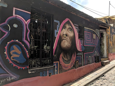
After the museum, we went on a walking tour of the colonial La Candelaria section of town close to our hotel. We stopped at the oldest church in South America, El Sagrario, then to nearby "graffiti street," the city's former sewer, to view the colorful art and buildings lining the street.
 |
| El Sagrario Church in Bogota |
 |
| Graffiti Street in La Candelaria, Bogota |
 |
| Graffiti Street in La Candelaria, Bogota |
 |
| Graffiti Street in La Candelaria, Bogota |
 |
| Graffiti Street in La Candelaria, Bogota |
 |
| Graffiti Street in La Candelaria, Bogota |
 |
| Graffiti Street in La Candelaria, Bogota |
 |
| Graffiti Street in La Candelaria, Bogota |
 |
| Graffiti Street in La Candelaria, Bogota |
 |
| Graffiti Street in La Candelaria, Bogota |
 |
| Graffiti Street in La Candelaria, Bogota |
 |
| Graffiti Street in La Candelaria, Bogota |
We then wandered south to a replica of a gothic church from France called El Carmen, then east to Bolivar Square containing the presidential palace, cathedral, supreme court, and Congress.
 |
| El Carmen Church |
 |
| El Carmen Church |
 |
| Presidential Palace |
 |
| Colombian Congress |
 |
| Colombian Supreme Court |
 |
| Presidential Palace |
 |
| Colombia National Cathedral |
 |
| Street Scene Near Presidential Palace |
We then went to a former ministry building housing old religious artifacts made of solid gold and sided with precious stones. The tour ended at our hotel just as my camera battery ran out.
We had lunch at our hotel (lasagna and pizza) and coffee next door before returning to the hotel for a nap. My knee had swelled up overnight so I needed the rest since I aggravated it on the tour.
After the nap, we went for a walk in our neighborhood. We ended up at the Fernando Botero Museum, which contains many of the paintings and sculptures of this world-famous contemporary Colombian artist. Well worth a visit.
 |
| Botero Museum in Bogota |
 |
| Botero Museum in Bogota |
 |
| Botero Museum in Bogota |
 |
| Botero Museum in Bogota |
Afterward, we wandered the various streets of La Candelaria till we found a lively Irish bar called The Pub, where we stopped for a beer and chatted with a couple of women from Scotland who were working in Colombia as engineers.
Afterward, we went over to our hotel where Joe had something to eat while I had a beer and caught up on my journal. Afterwards, we headed back to the room and watched TV for a little while until I fell asleep.
Day 7 – Thursday, November 8, 2018 – Fly to Guayaquil, Ecuador
Itinerary: Flight from Bogota to Guayaquil, Ecuador. Balance of the day is at leisure.
About Ecuador from Lonely Planet
Daily Journal
Weather: 80F and sunny
I woke up at 6 am. I got a good night's sleep even though my knee was still a little swollen. It's the same swelling I experienced in July 2017 for which doctors could not find a cause. It ended up swelling even more over the next several days and didn't subside until I was about to come home at the end of the trip.
We had breakfast in the hotel restaurant since it was included in the price of the room. This morning we had the cereal breakfast option. We inadvertently put the yogurt in our coffee instead of milk. I should have noticed when it curdled a bit. The coffee still tasted ok though.
 |
| Healthy Breakfast at the Hotel |
After breakfast, we went to find the drug store recommended by our hotel so I could get an elastic bandage for my knee. It did not open till 9 so we went for another cup of coffee. Afterward, Joe went back to the hotel and I went back to the drug store and waited for it to open at 9.
I got my knee brace and everything was cool. Then we called Uber Black and went to the airport at 10 am. It seemed to take forever for the driver to get to us but when he did we had a quick half-hour drive to the airport and we were standing in a long check-in line 3 hours before our flight left.
 |
| Big Commuter Bus - No Subway in Bogota |
We wore shorts to the airport because it was going to be 93F in Guayaquil, Ecuador upon arrival.
We proceeded relatively quickly through check-in and customs and wandered down the long corridor to our gate. We saw William from the tour yesterday, who was on his way home to New York today. We visited with him for an hour before heading to our gate.
At 2:30 pm, our Avianca A320 flight left 55 minutes late for the 1 hour 25-minute flight to Guayaquil. We arrived a little after 4 pm, about a half-hour behind schedule.
 |
| The Plane from Bogota to Guayaquil |
We sailed through immigration, baggage claim, and customs fairly quickly and met our Gate1 guide Fernando in the arrival Hall at the Guayaquil Airport. We then drove about a half-hour into the city to our hotel in the downtown area about 14 blocks from the riverfront.
 |
| The Hotel in Guayaquil |
Along the way, Fernando briefed us on tomorrow's itinerary, which included a flight to the Galapagos Islands and sightseeing on the way to the hotel on Santa Cruz Island.
The most important part of the briefing was to make sure certain items were not in our luggage, or we could face a $600 fine for each violation. Among those items were:
- No plastic bags with handles
- No aerosol sprays
- No cranberries
- No caked-on mud on shoe soles.
 |
| No-No's in the Galapagos |
We were advised to use hotel laundry bags in place of plastic bags with handles and to scrape mud off the bottoms of our shoes. I also had to donate all of my fruit-and-nut granola bars because they had cranberries. Cranberries apparently grow even when processed into food and could become an invasive species of plant.
We were then told that we had to leave the hotel no later than 7:20 am tomorrow morning and that we should carry a day bag because we'll be hiking for 5 hours on the Galapagos Islands prior to returning to our hotel for the evening.
The early hotel departure meant that we had to schedule a 5:45 am wakeup call, prepare to have breakfast between 6:15 and 7 am, and be down in the lobby with our bags by 7:15 am.
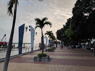
Upon arrival at the hotel, we checked in and dropped our stuff off in our room and then headed 14 blocks east of the hotel to the waterfront before the sun went down. The waterfront is a civic improvement project called Malecon 2000. It had an amusement park, shopping mall, and pedestrian walkway, all in a park-like setting.
 |
| Near Guayaquil Waterfront - Malecon 2000 |
 |
| Near Guayaquil Waterfront - Malecon 2000 |
 |
| Near Guayaquil Waterfront - Malecon 2000 |
 |
| Near Guayaquil Waterfront - Malecon 2000 |
 |
| Guayaquil Waterfront - Malecon 2000 |
 |
| Guayaquil Waterfront - Malecon 2000 |
 |
| Guayaquil Waterfront - Malecon 2000 |
 |
| Guayaquil Waterfront - Malecon 2000 |
After visiting the waterfront, we went over to Iguana Park where we saw iguanas in the trees and in enclosures. We then ducked into a nearby church across the street and ran into three of our travel mates from the South Africa trip 4 years ago as they were coming out (Ellis, Isabelle, and Russ).
 |
| Near Iguana Park in Guayaquil |
 |
| Iguana Park in Guayaquil |
 |
| Iguana Park in Guayaquil |
 |
| Iguana Park in Guayaquil |
We chatted with them and then headed back to the hotel and had dinner at one of its restaurants called Le Patio. After dinner I returned to the room to pack my bags, take a shower, and catch up on my journal. Looking forward to tomorrow.
Itinerary: Morning flight from Guayaquil to Baltra Island in the Galapagos. Transferred by boat to Santa Cruz Island. Sightseeing stops and lunch along the way to Puerto Ayora on the southern coast.
About the Galapagos Islands from Lonely Planet
Daily Journal
Weather: 83F and sunny. Very dry like the Arizona desert.
Well, I'm finally made it to the Galapagos Islands, an archipelago of volcanic islands five million years in home to thousands of plant and animal species. It was on my bucket list for years. It is a UNESCO World Heritage site.
 |
| Relief Map of the Galapagos Islands |
The day started in Guayaquil with a 5:45 am wake-up call and a great buffet breakfast at our hotel. By 7:20 am, we were down in the lobby and our group of 17 was off to the airport for the 1-hour 30-minute flight to the Galapagos Islands 720 miles to the west.
We arrived at the airport around 8:30 am and quickly got through check-in and were soon sitting in the gate area waiting for our 9:40 am flight to Galapagos. Our LATAM A319 took off and landed on time. We sat in the first row, which was good since I needed to stretch out my swollen knee.
 |
| Guayaquil Airport on Way to Galapagos Islands |
 |
| Flight XL 1411 to Galapagos Islands |
The German lady sitting in the aisle seat next to me got upset that Joe took a selfie of the two of us and insisted that he show her his camera to make sure she was not in the photo. Joe just told her she wasn't in the picture and left it at that. It was a weird situation.
We arrived at Baltra Island airport in the Galapagos Islands a little after 11 am, quickly cleared customs, met our guides Valentine and Sato, and took a bus to a boat for a ride over to Santa Cruz Island. The Galapagos airport is on the desert island of Baltra, which looks just like Arizona. The airport itself is surrounded by desert with cacti and other desert plants. It was a beautiful day with temperatures around 80F and no humidity.
 |
| First Glimpse of the Galapagos Islands |
 |
| Our Plane to the Galapagos Islands |
 |
| Arrival at Galapagos Airport on Baltra Island |
 |
| The Desert Environment Outside the Airport |
 |
| The Desert Environment Outside the Airport |
 |
| The Desert Environment Outside the Airport |
We made our way south from the airport to the dock on Baltra Island where boats would take us a short distance south to Santa Cruz Island.
The first glimpse of the Pacific Ocean to the south caused another stop for photos shortly after the previous stop to photograph an iguana in a tree. The water was multiple colors of blue and just spectacular.
 |
| Ferry Dock at Baltra - Destination Santa Cruz Island |
Once at the dock, we got on a boat and proceeded to Santa Cruz Island where we met another bus that would take us all the way to Puerto Ayora on the southern coast of Santa Cruz island. Puerto Ayora was home to the spectacular Finch Bay Resort where we would be staying for the next three nights.
 |
| Baltra Island Ferry Dock |
 |
| En Route to Santa Cruz Island |
 |
| Welcome to Santa Cruz Island |
While making our journey souths, we learned that the Galapagos Islands have two seasons, winter and summer. It is just the beginning of summer now. Five of the 16 islands are occupied. Santa Cruz is the most populous with 18,000.
We made two stops. The first stop was a pair of volcanic sinkholes formed by the movement of tectonic plates called Los Gemelos. They were located at the highest point on Santa Cruz Island where the terrain changes from desert to Galapagos rainforest. Ecuador and the Galapagos have many earthquakes every day but few are ever felt. All the Galapagos islands are volcanoes. In several million years from now, the Galapagos Islands will slide under the South American continent and disappear forever.
 |
| Los Gemelos on Santa Cruz Island |
 |
| Los Gemelos on Santa Cruz Island |
The second stop was a land tortoise refugee. Land tortoises, or Tortugas, can live up to 150 years, grow to 600 pounds, and grow to 1-1/2 meters tall. There were several tortoises on the road before we got to the refugee as well as many on the refugee grounds. They are not afraid of people and you can get pretty close to them. There were once 15 species of Tortugas but now there are only 11. Their numbers are shrinking so there are several breeding programs underway to replenish their numbers.
 |
| Tortoise Refuge on Santa Cruz Island |
 |
| Tortoise Refuge on Santa Cruz Island |
 |
| Tortoise Refuge on Santa Cruz Island |
 |
| Tortoise Refuge on Santa Cruz Island |
 |
| Tortoise Refuge on Santa Cruz Island |
 |
| Tortoise Refuge on Santa Cruz Island |
 |
| Tortoise Refuge on Santa Cruz Island |
While at the tortoise refugee, we stopped for lunch. We feasted on plantains, chicken, and fish. The coffee ice cream we had for dessert was delicious.
 |
| Lunch at the Tortoise Refuge on Santa Cruz Island |
After lunch we continue to Puerto Ayora where we boarded a water taxi to the Finch Bay Resort. While waiting at the dock for our boat, we saw a giant seal laying on a park bench sleeping. There were also two seals lounging on a boat in the harbor several feet off the pier. They are protected so there's not much that can be done to keep them from hanging out wherever they please.
 |
| Puerto Ayora Dock |
 |
| Puerto Ayora Dock |
 |
| Puerto Ayora Dock |
 |
| Puerto Ayora Dock |
Upon arrival at Finch Bay five minutes later, we got off the boat, called a panga, and made a long trek up a boardwalk to our hotel, The Finch Bay Resort. I wouldn't have minded but my knee was now quite swollen and it made walking difficult. The hotel was a welcome sight after the long walk. Beaches, pool, outdoor bar, open-air dining room.
 |
| Puerto Ayora Map |
 |
| Finch Bay Resort Near Puerto Ayora |
 |
| Finch Bay Resort Near Puerto Ayora |
 |
| Finch Bay Resort Near Puerto Ayora |
 |
| Finch Bay Resort Near Puerto Ayora |
 |
| Finch Bay Resort Near Puerto Ayora |
After checking in, we hung out by the pool, had a glass of wine, then went to dinner at the hotel restaurant. Dinner consisted of an octopus appetizer, soup, fish, and ice cream. Tonight's meal, like all the others that were to come over the next few days, was a masterpiece in flavor and presentation.
 |
| Joe, Ellen, Me and Janet at the Finch Bay Pool |
After dinner, I went right to bed. Other members of the group went into town by water taxi to see an outdoor concert featuring local musicians. Apparently, the show was good and the venue crowded. But I was still glad I stayed behind to rest.
Go to Table of Contents
Itinerary: Morning excursion to Divine Bay by boat, hike to Playa de los Perros (Dog Beach), and snorkeling on a calm section of a cove on Playa Punta Estrada. Afternoon excursion into Puerto Ayora to visit the Fausto Llerena Giant Tortoise Breeding Centre and the Charles Darwin Research Station.
 |
| Area We Visited on Today's Tour Near Puerto Ayora |
Daily Journal
Weather: 72F and sunny. Very dry.
I got up at 6 am, took a shower, washed some clothes in the sink, then met the group for breakfast at 7 am. Around 8:00 am, the group met in the hotel lobby and we began today's events with a hike through a reserve next to the hotel to a boat waiting for us in nearby Divine Bay.
 |
| Ready for a Day of Touring |
 |
| Hiking to Our Boat at Divine Bay |
 |
| Prickly Pear Cacti Along the Trail |
 |
| Hiking to Our Boat at Divine Bay |
When we got to the dock, we were greeted by an abundance of red crabs crawling amongst the rocks below and a number of sea lions sunning themselves on the dock and boats moored in the Bay.
 |
| The Dock at Divine Bay |
 |
| Red Crab at the Dock at Divine Bay |
 |
| Sea Lion Pup at the Dock at Divine Bay |
 |
| Sea Lion Pup at the Dock at Divine Bay |
 |
| Sea Lions in a Boat at the Dock at Divine Bay |
Under Captain Armando's command, we boated across Divine Bay, admiring the picturesque harbor and rock formations. Noddy terns, herons, marine iguanas, blue-footed boobies and Galapagos brown pelicans are commonly seen here. We saw a number of these. Once across the Bay, we disembarked and continued our hike through the desert landscape to Playa de los Perros.
 |
| Divine Bay |
 |
| Divine Bay |
 |
| Divine Bay |
 |
| Marine Iguana at Divine Bay |
 |
| Red Crabs at Divine Bay |
 |
| Volcanic Rock on Shore at Divine Bay |
 |
| Grotto at Divine Bay |
At Playa de los Perros, we found an abundance of iguanas, birds, crabs and sea lions along the volcanic rock beach.
 |
| Playa de los Perros |
 |
| Playa de los Perros |
 |
| Playa de los Perros |
 |
| Playa de los Perros |
 |
| Playa de los Perros |
 |
| Iguanas at Playa de los Perros |
 |
| Playa de los Perros |
 |
| Playa de los Perros |
 |
| Playa de los Perros |
 |
| Playa de los Perros |
 |
| Playa de los Perros |
We then returned to the boat for a short ride over to Playa Punta Estrada where we donned masks, snorkels and flippers to swim along the rocky coast. While there, we saw the famous blue-footed booby birds nesting in the rocks. I also chased a marine iguana swimming nearby, but he was too fast for me. As I dove down 15-20', I encountered schools of colorful tropical fish swimming and feeding amongst the rocks on the bottom of the Bay.
 |
| Blue Footed Booby at Divine Bay |
 |
| Rocky Shore at Divine Bay |
The highlight was swimming alongside a very large sea tortoise only inches away. He was difficult to see at first because the turbulent waves had churned up a lot of mud and made the water a cloudy. But when I looked to my right, his flipper nearly hit me in the arm. We followed him briefly until it was time to get back on the boat.
After snorkeling, we returned to the dock near our hotel and took a break for lunch at the hotel.
At 3 p.m. we boarded our panga (dinghy boat) down at the dock and went over to the public pier in Puerto Ayora, from which we walked 20 minutes down the road to the Charles Darwin Research Station, which also is home to the Fausto Llerena Giant Tortoise Breeding Centre.
 |
| Darwin Research Station Visit |
 |
| Cemetery Near Darwin Research Station |
 |
| Iguana Sunning Itself Near Darwin Research Station |
The Fausto Llerena Centre runs a successful breeding program to reverse the dwindling number of land tortoises in the Galapagos. Its most famous resident was Lonesome George, a tortoise (Tortuga) who didn't prove to be the "Don Juan" they were looking for, but was loved by visitors nonetheless. Lonesome George died a few years ago and his taxidermy remains are on display in a climate and light controlled exhibit at the museum. He was named after comedian George Gobel, whose comedy act once included his melancholy alter ego of the same name.
Land tortoises had once been hunted to near extinction by sailors (for meat) and invasive species who attacked them or ate their food supply, such as rats, dogs, cats and goats. Several measures have been taken over the years to control the threats to the native tortoise population.
Next to the tortoise rescue center was the Charles Darwin Research Station, which also focuses on preserving and studying the unique species that inhabit the Galapagos, which began with Darwin in the mid-1800s. There wasn't much to see here except the gift shop since it is really more of a scientific research site than a tourist destination.
 |
| Darwin Research Station Visit |
 |
| Darwin Research Station Visit |
 |
| Darwin Research Station Visit |
 |
| Darwin Research Station Visit |
 |
| Lonesome George - Darwin Research Station Visit |
 |
| Darwin Lookalike Outside the Gift Shop |
Following the visit to the Darwin Research Station, we hiked 45 minutes back to town, stopping in town to shop and people watch.
 |
| Home with Mosaic Tile Entrance at Puerto Ayora |
 |
| Home with Mosaic Tile Entrance at Puerto Ayora |
 |
| Home with Mosaic Tile Entrance at Puerto Ayora |
 |
| Home with Mosaic Tile Entrance at Puerto Ayora |
 |
| Home with Mosaic Tile Entrance at Puerto Ayora |
 |
| Home with Mosaic Tile Entrance at Puerto Ayora |
 |
| Puerto Ayora, Santa Cruz Island, Galapagos |
 |
| Puerto Ayora, Santa Cruz Island, Galapagos |
 |
| Puerto Ayora, Santa Cruz Island, Galapagos |
 |
| Puerto Ayora, Santa Cruz Island, Galapagos |
 |
| Puerto Ayora, Santa Cruz Island, Galapagos |
 |
| Baby Shark, Puerto Ayora, Santa Cruz Island, Galapagos |
At 6 pm, we met our hotel water taxi at the public dock and went back to the hotel. Half the group went walking over to the grottoes nearby to swim while the rest of us relaxed back at the hotel pool before dinner. My knee was really swollen after a long day of hiking.
 |
| My Poor Swollen Knee - Could Still Walk Though! |
After dinner, I went straight to bed.
Itinerary: Morning excursion to Seymour Island. Afternoon visit to Bachas Beach on the northern coast of Santa Cruz Island.
Daily Journal
Weather: 80F and sunny
I woke up at 5:45 am after a good night's sleep. I had breakfast then met the group for the 7:45 am departure for Seymour Island for a long nature hike, followed by a journey to Bachas Beach on Santa Cruz Island.
 |
| Sea Turtle at the Dock in Puerto Ayora |
The bus ride over was interesting. As we headed north from Puerto Ayora to the boat on the north side of Santa Cruz Island, it was rainy and cloudy. Once we reached the highest point on the island in the center, the weather turned sunny and warm and we descended towards the north coast.
 |
| The Warmer and Dryer Side of Santa Cruz Island |
Once we reached the northern shore of Santa Cruz Island, we boarded a small boat and made our way to a much larger private boat called the Sea Lion parked out in the harbor.
 |
| Waiting to Go to Our Boat on Santa Cruz Island |
 |
| Our Private Boat, The Sea Lion |
We proceeded across the channel to Seymour Island for a long nature walk. Along the way, we enjoyed the scenery and the frigate birds coasting above the boat in our wake.
 |
| Heading to Seymour Island |
 |
| Heading to Seymour Island |
 |
Heading to Seymour Island
|
 |
| Heading to Seymour Island |
 |
| Frigate Bird Soaring Overhead |
 |
| Heading to Seymour Island |
Once we reached Seymour Island, we took turns being ferried to the rocky shore in a small dinghy. Seymour Island was lifted from the ocean floor by a seismic event. The cliffs forming the shoreline stand only a few feet high. The island is teeming with life. We were greeted by pelicans and swallow-tailed gulls perched on the rocky ledges peeking through the water and a tiny forest of silver-grey Palo Santo trees just above the boat landing.
 |
| Shore of Seymour Island |
 |
| Shore of Seymour Island |
 |
| Shore of Seymour Island |
 |
| Shore of Seymour Island |
Once the entire group was ashore, we ventured into the bird nesting grounds scattered about the islands while enjoying the views and numerous iguana and sea lion sightings along the way. The most interesting birds were the frigates. The male of one variety has a scarlet pouch beneath his bill that is inflated to attract females.
 |
| Nesting Frigates |
 |
| Nesting Frigates |
 |
| Male Frigate Inflating Pouch Under His Bill |
Another interesting bird was the blue-footed booby. Unlike the frigates that nest in the trees, the boobies nest on the ground and mark their nesting areas with poop to keep other birds away.
 |
| Blue Footed Booby |
Along the trail, we saw scores of iguanas sunning themselves to maintain body temperature.
 |
| Iguana on Seymour Island |
 |
| Booby Nesting Ground |
 |
| Frigate Birds |
 |
| This Iguana Died Happy :-) |
 |
| Seymour Island |
 |
| Frigate Birds on Seymour Island |
 |
| Iguana on Seymour Island |
 |
| Tree Sap Used for Church Incense |
 |
| Iguana on Seymour Island |
 |
| Iguana on Seymour Island |
 |
| Views Towards the Beach on Seymour Island |
 |
| Frigate Birds |
 |
| Seymour Island |
 |
| Seymour Island |
 |
| Seymour Island |
 |
| Seymour Island |
 |
| Seymour Island |
 |
| Seymour Island |
 |
| Seymour Island |
 |
| Me at Seymour Island |
 |
| Frigate Bird |
As we came to the coastline, we were greeted by sea lions and marine iguanas fighting over territory.
 |
| Sea Lion Remains on Seymour Island |
 |
| Sea Lions on Seymour Island |
 |
| Sea Lions on Seymour Island |
 |
| Sea Lion Pup on Seymour Island |
We then reboarded the Sea Lion and headed back to Bachas Beach on the north coast of Santa Cruz Island, having lunch on board along the way.
Upon arrival at Bachas Beach, some members of the group snorkeled while the rest went ashore to walk along the beach to take photos of volcanic rock, white sands, birds, iguanas, and red crabs.
 |
| Bachas Beach on Santa Cruz Island |
 |
| Bachas Beach on Santa Cruz Island |
 |
| Bachas Beach - Iguana and Sea Turtle Nest |
 |
| Bachas Beach - Iguana and Sea Turtle Nest |
 |
| Bachas Beach on Seymour Island |
 |
| Bachas Beach on Seymour Island |
 |
| Crabs at Bachas Beach on Seymour Island |
 |
| Crab at Bachas Beach on Seymour Island |
 |
| Bachas Beach on Seymour Island |
After the visit to the beach, we went back to Puerto Ayora and our hotel, where we relaxed around the pool.
 |
| Seal Lions at Puerto Ayora Dock |
We had dinner at 6:30 pm where we sang happy birthday to tour group member Monica, who was celebrating her 60th birthday.
 |
| Happy Birthday, Monica! |
After dinner, I went to bed at 8:30 pm to give my swollen knee much-needed rest.
Itinerary: Flight from the Galapagos Islands to Quito, Ecuador.
Daily Journal
Weather: 69F and overcast in Quito
I got up before 6 am, had breakfast, settled my tab at the front desk of the hotel, and checked out of our room.
 |
| Sunrise at Finch Bay on Santa Cruz Island |
Since we still had an hour to go before our departure for the airport, I walked down to the dock and took the water taxi over to Santa Cruz and watched the fisherman clean this morning's catch.
 |
| Path from Finch Bay Hotel to Water Taxi |
 |
| Path from Finch Bay Hotel to Water Taxi |
 |
| Path from Finch Bay Hotel to Water Taxi |
 |
| Path from Finch Bay Hotel to Water Taxi |
 |
| Waiting for the Water Taxi |
 |
| Finch Bay |
 |
| Puerto Ayora on Santa Cruz Island |
 |
| Puerto Ayora on Santa Cruz Island |
 |
| Puerto Ayora on Santa Cruz Island |
 |
| Puerto Ayora on Santa Cruz Island |
 |
| Fishermen in Puerto Ayora |
 |
| Fishermen in Puerto Ayora |
 |
| Fishermen in Puerto Ayora |
Around 8:45 am I got back on the water taxi and went back over the dock near our hotel. When I get there, the group was just coming down the hill towards the dock so I didn't have to walk all the way back to the hotel, which was a long walk.
We then took the Finch Bay water taxi back to where I just came from, and boarded the bus for the 45-minute drive to the airport on Baltra Island.
 |
| En Route to the Baltra Island Airport |
 |
| Deserted US Military Base on Baltra Island |
 |
| Deserted US Military Base on Baltra Island |
 |
| Deserted US Military Base on Baltra Island |
 |
| Deserted US Military Base on Baltra Island |
At the airport, we said goodbye to our Galapagos guide Soto, then went to the LATAM airline VIP lounge for snacks, coffee and Internet.
A little after noon, we walked out to our A319 aircraft parked a 1/4 mile away on the tarmac. I was hoping not to walk too much because my knee was still swollen.
 |
| LATAM Plane, Galapagos to Quito via Guayaquil |
 |
| AC on Airplane Working Overtime |
Our flight departed on time at 1 pm for the 1-1/2 hour, 727-mile flight to Guayaquil. Once in Guayaquil, we had a 45-minute layover before continuing to Quito. The flight to Quito was 35 minutes from takeoff to touchdown. We had to take a bus from the plane to the terminal in Quito, so our luggage was waiting for us when we got to baggage claim. The airport in Quito is new and not yet fully operational.
We met our Gate1 guide, Patricio Puga, and our bus driver, Walter, in the arrival hall and said goodbye to our new travel friends, Monica and Ken from Vermont, who were only signed up for the Galapagos portion of the tour. We were later joined by 9 people at our hotel who only signed up for the Quito portion of the tour. So we would be a group of 24.
 |
| "Quito" Sign at Quito Airport |
We lost an hour on the way from the Galapagos to Quito, so it was already late afternoon and dark by the time we arrived in Quito. There was a lot of traffic in both directions leading in and out of town so it was slow going.
Along the way, we learned that Quito is the second highest capital in the world, 9,400' above sea level, next to La Paz, Bolivia. Locals and visitors who experience altitude sickness often drink coca tea to relieve nausea, lightheadedness, and dizziness. I had a little difficulty with it in Bogota a few days back but experienced no problems in Quito.
 |
| Coca Tea for Altitude Sickness |
Ecuador uses the US dollar as its currency following economic upheaval several years back. The only difference is that they use the Sacajawea dollar coin instead of $1 bills. Their pennies, nickels, dimes and quarters are also minted with a number on the back to make them easier to identify.
We eventually reached the Hilton Colon Hotel in downtown Quito. After checking out the hotel, we went for a walk outside the hotel but my knee was so swollen I returned to the hotel and went to the bar where I relaxed and have a few beers. Then it was off to bed.
 |
| Hilton Colon Hotel in Quito |
 |
| Quito from Downtown Hotel Window |
Itinerary: Morning City Tour and Visit to the Middle of the World Monument in Quito. Afternoon travel by motorcoach to Otavalo, Ecuador.
About Quito from Lonely Planet
Daily Journal
Weather: 69F and partly cloudy
I woke up at 5:30 am, made coffee in the room, ironed some clothes and took a shower. By 6:45 am, the sun had come up and I headed down to breakfast at the cafe in the hotel.
On the way downstairs, I met two new members of the group, Shannon and Juergen, who were conspicuous by their Gate1 name tags.
By 8 am, all 24 of us were on the bus and ready to head out into the 16th century colonial center of Quito for our morning tour. The old town of Quito is a UNESCO World Heritage Site.
 |
| Gate1 Guide Patricio |
 |
| Heading to the Tour of Colonial Quito |
The streets of Quito are very steep like San Francisco. The large bus we were traveling on managed to navigate the streets well, but some of the tight turns and corners we drove over caused such a rocking motion that I was certain we were going to tip over. Several people became queasy as we rocked back and forth.
 |
| Streets of Quito |
 |
| Streets of Quito |
 |
| Streets of Quito |
Eventually, we found ourselves parked in front of the Quito Cathedral in the heart of town. We marveled at this Gothic behemoth from the outside. While outside the cathedral, a couple of local Otavalo Indian women hawked their woven goods while a couple of us ducked into the cathedral for pictures.
 |
| Quito Cathedral |
 |
| Quito Cathedral |
 |
| Quito Cathedral |
 |
| Quito Cathedral |
 |
| Indigenous Indians Outside Quito Cathedral |
Our next stop was the Independence Plaza several blocks away. When we arrived, the Indian women we had just seen at the cathedral were already there to greet us again. How they beat us there is a mystery to me.
We got off the bus an proceeded on a walking tour of the area. We went into a mall area just off the plaza to visit a chocolate store. Chocolate is a major Ecuadoran export. We watched several workers as they made chocolate in the kitchen behind some large windows.
 |
| Quito Chocolate Maker |
We then went back out into the plaza admiring the colonial style public buildings and numerous churches, including the Presidential Palace, the Archbishop's Palace, and La Compañia de Jesus Church, with its beautiful gilded interior, and the Church and Monastery of San Francisco, one of the great religious buildings of the New World with its impressive facade and atrium.
 |
| Streets of Colonial Quito |
 |
| Streets of Colonial Quito |
 |
| Streets of Colonial Quito |
 |
| Church in Colonial Quito |
 |
| Coca Tea Vendors on Streets of Colonial Quito |
 |
| Plaza de la Independencia in Quito |
 |
| Plaza de la Independencia in Quito |
 |
| Plaza de la Independencia in Quito |
 |
| Plaza de la Independencia in Quito |
 |
| Plaza de la Independencia in Quito |
 |
| Plaza de la Independencia in Quito |
 |
| Plaza de la Independencia in Quito |
 |
| Plaza de la Independencia in Quito |
 |
| Plaza de la Independencia in Quito |
 |
| Central Bank in Plaza de la Independencia in Quito |
 |
| Plaza de la Independencia in Quito |
 |
| Plaza de la Independencia in Quito |
 |
| Plaza de la Independencia in Quito |
 |
| Plaza de la Independencia in Quito |
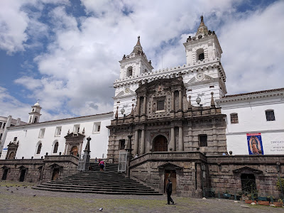 |
| Plaza de la Independencia in Quito |
 |
| Plaza de la Independencia in Quito |
 |
| Plaza de la Independencia in Quito |
 |
| Plaza de la Independencia in Quito |
After the visit to Independence Plaza, we got back on the bus and made our way to Mitad del Mundo (Middle of the World), a tourist destination located on exactly on the equator (0 degrees, 0 minutes, 0 seconds). On the way there, we drove through the city's high ground where many residents live. We made an ice cream stop along the way and I used the opportunity to duck into a nearby drug store for some ibuprofen for my swollen knee, which was improving by the day but still painful.
 |
| Residential Quito |
 |
| Residential Quito |
 |
| Residential Quito |
 |
| Residential Quito |
 |
| Ice Cream Stop in Residential Quito |
Upon reaching Mitad del Mundo, we went through the museum and then had 2 hours to venture on our own. We immediately headed to a spot where you could pose with one foot in the northern hemisphere and the other in the southern hemisphere.
 |
| Middle of the World Monument in Quito |
 |
| Middle of the World Monument in Quito |
 |
| Middle of the World Monument in Quito |
 |
| Middle of the World Monument in Quito |
 |
| Middle of the World Monument in Quito |
 |
| Middle of the World Monument in Quito |
 |
| Middle of the World Monument in Quito |
We then headed to an observation tower in the back of the complex. I climbed to the top along with the others for a panoramic view of the surrounding area. We descended the tower and went to a second area along the equator for more pictures.
 |
| Middle of the World Monument in Quito |
 |
| Middle of the World Monument in Quito |
 |
| Middle of the World Monument in Quito |
 |
| Middle of the World Monument in Quito |
After that, we headed into a complex of buildings housing a church, a square, several shops and restaurants. We stopped for lunch and while we were waiting for our food, I went across the street to a gift shop and bought a souvenir t-shirt.
 |
| Middle of the World Monument in Quito |
 |
| Middle of the World Monument in Quito |
 |
| Middle of the World Monument in Quito |
 |
| Middle of the World Monument in Quito |
 |
| Passport Stamp at Middle of the World Monument in Quito |
 |
| Souvenir T-Shirt from Middle of the World Monument in Quito |
After lunch, we got back on the bus and made a two-hour drive up the Pan-American Highway to the town of Otavalo, where we checked into the most awesome hotel, the Puertolago Country Inn. Virtually everyone in the group had a private cabin facing a lake with mountains and volcanoes in the background. We strolled the hotel grounds taking photos of the beautiful scenery.
 |
| Rest Stop Outside Otavalo |
 |
| Rest Stop Outside Otavalo |
 |
| Rest Stop Outside Otavalo |
 |
| Puertolago Country Inn in Otavalo |
 |
| Puertolago Country Inn in Otavalo |
 |
| Our Cabin at Puertolago Country Inn in Otavalo |
 |
| Puertolago Country Inn in Otavalo |
 |
| Puertolago Country Inn in Otavalo |
 |
| Puertolago Country Inn in Otavalo |
 |
| Puertolago Country Inn in Otavalo |
 |
| Puertolago Country Inn in Otavalo |
 |
| Puertolago Country Inn in Otavalo |
 |
| Puertolago Country Inn in Otavalo |
At 6:30 pm, the group met at the restaurant meeting room for a meet and greet session. We drank cinnamon tea with hurricane rum and each person took a turn introducing themselves to the rest of the group. After that session, we were practically family. Afterward, we went to the hotel restaurant where I enjoyed a delicious sea bass entree.
 |
| Puertolago Country Inn in Otavalo |
After dinner, I strolled around the hotel grounds in the dark noticing the lights of Otavalo across the lake in the distance. Then it was time for bed.
 |
| View of Otavalo from Puertolago Country Inn |
Go to Table of Contents
Itinerary: Early morning drive to nearby Peguche, known for its beautiful waterfall. Late morning visit to Otavalo to stroll the town and visit one of the largest outdoor markets in South America run by the local Otavaleños. Midafternoon drive to hotel in Papallacta, located high up in the Andes Mountains. Late afternoon trail hike and visit to the hotel thermal pools.
Daily Journal
Weather: 73F and partly sunny
I woke up at 6 am after being serenaded by the sound of crickets, frogs and cats outside our window all night. I showered and roamed the hotel grounds until the restaurant opened for breakfast at 7 am.
We departed the hotel for the nearby town of Peguche around 8 am. The main attraction there is a waterfall called Casada de Peguche. We arrived in Peguche around 8:30 am. We parked in the main square and set out on foot for a short hike through town and the waterfall. The smell of citronella permeated the air.
 |
| Peguche, Ecuador |
 |
| Peguche, Ecuador |
 |
| Peguche, Ecuador |
 |
| Peguche, Ecuador |
 |
| Peguche, Ecuador |
After walking through the town square, we visited an outdoor sun calendar. Our guide stood in the center of the stone structure and explained that on the equinox (March 22 and September 23), a person standing in the center of the calendar would not see his shadow. What was equally interesting is that the acoustics of the round structure was so good that a person speaking softly from the center of the calendar could be heard easily by people sitting around the perimeter.
 |
| Sun Calendar in Peguche |
 |
| Sun Calendar in Peguche |
 |
| Sun Calendar in Peguche |
Following the sun calendar, we walked through the woods up a meandering trail to the waterfall.
 |
| Waterfall in Peguche |
 |
| Waterfall in Peguche |
 |
| Waterfall in Peguche |
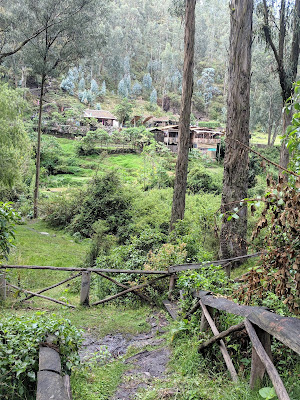 |
| Waterfall in Peguche |
 |
| Waterfall in Peguche |
 |
| Waterfall in Peguche |
 |
| Waterfall in Peguche |
 |
| Waterfall in Peguche |
 |
| Waterfall in Peguche |
 |
| Waterfall in Peguche |
 |
| Waterfall in Peguche |
After the waterfall, we drove 30 minutes to the town of Otavalo for two hours to visit the lively local market, stroll through town, and have lunch. Otavalo means "valley of sun."
We visited the market and walked the town for 1-1/2 hours before stopping at a local restaurant for homemade empanadas. Unfortunately, the young lady working there did not understand English or our Spanish and had to go find a young man to retake our order and make our food. For just a few dollars, we got these huge empanadas. Isabelle in our group gave one of hers to an elderly Otavalo Indian lady and I gave one of mine to a young man who was hovering around the restaurant looking for a meal.
 |
| Otavalo, Ecuador |
 |
| Otavalo, Ecuador |
 |
| Otavalo, Ecuador |
 |
| Otavalo, Ecuador |
 |
| Otavalo, Ecuador |
 |
| Otavalo, Ecuador |
 |
| Otavalo, Ecuador |
 |
| Otavalo, Ecuador |
 |
| Otavalo, Ecuador |
 |
| Otavalo, Ecuador |
 |
| Otavalo, Ecuador |
 |
| Otavalo, Ecuador |
 |
| Otavalo, Ecuador |
 |
| Otavalo, Ecuador |
 |
| Otavalo, Ecuador |
 |
| Otavalo, Ecuador |
 |
| Otavalo, Ecuador |
 |
| Empanada Lunch in Otavalo, Ecuador |
After lunch, we stopped at a local grocery store by the bus for snacks, then boarded the bus for the 4-hour drive up and over the Andes Mountains to our hotel in Papallacta.
On the way to Papallacta, we crossed over the equivalent of the US Continental Divide, where half the water goes towards the Pacific and the other goes to the Amazon Basin. We reached an altitude of 13,392' above sea level, which was above the tree line and had the bus engine gasping for air as we slowing made our way up and through the mountain pass.
 |
| On the Way Out of Otavalo, Ecuador |
 |
| Going Over the Top of the Andes Mountains |
 |
| Going Over the Top of the Andes Mountains |
 |
| Going Over the Top of the Andes Mountains |
 |
| Going Over the Top of the Andes Mountains |
We arrived at our hotel, Hotel Termas de Papallacta, in midafternoon. It is renowned for its thermal baths and spa. Guests can take a dip in the hot tub outside each room in the courtyard or head up to the pool area for a massage or to soak in a number of outdoor pools of various temperatures.
 |
| Hotel Termas de Papallacta |
 |
| Hotel Termas de Papallacta |
 |
| Hotel Termas de Papallacta |
 |
| Hotel Termas de Papallacta |
 |
| Hotel Termas de Papallacta |
After check-in, we went on nature hike on the hotel's trail. Along the way we saw llamas, rivers, bridges, and waterfalls along a 1-1/2 hour loop. Due to the high altitude, I got a little winded. Fortunately, the swelling in my knee had gone down considerably and I was able to manage the trail without any problems.
 |
| Hike Near Hotel Termas de Papallacta |
 |
| Hike Near Hotel Termas de Papallacta |
 |
| Hike Near Hotel Termas de Papallacta |
 |
| Hike Near Hotel Termas de Papallacta |
 |
| Hike Near Hotel Termas de Papallacta |
 |
| Hike Near Hotel Termas de Papallacta |
 |
| Hike Near Hotel Termas de Papallacta |
 |
| Hike Near Hotel Termas de Papallacta |
 |
| Hike Near Hotel Termas de Papallacta |
After the hike, we went to the spa and pools to soak for a half-hour. We made small talk with people there and I even got to practice my rusty Dutch with a young lady who was in Ecuador on sabbatical from work to improve her Spanish.
 |
| Hotel Termas de Papallacta |
 |
| Hotel Termas de Papallacta |
 |
| Hotel Termas de Papallacta |
 |
| Hotel Termas de Papallacta |
After the spa, we went to bar for a beer before dinner. Dinner in the hotel restaurant was wonderful. While most members of the group opted for trout, the local favorite, some of us opted for steak after eating fish for dinner the last three days.
After dinner, I went right to bed.
Itinerary: Morning drive to Punta Ahuano on the Napo River in the Amazon Basin. Afternoon boat trip to visit a local Quechua family and learn about their way of life first hand.
Daily Journal
Weather: 87F, sunny and very humid in Punta Ahuano
I woke up early, strolled the hotel grounds taking pictures, them met the group for breakfast at 7 am. The big topic of discussion was some couple having sex in the hot tub outside our rooms late at night. I didn't see or hear anything though. My right knee, which had been swollen since Bogota last week, seems to be almost back to normal.
 |
| Termas de Papallacta Hotel |
 |
| Volcano Outside Papallacta |
 |
| The Swelling in My Right Knee Almost Gone |
Around 8 am, we started our 3-hour drive from 11,000' above sea level in Papallacta to 0' above sea level at our hotel in Punta Ahuano in the Amazon River basin. The morning temperature high up in the Andes was 45F. It rose 44F to 89F at our destination, Punta Ahuano, in the heart of the Amazon rain forest. On our way out of Papallacta, we saw several oil processing facilities. Oil is biggest industry in the area.
 |
| Heading Down to the Amazon Basin |
 |
| Heading Down to the Amazon Basin |
 |
| Heading Down to the Amazon Basin |
 |
| Heading Down to the Amazon Basin |
As we approached the Amazon, we learned that the rain forest provides 40% of the world's oxygen and is the world's "future pharmacy" given all the drugs that are being produced from rain forest plants.
The Amazon River Basin has two distinct regions. The lower basin is more tropical. There are lots of mosquitoes and a high incidence of malaria and yellow fever. The upper basin where we will be has a lower incidence of yellow fever and other diseases. Unlike the lower basin, the upper basin has no piranhas, camins, anacondas or capybaras. And most of the animals in the upper basin are afraid of people. So we were relatively safe from predators.
There is an abundance of plant life in the rain forest. Lichens and mosses are the lowest levels of life. Then come cacti, ferns, bushes and trees. 65% of animals live in the canopy. The Amazon rain forest has 60% of the world's rain forests. It stretches from Ecuador to the Atlantic Ocean, with Brazil having most of it within its borders.
There are seven distinct tribes living in the rain forest. They have their own dialects, laws and customs. They have no contact with the outside world and move about the rain forest as they please.
Around noon, we arrived near Punta Ahuano. We got into motorized canoes and made our way down the Napo River to our resort a mile or two down the river.
 |
| Motorized Canoes We Took to Hotel |
 |
| Motorized Canoes We Took to Hotel |
 |
| Motorized Canoes We Took to Hotel |
 |
| Heading Down the Napo River |
 |
| Heading Down the Napo River |
|
 |
| Heading Down the Napo River |
|
Upon arrival at our fantastic hotel, we checked into our room then headed down to the open air restaurant for lunch. The rooms had no air conditioning but had ceiling fans and floor-to-ceiling screens on two sides. All rooms had a balcony and a hammock, which we didn't use because of mosquitoes.
 |
| Casa del Suizo, Punta Ahuano, Ecuador |
 |
| Casa del Suizo, Punta Ahuano, Ecuador |
 |
| Casa del Suizo, Punta Ahuano, Ecuador |
 |
| Casa del Suizo, Punta Ahuano, Ecuador |
 |
| Casa del Suizo, Punta Ahuano, Ecuador |
 |
| Casa del Suizo, Punta Ahuano, Ecuador |
 |
| Casa del Suizo, Punta Ahuano, Ecuador |
 |
| Casa del Suizo, Punta Ahuano, Ecuador |
 |
| Casa del Suizo, Punta Ahuano, Ecuador |
 |
| Casa del Suizo, Punta Ahuano, Ecuador |
 |
| Casa del Suizo, Punta Ahuano, Ecuador |
 |
| Casa del Suizo, Punta Ahuano, Ecuador |
After lunch, we had to put on long pants and long sleeve shirts for the excursion to a Quechuan village down the river. It was really hot but the dress code was the dress code. It was to protects us from the sun, mosquitoes and plants in the rain forest. Prior to getting on the boat, we had to stop at a building on the way down for a pair of knee-high rubber boots. Not my best fashion moment, but the rain forest is very muddy and they could not guarantee a dry landing at our destination.
 |
| Rubber Boots for Wet Landings & Muddy Hikes |
 |
| Rubber Boots for Wet Landings & Muddy Hikes |
When we arrived at our destination, we walked 15 minutes through the dense brush to the Quechuan village. We assembled in a family's outdoor living room hut to learn about life in the rain forest, as well as their culture and arts. At the end of the lecture, we went outside for a blowgun demonstration. Poison darts are used to hunt the food they eat. Several of us got a chance to demonstrate our blowgun prowess by attempting to hit a monkey decoy hung from a wire 20 feet away. I was the first volunteer and managed to nail the target in hindquarters the very first try. The guys ultimately prevailed in the blowgun competitions.
We also got to sample fresh cocoa seeds. The local tribesman cut a cocoa pod open with a machete to expose the raw seeds inside. It's kind of gross because the seeds are covered in a white, sweet slime that you suck off. This eventually led to a cocoa seed spitting competition, which Joe and Angel won.
Afterward, we trudged back through the dense brush, boarded our canoes, and made our way back to the hotel.
 |
| Heading to the Quechuan Village |
 |
| Wet Landing on Way to Quechuan Village |
 |
| Heading to Quechuan Village |
 |
| Heading to Quechuan Village |
 |
| Heading to Quechuan Village |
 |
| Heading to Quechuan Village |
 |
| Heading to Quechuan Village |
 |
| Heading to Quechuan Village |
 |
| Quechuan Village |
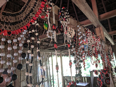 |
| Quechuan Village |
 |
| Quechuan Village |
 |
| Quechuan Village, Cat on a Hot Tin Roof |
 |
| Quechuan Village |
 |
| Blow Gun Demo at Quechuan Village |
 |
| Me Showing Off Blow Gun Skills |
|
 |
| Nailed the Monkey Decoy in the Hind Quarters on First Try |
 |
| Leaving the Quechuan Village |
 |
| Heading Back to Hotel from Quechuan Village |
 |
| Heading Back to Hotel from Quechuan Village |
Instead of attending the local cooking demonstration poolside, I sat at the bar and had a couple beers to quench my thirst. I'm glad I missed the cheecha, a puff potato snack that looks like mashed potatoes but smells like spoiled milk.
I took a relaxing dip in the pool before dinner as the sunset.
 |
| Enjoying the Hotel Pool |
We enjoyed a buffet dinner that included something appealing to every appetite.
 |
| Sunset Over the Napo River During Dinner |
Then it was off to bed. I had trouble sleeping because the room was hot. But as the night wore on, the temperature dropped and a blanket was necessary.


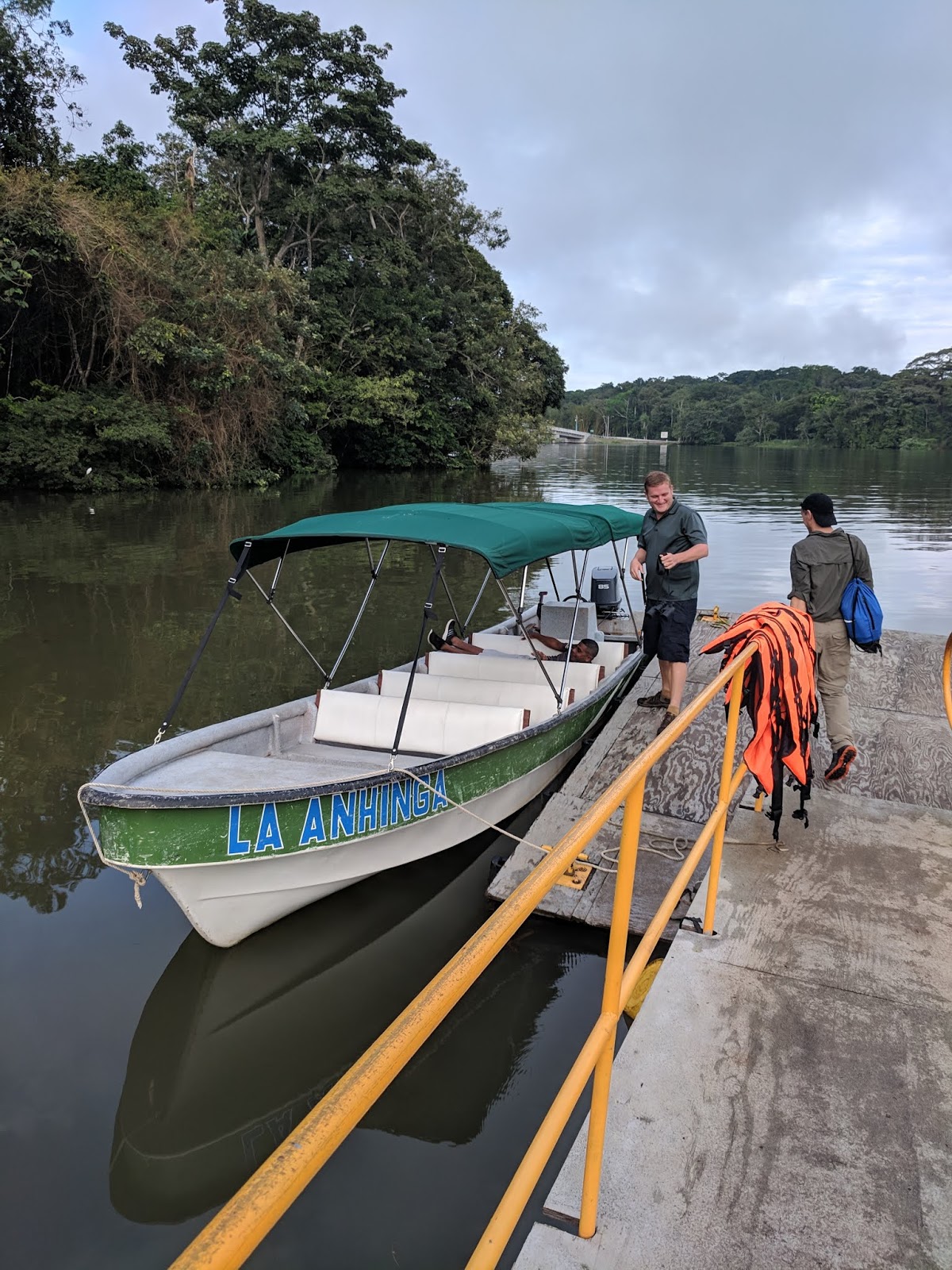

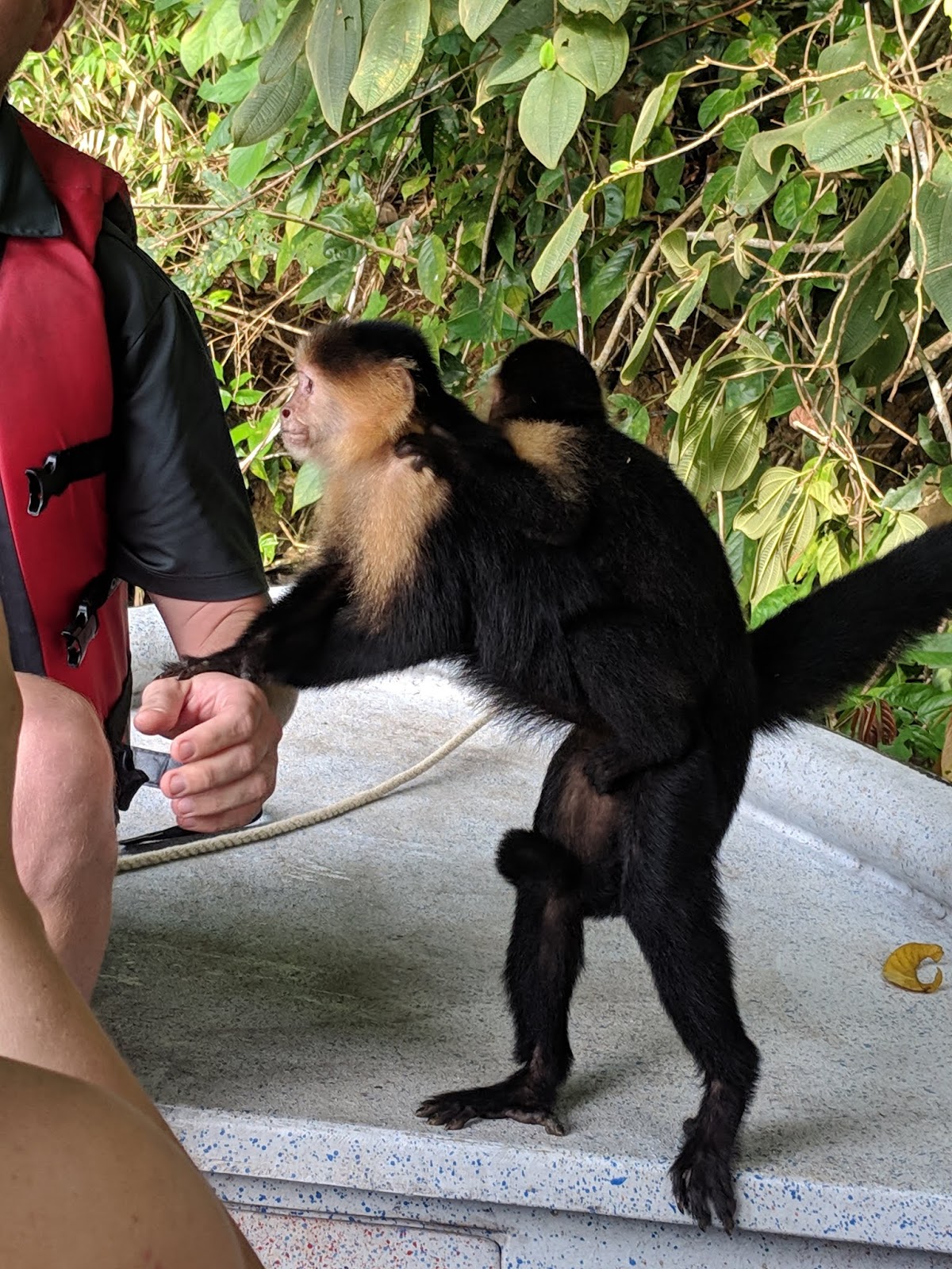


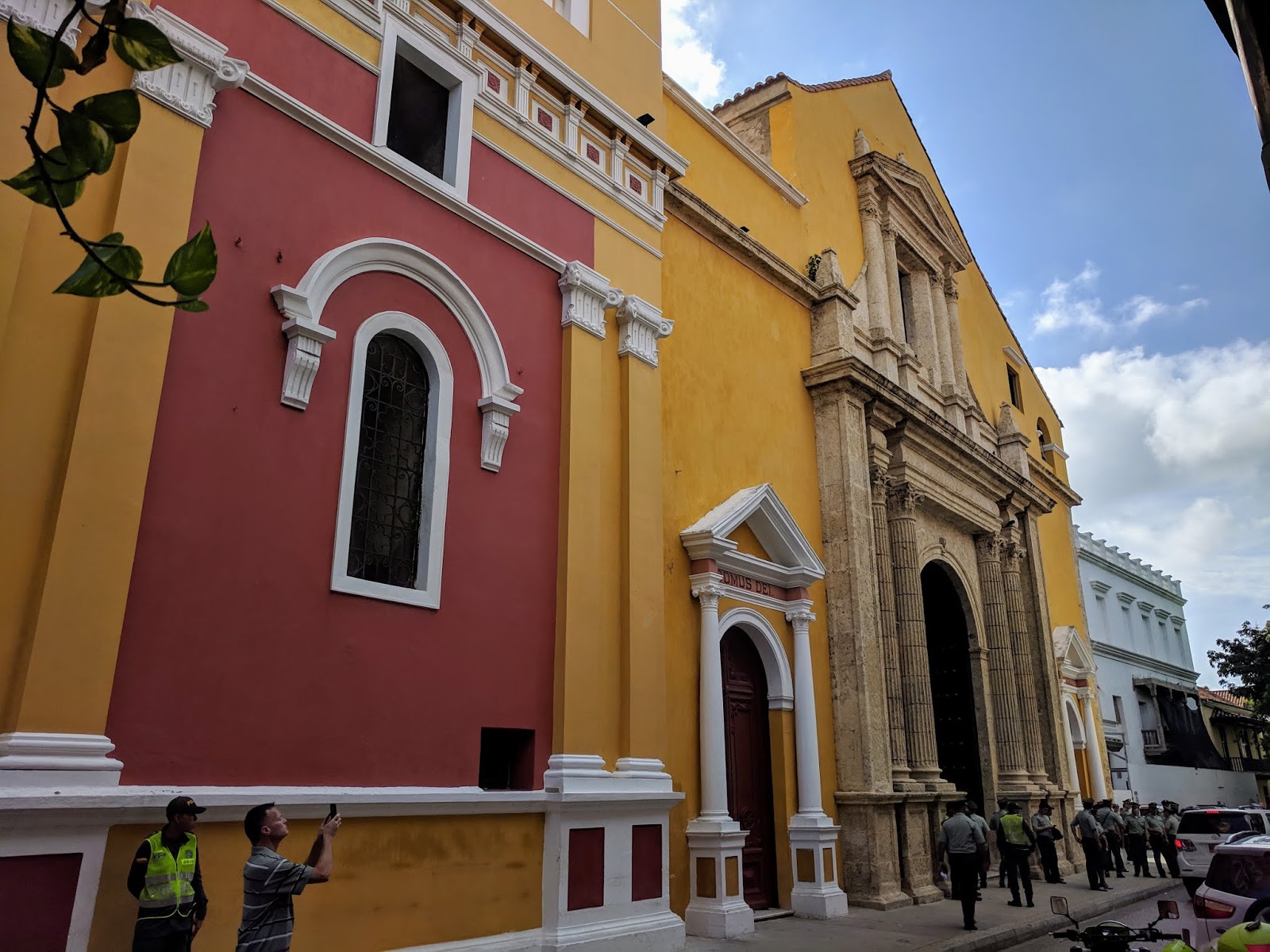


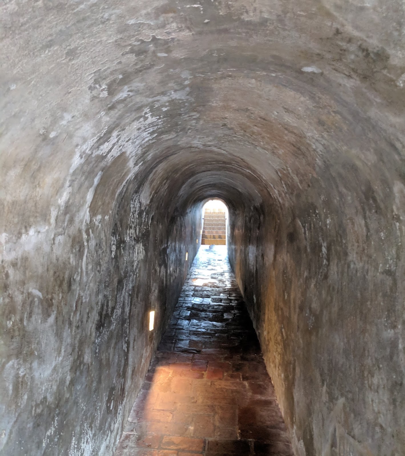


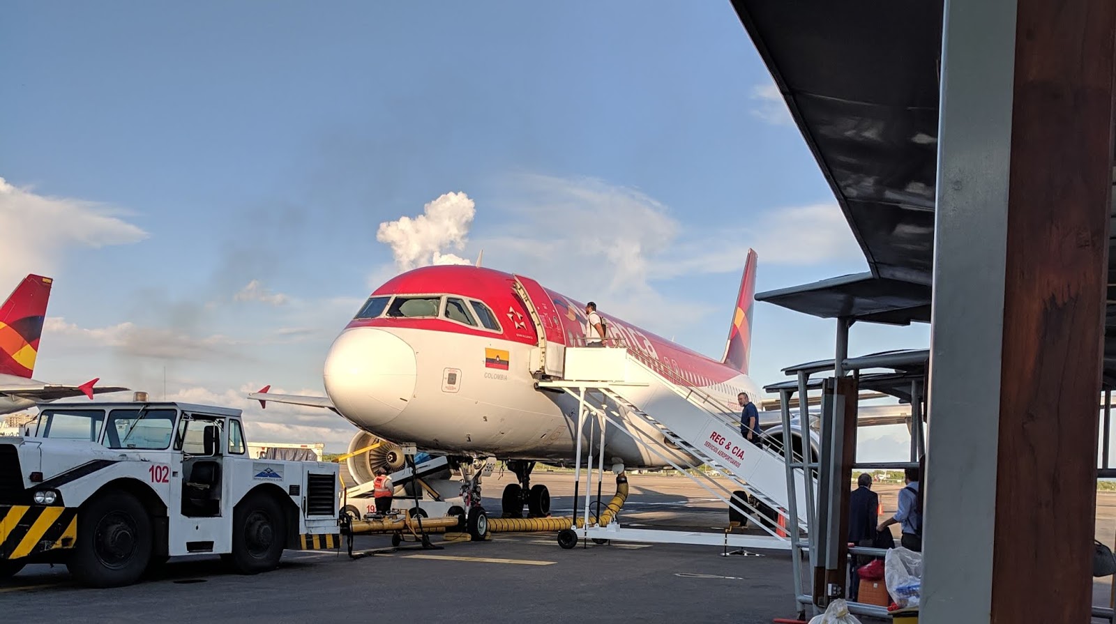
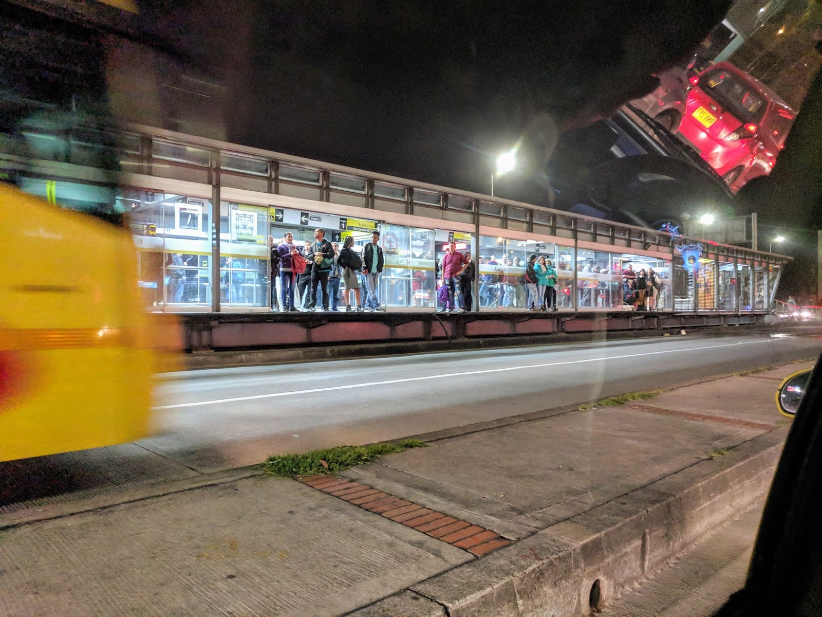


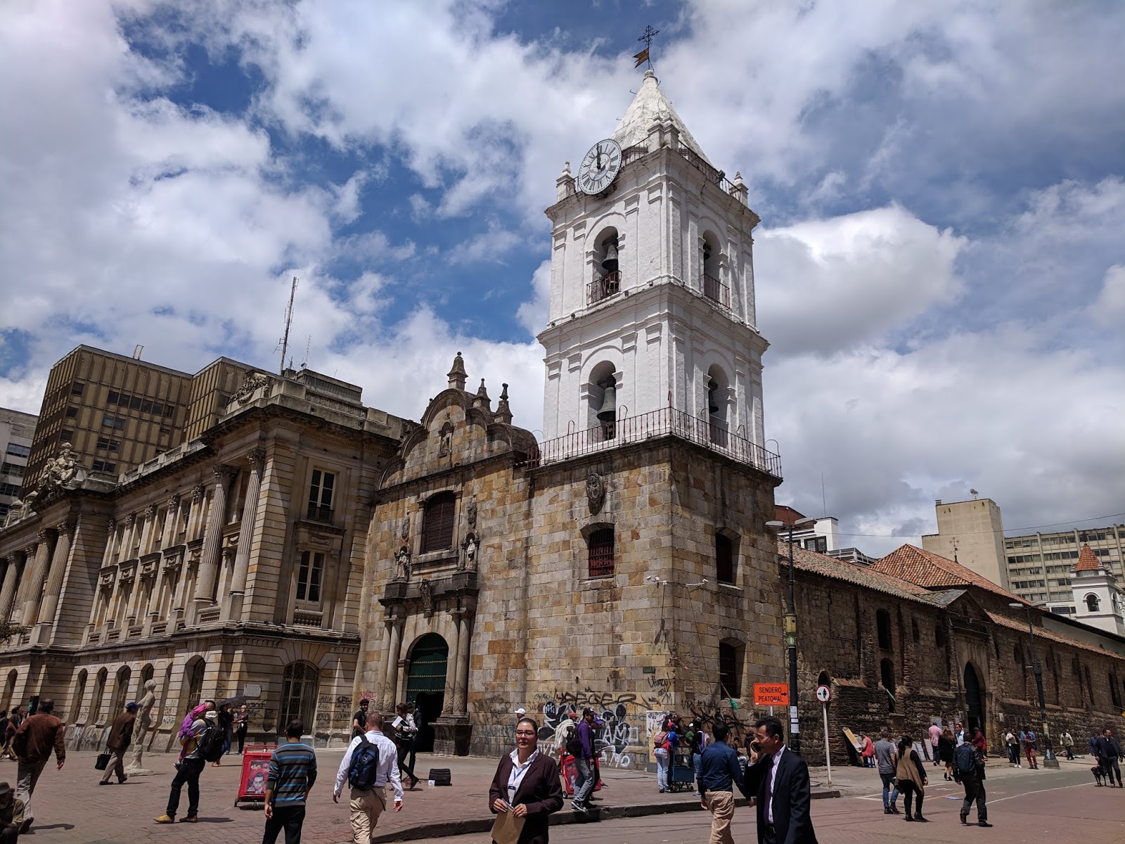


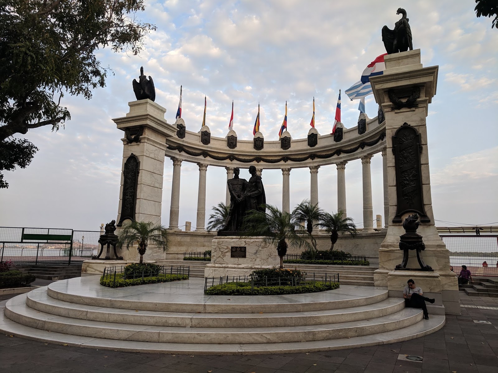


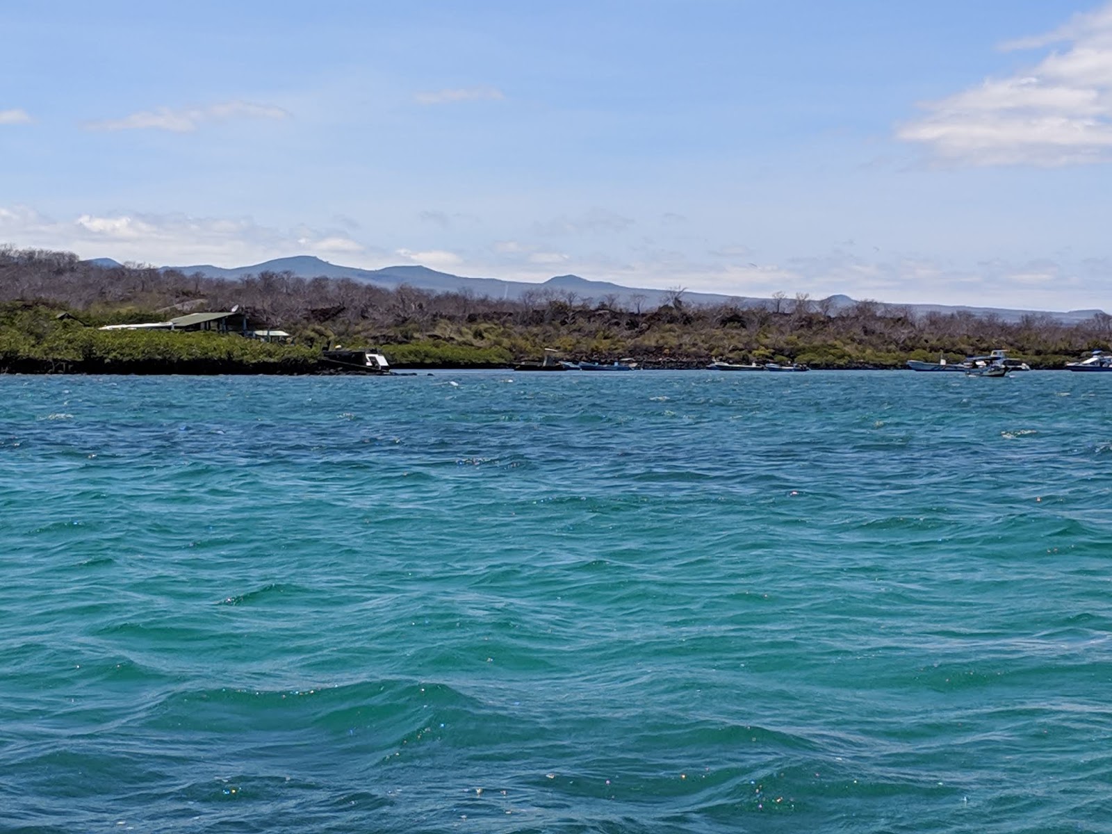


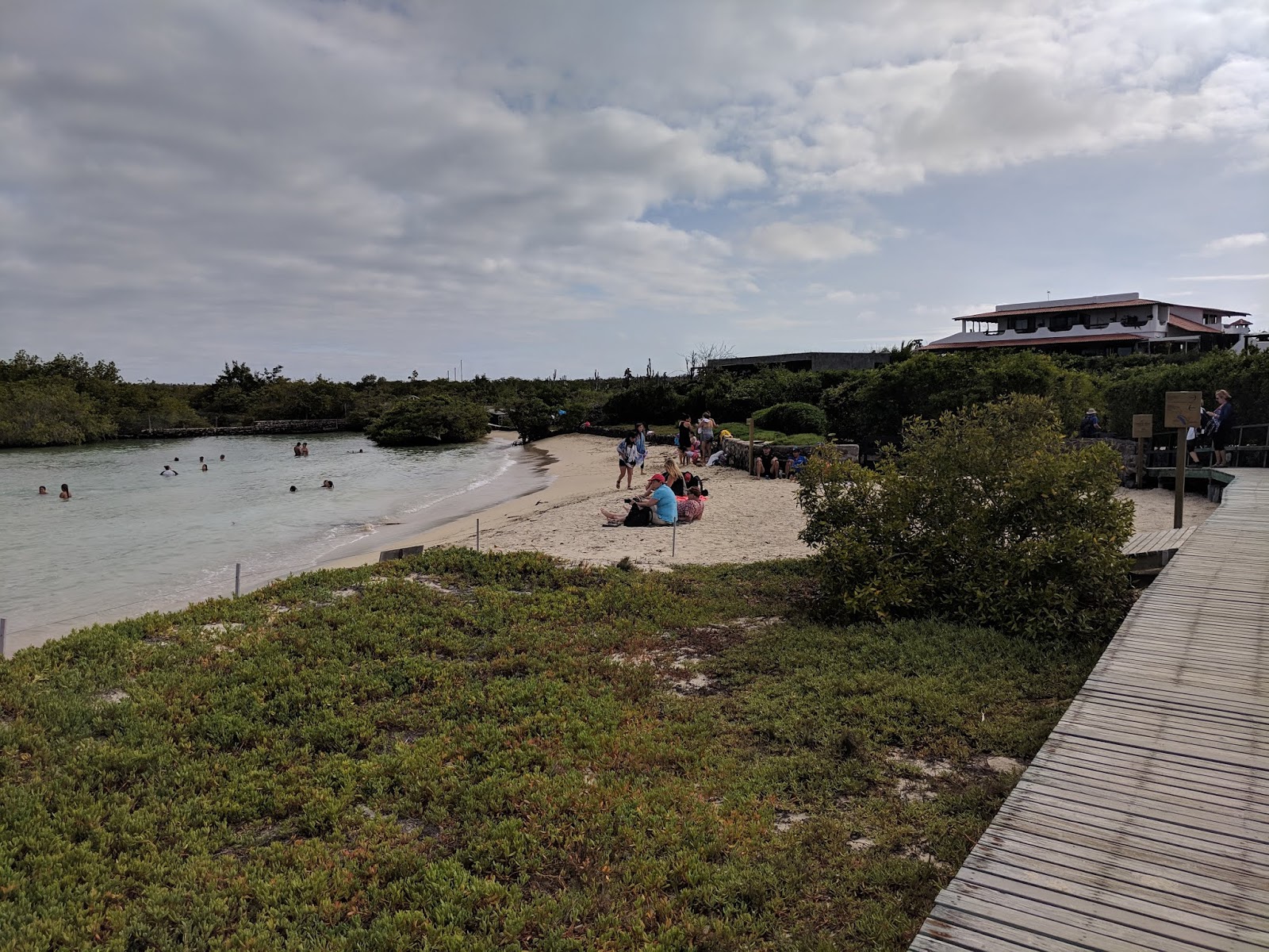


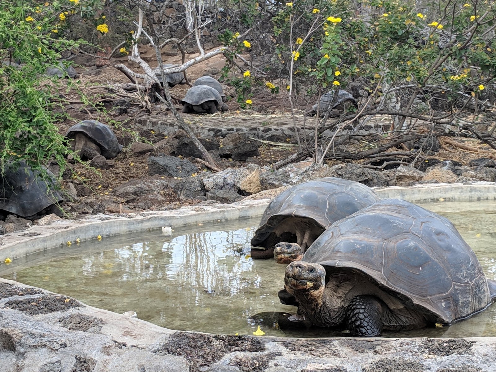

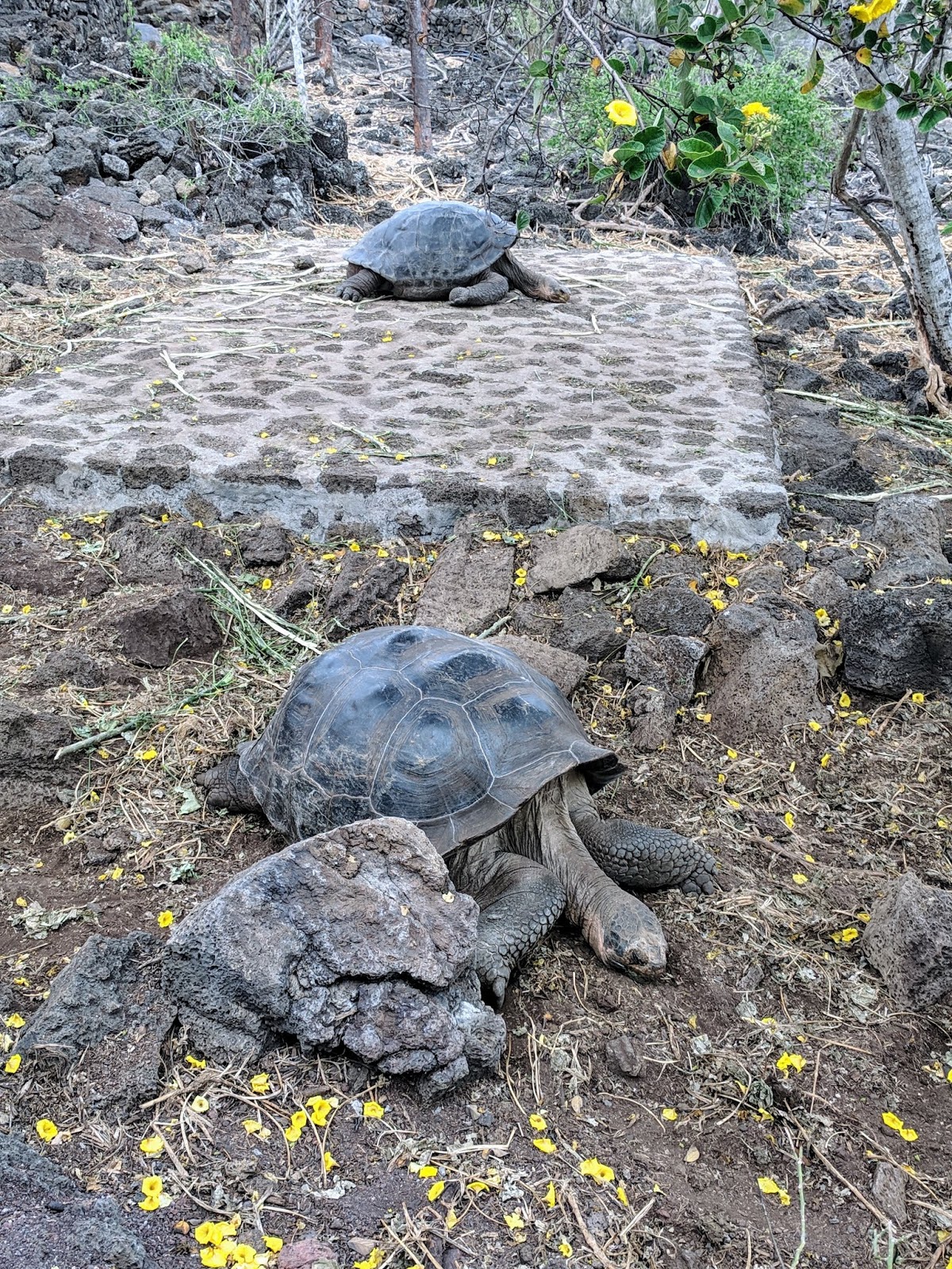


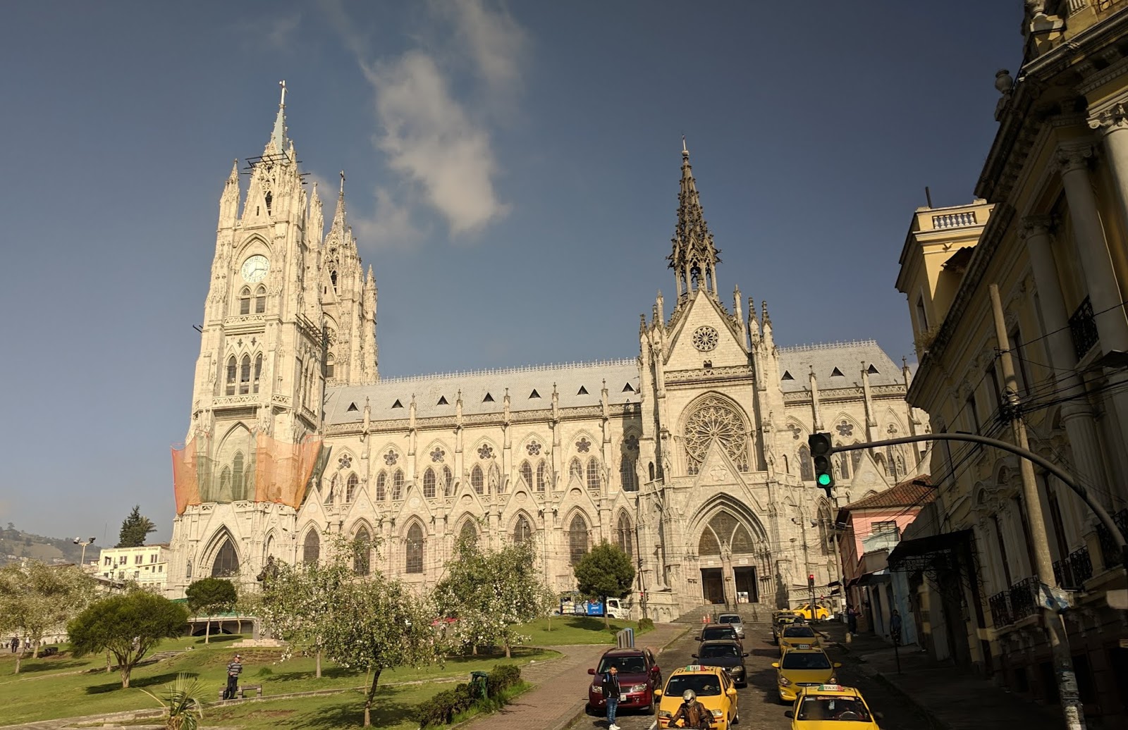


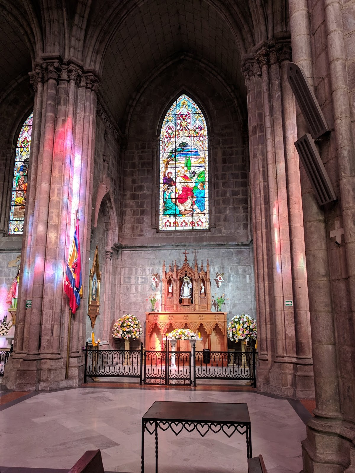


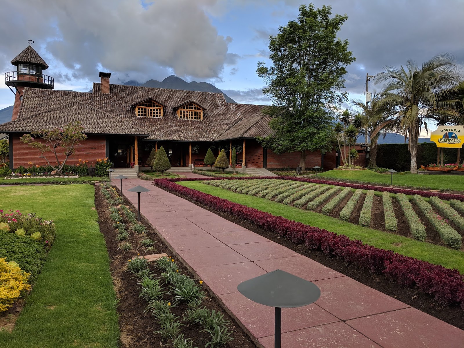


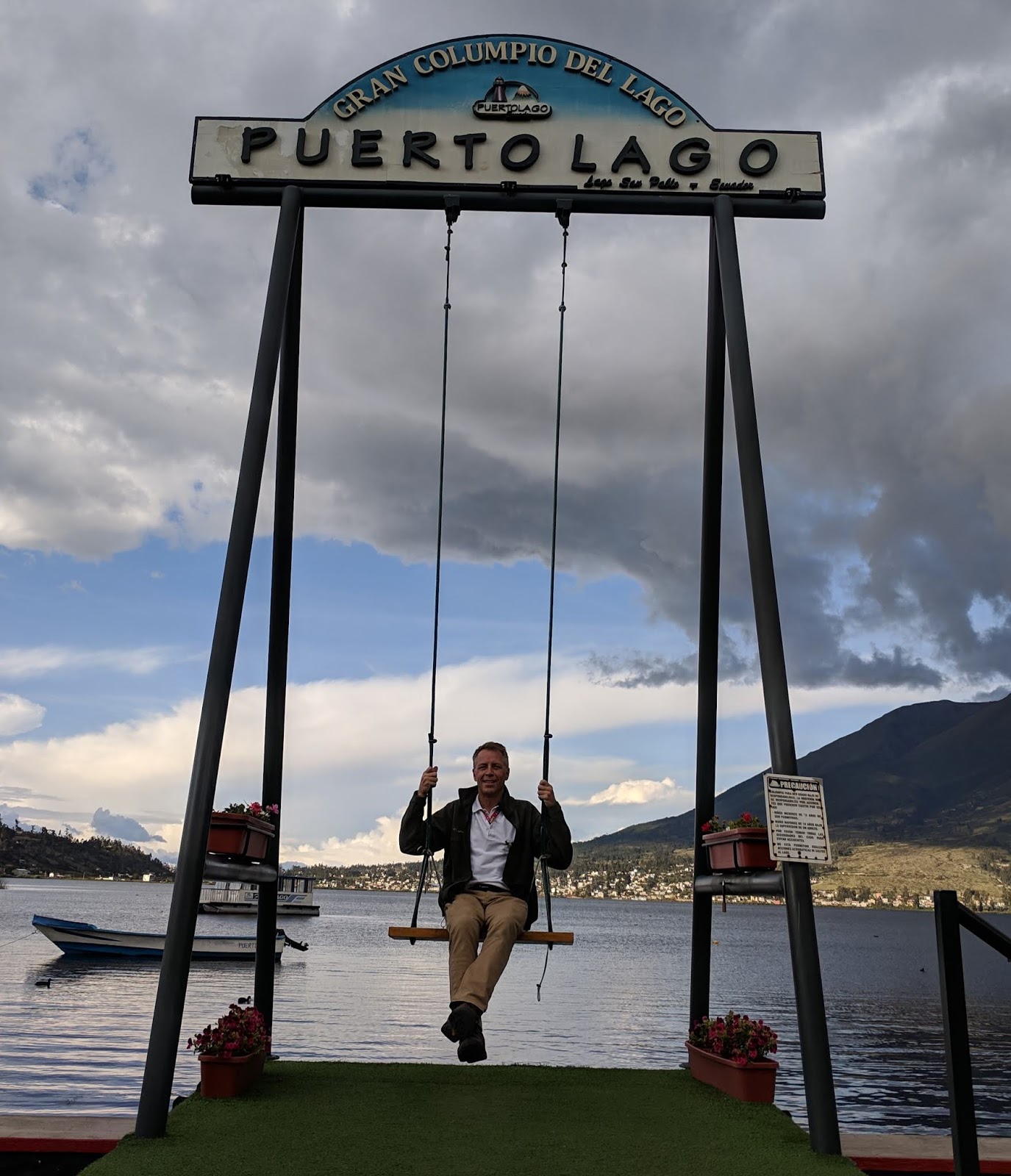


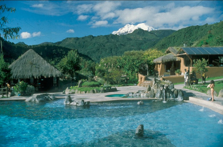


4 comments:
Very attractive article.
Passengers can visit my website if they want to what updates are included by the Turkish Airlines Cancellation Policy due to worldwide pandemics.
At Answers Thanks for this amazing content.
Lovely post, Galapagos island is one of my favorite travel destination which I had visited last year. There are many small islands present on this island. At the time of my trip, Tip Top Cruises delivered a good travel service to me.
I enjoyed reading your experience about Panama City tour in your article. Now I am keen to explore this place after enjoying america west coast tours.
Post a Comment